
Directions
From Hot Springs, North Carolina, take Highway 209 south for approximately 7 miles. Turn right onto Meadowfork Road NCSR# 1175. After 6 miles turn right onto Little Creek Road NCSR# 1181 for 3 miles. Take a left onto Max Patch Road NCSR# 1182, then travel approximately 0.75 miles and turn right onto Cold Springs Road NFSR# 148. Travel southwest for about 3 miles to the intersection of Fall Branch Road NFSR#3526, the continue a half-mile to entrance of the campground on the left. Also access from Interstate 40 Exit 7 Harmon Den, travel east 3.0 miles on Cold Springs road NFSR#148 to Falls Branch road NFSR#3526 and 0.5 mile to entrance.
Phone
828-689-9694
Activities
CAMPING, FISHING, HIKING, HORSEBACK RIDING, HUNTING, WILDLIFE VIEWING
Keywords
HARM,NFs IN NORTH CAROLINA – FS
Related Link(s)
North Carolina State Road Conditions
Overview
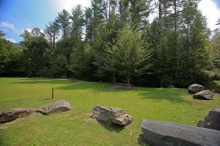
The Harmon Den Horse Campground is nestled on a mountainside beneath a forest of mixed hardwoods in the Pisgah National Forest. The camp is in a secluded area and the individual sites provide ample privacy. The campground is an ideal base for exploring the miles of nearby trails and enjoying the beautiful mountain scenery.
Recreation
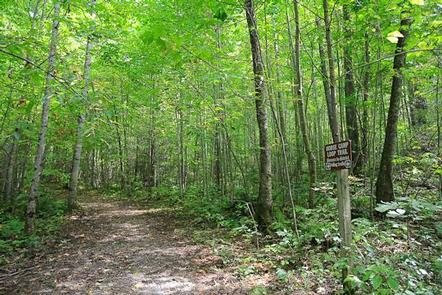
Local attractions include more than 14 miles of trails designated for horseback riding and about 40 miles for hiking. Equestrians may ride other open roads unless signed closed to horses with caution due to traffic during busy recreational seasons. Trails include the 5.4-mile Buckeye Ridge, 2.6-mile Cherry Ridge, 2.5 mile Robert Gap and 3.6-mile Cold Springs Trails. Hunting and fishing are other popular activities in the area.
Facilities
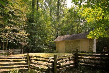
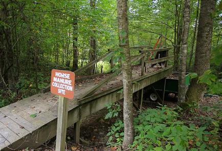
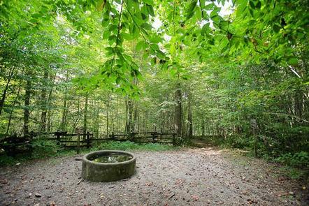
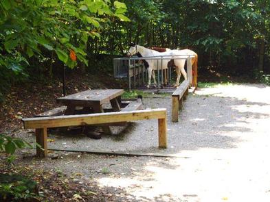
Harmon Den Horse Campground has 10 camp sites with potable water (hand pump) centrally located for all sites and a vault toilet (double). Facilities provided include horse stalls and mangers that accommodate a maximum of 4 horses and 8 people at each site with a picnic table, tent pad, lantern post, fire ring and parking for a single vehicle with horse trailer. Also located within the campground is a self-service livestock manure station and watering tank (non-potable) for livestock.
Natural Features
The Harmon Den Area is located on the Appalachian Ranger District, an area that stretches westward from the Great Smoky Mountain National Park’s eastern boundary to Craggy Gardens on the Blue Ridge Parkway to Roan Mountain near Tennessee. Elevations range from 1,900 feet at Max Patch to 6,684 feet at Mount Mitchell. Visitors to the area will find waterfalls, lush forest undergrowth, forested peaks and miles of cold mountain streams. Wildlife in the area include bear, deer, grouse and wild turkey.
Nearby Attractions
Great Smoky Mountains National Park makes an ideal day trip from Harmon Den. Max Patch is an open bald area with panaramic views and other trials for hiking include the Appalachian Trail, Cherry Creek and Groundhog Creek.