BERGER, CA Campground Reservation, Info, Images, Map, Directions

BERGER, California Campground Images, Info & Reservations

Listen

Directions

From Sierraville, drive 18 miles south on Highway 49, turn right at Bassett, and drive approximately 1.5 miles to the Sardine Lake turnoff. Turn right at the Packer Lake turnoff (Forest Road 93) and continue to the campground.

Phone

(530)478-6253

Activities

BIKING, BOATING, CLIMBING, CAMPING, HIKING, HORSEBACK RIDING, HUNTING, PICNICKING, WILDLIFE VIEWING, SWIMMING, MOUNTAIN BIKING, OFF ROAD VEHICLE TRAILS, KAYAKING, CANOEING, STAR GAZING, BIRDING, NON-MOTORIZED BOATING, SCENIC DRIVE, RAFTING, MOUNTAIN CLIMBING, MUSHROOM PICKING, OFF HIGHWAY VEHICLE TRAILS

Keywords

BRGR,TAHOE NF – FS

Related Link(s)

Rec Area Info & Images

California State Tourism

California State Road Conditions

Overview

Berger Campground is located in the Packer Lake area near Packer Creek and the Sierra Buttes, north of the Yuba River. Visitors enjoy a wide variety of recreational activities in the area, including hiking, equestrian use, hunting, fishing, canoeing and OHV use.  This campground is operated and maintained by Forest Service staff.

Recreation

A large network of trails is available in the Packer Lake area, including the Pacific Crest Trail, which is just a short trip from the campground. Many lakes in the area, including Packer Lake and Lower Sardine Lake, offer stocked rainbow and brook trout fishing, in addition to canoeing. During the late spring months, visitors looking for a more extreme adventure might want to try whitewater rafting on the North Yuba River.

Facilities

The campground offers single-family tent sites on two loops. Each site is equipped with a picnic table and campfire ring. Vault toilets are provided. Drinking water is not provided.

Natural Features

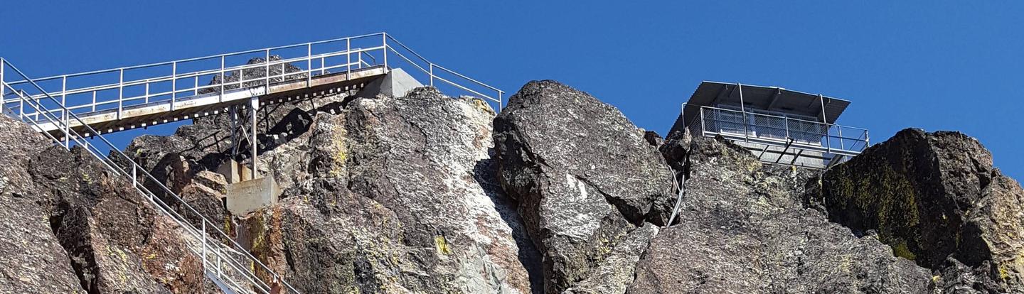
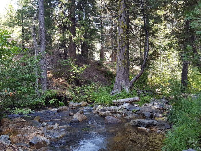
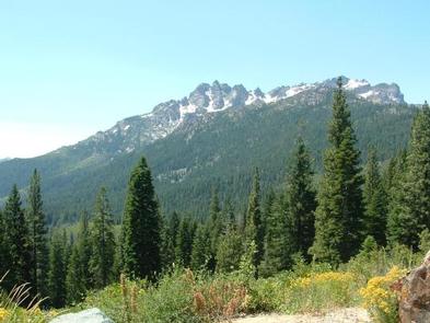
The campground is located at an elevation of 5,900 feet, near the banks of Packer Creek and just a short distance from Packer Lake. The campground is located within stands of lodgepole pine, cedar and fir trees. Packer Lake is a remote six-acre body of water tucked at the foot of the Sierra Buttes in Tahoe National Forest.

Nearby Attractions

The Lakes Basin offers boating, fishing and hiking. Over 30 miles of maintained trails branch out across the area. Many of the trails are also open to biking and horseback riding.   On the water, visitors enjoy boating, canoeing and fishing. Anglers will find rainbow and brook trout in many of the lakes throughout the basin. A boat ramp is located at Gold Lake.

Reservation

More from CampingHiking.net:

WILLIS KNOB HORSE CAMP, Georgia Campground Images, Info & Reservations

Listen Directions From Clayton, Georgia, take Warwoman Road east for about 12 miles. Turn right on Forest Service Road 157 and continue for 2 miles to the campground on the left. Phone 706-754-6221 Activities CAMPING, HORSEBACK RIDING, HUNTING, WILDLIFE VIEWING, HORSE CAMPING Keywords KNOB,CHATTAHOOCHEE-OCONEE NF – FS,HORSE CAMP Related Link(s)

PIEDMONT PARK, Missouri Campground Images, Info & Reservations

Listen Directions From Piedmont, MO, follow Missouri State Highway HH. Travel on Highway HH for 6 miles to the top of the dam. Turn right and follow signs into campground. Phone 573-223-7777 (CLEARWATER LAKE PROJECT OFFICE) 573-223-4432 (PIEDMONT PARK GATE HOUSE) Activities BOATING, CAMPING, SWIMMING SITE Keywords PIED,CLEARWATER LAKE,PIEDMONT,PARK ABOVE

BOGUS CREEK CAMPGROUND, Oregon Campground Images, Info & Reservations

Listen Directions From Roseburg, OR, travel east on OR-138 East /NE Diamond Lake Boulevard for 35 miles, Bogus Creek Campground is on the left side of the highway – opposite of the campground entrance sign. Phone 541-496-3532 Activities FISHING, HIKING, WILDLIFE VIEWING Keywords Related Link(s) Rec Area Info & Images

PRIEST RIVER, Idaho Campground Images, Info & Reservations

Listen Directions Priest River Recreation Area is 1 mile east of the town of Priest River on Highway 2. After the river it will be the first road on the right. The park is also known as the "Mudhole." Phone 208-437-3133 Activities BOATING, CAMPING, FISHING, VISITOR CENTER, WILDLIFE VIEWING, DAY

FALLEN LEAF CAMPGROUND, California Campground Images, Info & Reservations

Listen Directions From South Lake Tahoe, take Highway 89 North from the junction of State Highway 50 and 89. In 3 miles, turn left on Fallen Leaf Road. The campground is about half a mile on the right. Phone 530-544-0426 Activities BIKING, BOATING, HISTORIC & CULTURAL SITE, CAMPING, INTERPRETIVE PROGRAMS,

RAVENS ROOST CABIN, Alaska Campground Images, Info & Reservations

Listen Directions The Raven’s Roost Cabin is located above Petersburg Airport. The distance is 3 miles by helicopter or 4 miles by hiking trail from the trailhead at the water towers behind the airport. The first mile of the trail is moderate, the middle section is very steep, and the