

Directions
From North Jersey and New York: South on the New Jersey Turnpike, Exit 11 onto the Garden State Parkway (South), Exit 117 (Keyport/Hazlet). After toll, bear left and follow Route 36 East 12 miles to park entrance (after crossing the Highlands Bridge). Stay right to enter the park.
From South Jersey: North on Garden State Parkway, Exit 105 (Eatontown), bear left for Route 36 East. Continue on Route 36 East, pass Monmouth Mall and across Route 35 through Eatontown and Long Branch (Route 36 is called Joline Avenue here). Continue on Route 36, which turns left and follows north along ocean (Route 36 is called Ocean Blvd. here). North for six miles through the towns of Long Branch, Monmouth Beach and Sea Bright to park.
From Philadelphia & Camden, New Jersey: New Jersey Turnpike north to Exit 7A (Shore Points) onto I-195, East on I-195 to Garden State Parkway north, GSP north to Exit 105 (Eatontown). Then follow "From South Jersey" directions above.
For directions by bus or ferry please go to www.nps.gov/gate/planyourvisit/directions.htm .
Phone
(347) 630-1124 OR (732) 872-5918
Activities
BIKING, BOATING, HISTORIC & CULTURAL SITE, CAMPING, INTERPRETIVE PROGRAMS, FISHING, HIKING, PICNICKING, VISITOR CENTER, OBSERVATION SITE, INFORMATION SITE, ENVIRONMENTAL EDUCATION, PHOTOGRAPHY, PADDLING, SWIMMING, RANGER STATION, WATER ACTIVITIES, KAYAKING, CANOEING, STAR GAZING, BIRDING, NON-MOTORIZED BOATING, CULTURAL ACTIVITIES, EVENING PROGRAMS, GUIDED INTERPRETIVE WALKS, RECREATION PROGRAMS, SCENIC DRIVE, WINDSURFING
Keywords
Sandy Hook,Sandyhook,Fort Hancock,Highlands,Gateway,Sea Bright,Gateway National Recreation Area,Gunnison
Related Link(s)
New Jersey State Road Conditions
Overview
Welcome to Gateway National Recreation Area, Sandy Hook Unit! There are a variety of cultural and recreational opportunities available at the park including history tours, living history demonstrations, hiking, birding, kayaking, camping, swimming, and biking. Sandy Hook is known for its beautiful beaches, the Fort Hancock and Sandy Hook Proving Ground National Historic Landmark, and the country’s oldest continuing working lighthouse.
Recreation
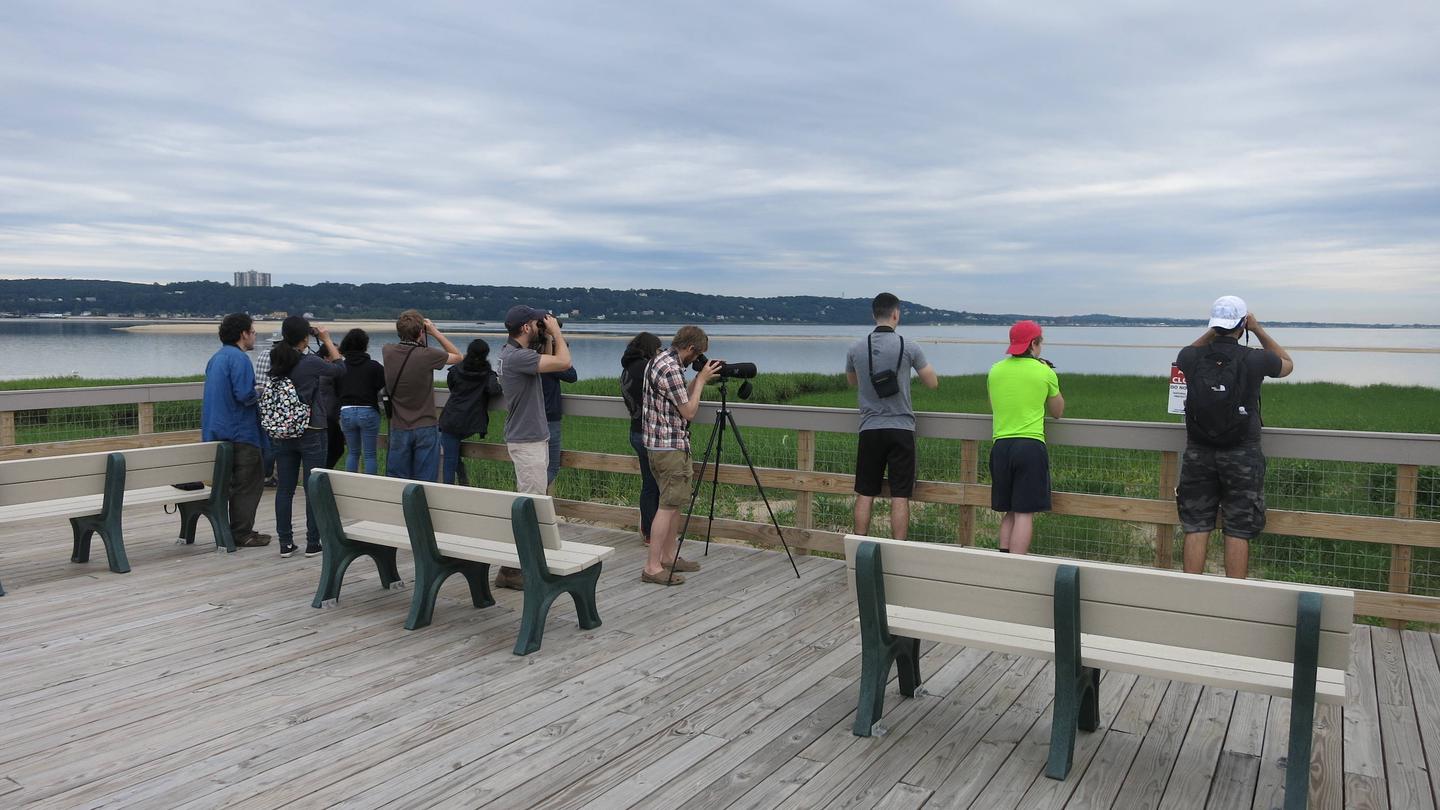
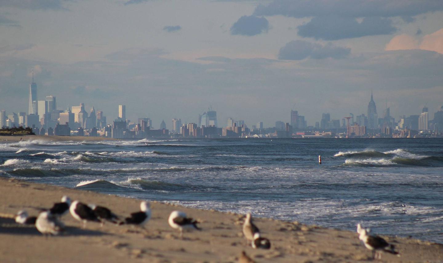
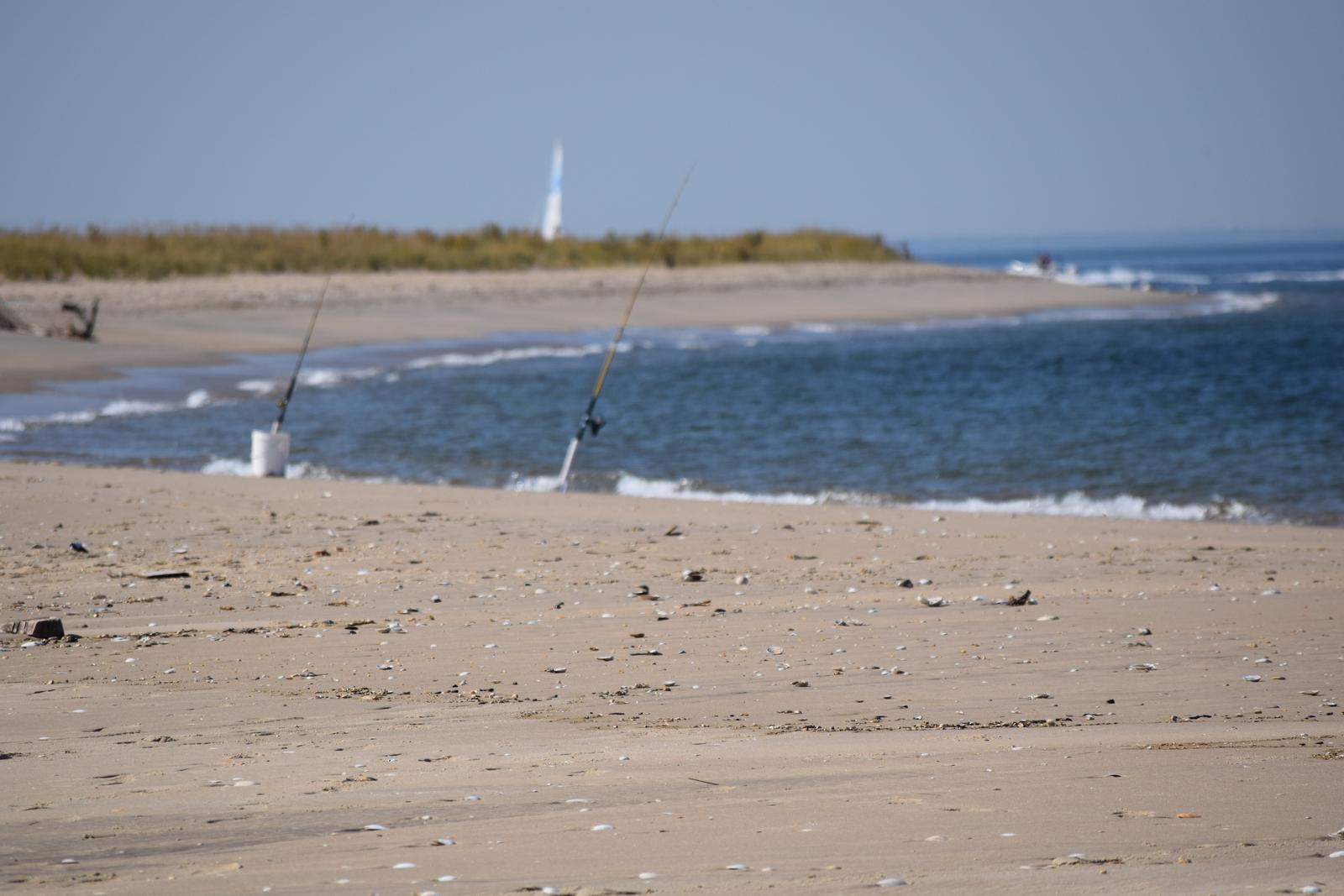
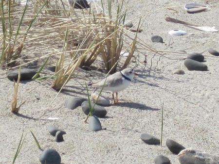
Lifeguards are on duty from 10 a.m. to 6 p.m. from Memorial Day weekend through Labor Day at five ocean beaches. Please swim only at guarded beaches and only when lifeguards are on duty. When wading, be aware of sudden drop-offs. If you can’t swim, don’t go in. Surf fishing is permitted at all beaches except when lifeguards are on duty. Fishing beach and “M” lot are prime spots. Please stick to the posted signs for closures, as they do occur throughout the summer months for endangered shorebird nesting. For a great way to see Sandy Hook by bicycle, the seven-mile long multi-use path starts at the park entrance and loops around Fort Hancock. It is shared by walkers, bicyclists and in-line skaters. Bike rentals are also available throughout the summer. Hiking trails begin at the Sandy Hook Visitor Center and at Area M near Nine Gun Battery. Walking ocean beaches is permitted but in spring and summer shorebird nesting season closes some areas. Sandy Hook is a prime spot for birding. Try Plum Island, the Spermaceti Cove boardwalk, the Horseshoe Cove salt marsh, North Pond or the fields at Fort Hancock. Non-motorized, car-top boats can be launched from Beach Area C and Horseshoe Cove. Horseshoe Cove is popular with recreational boaters. Landing on beach with a motorized boat is prohibited. Surfing is allowed on beaches B and C. Windsurfing and kite-boarding is best on the bay across from Beach Area C. Kayak and paddleboard rentals are also available at C beach throughout the summer. Enjoy a blanket picnic on the beach. The North Beach Observation Deck has tables and a view of New York Harbor. Grilling outside of the campground is permitted only at Guardian Park in Fort Hancock. The Visitor Center is now located in the Keeper’s Quarters adjacent to the lighthouse and is open from 9:00 a.m. – 5:00 p.m. The lighthouse tours with a ranger occur every 30 minutes from 1:00 p.m. to 4:00 p.m., daily. Climbers must be at least 48 inches tall to climb. For seasonal programs both ranger-led and partner-led, visit www.nps.gov/gate/planyourvisit/index.htm for more information. Please visit www.nps.gov/gate for more information about any of the above.
Facilities
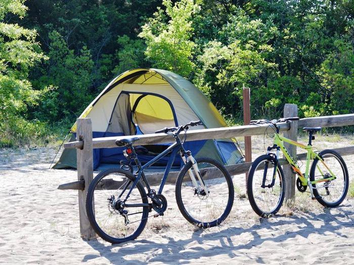
This campground accommodates tent camping only. Be prepared to walk your gear up to .25 miles into the sites from the parking area. No cars are permitted in the campground or campsites. All campsites come equipped with a fire-ring, charcaol grill, picnic table, and food storage container. Please bring your license plate information with you for check-in.
Firewood must be purchased at the Camping Office in the campground. No outside wood is permitted.
Ice is sold out for the season. Plan accordingly and purchase ice outside the park before arriving.
Flush toilets and running water are available. There are no showers and no electric outlets in the campsite or in the bathrooms. There is no public Wifi.
There is no day-use permitted in the campground; all guests must be camping overnight.
All Beach Centers have restrooms and outdoor rinse showers.
A variety of Food trucks are available throughout the summer at various beach plazas. Presence is not guaranteed daily.
Natural Features
Gateway National Recreation Area exists within one of the most urbanized areas of the country, covering 26,000 acres of New Jersey and three New York City boroughs. Among the urban environment, the park boasts grasslands, woodlands, sand dunes, beaches, ponds, salt marshes and forests.
Nearby Attractions
Twin Lights New Jersey Historic Site – Situated 200 feet above sea level atop the Navesink Highlands, Twin Lights has stood as a sentinel over the treacherous coastal waters of northern New Jersey since 1828. Named Navesink Lightstation, it became known as the “Twin Lights of Highlands” to those who used its mighty beacons to navigate. The lighthouse tower, museum, gift shop, and other buildings are open daily 10 a.m. – 5 p.m. from Memorial Day through Labor Day, and Wednesday through Sunday 10 a.m. – 4:30 p.m., September through May. Mount Mitchill Monmouth County Scenic Overlook – At 266 feet, this overlook in Atlantic Highlands sits on the highest natural elevation on the Atlantic seaboard (excluding islands) from Maine to the Yucatan providing beautiful views of Sandy Hook, Sandy Hook Bay, Raritan Bay and the New York skyline. Hartshorne Woods Mounmouth County Park – A hilly, forested 787-acre site overlooking the Navesink River, this park is among the highest elevations along the Atlantic Coast and features prominently in area history as a former coastal defense site. Known for its challenging trail system and scenic views, Hartshorne Woods is a popular park for area hikers, bicyclists and outdoor enthusiasts. Holmdel Monmouth County Park – Holmdel Park is one of Monmouth County’s most popular locations for active recreation and nature appreciation. Acquired by the Monmouth County Park System in 1962, just shy of one million visitors enjoy this 565-acre site yearly. This park features a historic farm, an arboretum, fishing, picnic areas, 4 tennis courts, 2 playgrounds, ice skating, sledding and 10 miles of trails – including a 1/2 mile paved loop linking the Pond View and Forest Edge areas of the park with group picnic facilities and playgrounds.
Charges & Cancellations
Recreation.gov refund and cancellation policy:
Change and Cancellation Policies and Fees
- Camping / Day Use: A $10.00 service fee will apply if you change or cancel your reservation (including campsites, cabins, lookouts, group facilities, etc.). The $10.00 service fee will be deducted from the refund amount.
- You can cancel or change reservations through Recreation.gov or by calling 1-877-444-6777.
Late Cancellations
- Overnight and Day Use Facilities: Late cancellations are those cancelled between 12:01 a.m. (Eastern) on the day before arrival and check out time on the day after arrival.
- Individual Campsites: If a customer cancels a reservation the day before or on the day of arrival they will be charged a $10.00 service fee and will also forfeit the first night’s use fee (not to exceed the total paid for the original reservation). Cancellations for a single night’s reservation will forfeit the entire use fee but no cancellation fee will apply.
Refunds
- Customers must request refunds no later than 14 days after the scheduled departure date. Recreation.gov will not grant refund requests after 14 days of departure.
- Refunds for Bankcard Purchases: Refunds for bank card payments will be issued as a credit to the original bank card.
- Refunds for Check or Cash Purchases: Refunds for Recreation.gov payments made by check or money order, and cash payments at selected campgrounds will be issued a check refund. A refund will be processed within 30 days of receipt and approval. Please Note: Refund requests made during or after departure can only be processed when approved by the facility management staff based upon local policy.
- Refunds for Emergency Closures: In the event of an emergency closure, the Recreation.gov team will attempt to notify users and offer alternate dates (as appropriate). If this is not possible, reservations will be cancelled and all fees paid will be refunded. Reservation fees for free tickets are non-refundable in the event of an emergency closure.
No-Shows
- Camping / Day Use: A camping no-show customer is one who does not arrive at a campground and does not cancel the reservation by check-out time on the day after the scheduled arrival date. Reserved campsites and group overnight facilities will be held until check-out time on the day following your scheduled arrival. Group day-use facilities will be held until check-in time on your scheduled arrival date.
- If a customer does not arrive at the campground or group facility by check-out time the day after arrival or does not cancel the reservation by the times listed under “Late Cancellations” above, the customer may be assessed a $20.00 service fee and forfeit use fees.