
Directions
From the intersection of CR 379 and SR 65 in Sumatra, drive south on SR 65 for 2.5 miles. Turn right onto FR 101 (Wright Lake Rd) and follow it west for 1.5 miles to the Wright Lake Recreation Area entrance on the right. Turn right and follow the entrance road up to the kiosk.
Phone
850-643-2282
Activities
CAMPING, FISHING, HIKING, WILDLIFE VIEWING, DAY USE AREA, BIRDING, WATER ACCESS
Keywords
Wright Lake Recreation Area,Wright Lake Campground,Wright Lake
Related Link(s)
Overview
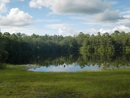
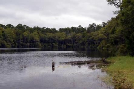
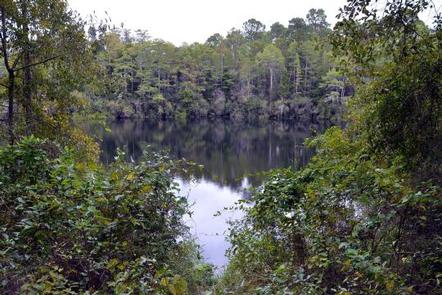
Wright Lake is located approximately 25 miles from the Gulf of Mexico in an area known as the Forgotten Coast. Wright Lake and nearby Hickory Landing provide easy access to the Apalachicola River, known for its sport fishing, boating and paddling. You will never run out of things to do!
Recreation
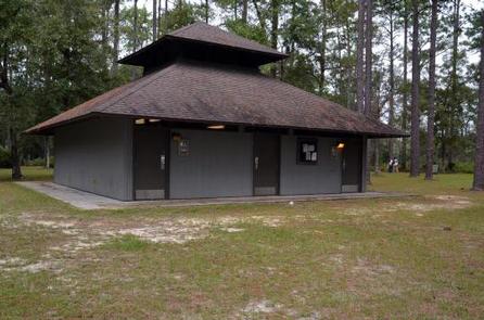
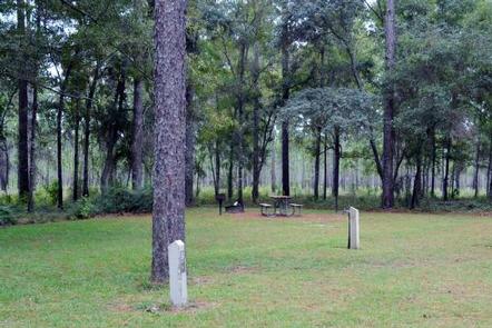
Wright Lake is a quiet scenic lakefront recreation area that offers a host of amenities and activities for campers and day-trippers. The area around the clear, spring-fed lake offers both a day-use area for swimming, picnicking, and hiking, and a campground in a beautiful forest setting along one portion of the lakeshore. It is perfect for fishing and boating. The campground bathhouse includes flush toilets and hot showers. Picnic tables and grills are scattered among trees with views of the lake.
Hikers can enjoy a 4.6-mile trail that winds through several different ecosystems in the area, and there is a short 0.2 mile loop that circles the lake. Nearby Hickory Landing offers boating access to Owl Creek and the Apalachicola River.
Facilities
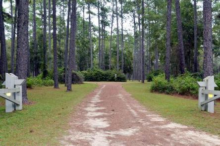
The campground includes 1 electric and 18 nonelectric campsites with picnic tables, grills, tent pads and fire rings. The recreation area is fairly level and easily accessible. The comfort station has flush toilets and warm showers.
Natural Features
You will find peace and quiet on a ridge in the Apalachicola Savannahs. The longleaf pine dominates this open landscape where wiregrass, or sometimes palmetto, covers the forest floor. Swamps and savannahs are commonly interspersed with the longleaf community.
Nearby Attractions
The Apalachee Savannahs Scenic Byway is part of a nationwide program to provide viewing opportunities of well-managed and pleasing forest landscapes. This scenic drive is an excellent way to see the forest, as it showcases grassy, open savannahs sporting the most diverse collection of wildflowers in Florida’s Panhandle.
Nearby, historic Fort Gadsden played an important role in Florida history. Located along the Apalachicola River, this interpretive area offers detailed information about the site and its history along with trails, river access, and a picnic area. Detailed interpretive information in the form of kiosks and signage lead you through the site of both forts and the cemetery where the victims from 1816 are buried.
Charges & Cancellations
Refunds can not be processed on site. All refunds must go through Recreation.gov.