NORTH FORK CAMPGROUND (OR), OR Campground Reservation, Info, Images, Map, Directions

NORTH FORK CAMPGROUND (OR), Oregon Campground Images, Info & Reservations

Listen

Directions

From Medford OR, take OR-140 (Lake of the Woods Hwy) about 28 miles and turn right on Forest Road 37. Continue 1 mile on Forest Road 37, campground is located on the right.

Phone

541-560-3900

Activities

CAMPING, VISITOR CENTER, DAY USE AREA, HOTEL/LODGE/RESORT PRIVATELY OWNED

Keywords

Related Link(s)

Rec Area Info & Images

Oregon State Tourism

Oregon State Road Conditions

Overview

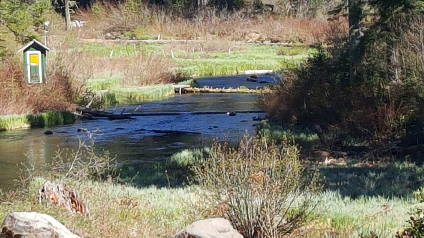
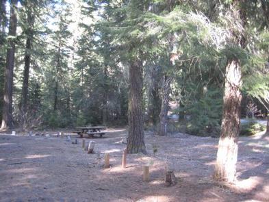
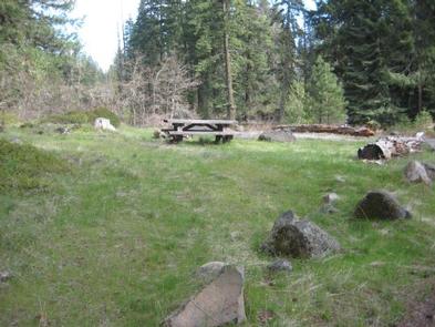
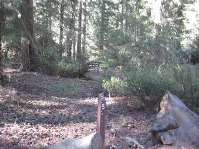
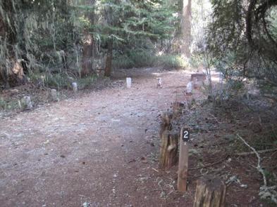
North Fork Campground is a remote and picturesque small campground is in the midst of old growth forest located off Forest Road 37 from Highway 140.

Recreation

Numerous hiking trails are within easy access, including the Fish Lake, High Lakes, Brown Mountain and the famous Pacific Crest National Scenic trail.

Facilities

This small campground contains a variety of campsites to accommodate all types of visitors and campers, including group, family, and single campsites. Drinking water is available. The campground has two vault toilets. Firewood is available for purchase from the off-site Host.

Natural Features

The campground offers easy access to Fish Lake, which is a premier fishing lake supplied by over 45 underground volcanic streams. A volume of hiking trails include the High Lakes and Fish Lake Trail systems, as well as the Pacific Coast Trail and Mount McCloughlin Trail. Many biking trails exist, including back-country and county highways.

Nearby Attractions

A boat launch for Fish Lake (10 mph) is within a few miles from this campground and many amenities are offered at nearby Fish Lake Resort. Kayaking, canoeing, paddle boarding, and boat access (10 mph), including a boat ramp are provided. Excellent fishing and swimming are also available at Willow Lake to the north on OR-821. Groceries and a hot meal are close by in Butte Falls, or within walking distance at the Fish Lake Resort. Additional campgrounds nearby include Fish Lake and Doe Point Campgrounds with Whiskey Springs and Fourbit Ford Campgrounds eleven miles away off OR-821.

Reservation

More from CampingHiking.net:

SPENCER BENCH CABIN, Alaska Campground Images, Info & Reservations

Listen Directions To catch the train (reservations required) into the Spencer Whistle Stop, drive south from Anchorage on the Seward Highway to the Portage Rail Depot (Milepost 80) and check in at the Train station. In the winter months there are 2 snowmachine parking lots at Seward Highway Milepost 78

POTATO PATCH CAMPGROUND, Arizona Campground Images, Info & Reservations

Listen Directions From Prescott, take U.S. Highway 89 north past Granite Dells, turn right on Hwy 89A and travel approximately 20 miles to the top of Mingus Mountain on steep, mountainous grade. Potato Patch Campground entrance will be to your left (across from the Summit Picnic Area) on Forest Road

MARTIN LAKE CABIN, Alaska Campground Images, Info & Reservations

Listen Directions Martin Lake Cabin is under reconstruction and unavailable for reservation at this time. When available access to the cabin is by float plane only, typically 30 minutes from Cordova. Float planes land on the lake next to the cabin. In fall, winter and early spring, the cabin may

ARMSTRONG, Oregon Campground Images, Info & Reservations

Listen Directions From Estacada, travel east on Highway 224 for 14 miles to Armstrong Campground, on the right. Phone 503-630-5721 Activities BIKING, BOATING, CAMPING, FISHING, HIKING, WATER SPORTS, WILDLIFE VIEWING Keywords ARMS,MT. HOOD NF – FS Related Link(s) Rec Area Info & Images Forest Service Concessionaire Oregon State Road Conditions

MILL CREEK (MISSOURI), Missouri Campground Images, Info & Reservations

Listen Directions From Branson, Missouri, travel west on Highway 76, then take Highway 13 south for 12 miles. Turn west onto Highway RB and follow signs to the campground. Phone 417-779-5378 Activities BIKING, BOATING, CAMPING, FISHING, PICNICKING, WATER SPORTS, WILDLIFE VIEWING, DAY USE AREA, SWIMMING SITE, PHOTOGRAPHY, SWIMMING, DIVING, SNORKELING,

SOUTH KAWISHIWI RIVER, Minnesota Campground Images, Info & Reservations

Listen Directions From Ely, Minnesota, travel about 10.3 miles south on State Highway 1 toward Lake Superior. Turn left onto the campground road. Phone KAWISHIWI RANGER DISTRICT: 218-365-7600, CONCESSIONAIRE (SUMMER): 218-365-2963 Activities BIKING, BOATING, CAMPING, FISHING, HIKING, HUNTING, WILDLIFE VIEWING, SWIMMING SITE Keywords SOKR,SUPERIOR NATIONAL FOREST,KAWISHIWI FOREST SERVICE CAMP,KAWISHIWI RIVER,KAWISHIWI,KAWISHIWI