


Directions
From Pittsburgh (west), take I-376 E keep left and continue onto US-22 E (27 miles). Make a left at PA-981 N located in New Alexandria, PA near the Sheetz gas station (5 miles). Turn right onto Tunnelton Road/SR 3003 (3 miles). Turn right onto Auen Road (1 mile). The entrance is on the right. From Blairsville (east), take Route 217 North to Newport Road. Turn left onto Newport Road. Travel 4 miles and turn left onto Clarksburg Road. Follow Clarksburg Road 2.8 miles to Y in road and bear left. Turn left onto Quick Road. Go 1/2 mile on Quick Road and turn left onto Auen Road. Follow Auen Road for 1.6 miles. The entrance is on your left. From Indiana (north), take Route 286 W out of Indiana (10 miles). Turn left onto Saltsburg Road (SR 3002). Travel 5.6 miles and make a left onto Tunnelton Road (SR 3003). Follow Tunnelton Road for 2.3 miles and make a left onto Auen Road. Travel 1 mile and the entrance to Conemaugh is on the right. From Latrobe (south), take Route 981 N thru New Alexandria (9.4 miles). At the intersection make a left to stay on 981 N. Travel 2 miles and turn right onto Tunnelton Road (SR 3003). Follow Tunnelton Road for 3 miles and turn right onto Auen Road (1 mile). The entrance is on the right.
Phone
724-459-7240
Activities
BIKING, BOATING, HISTORIC & CULTURAL SITE, CAMPING, FISHING, HIKING, HUNTING, VISITOR CENTER, WILDLIFE VIEWING, DAY USE AREA, ENVIRONMENTAL EDUCATION, PHOTOGRAPHY, KAYAKING, CANOEING, BIRDING, WATER ACCESS
Keywords
Conemaugh Dam,Conemaugh Reservoir,Conemaugh River Reservoir
Related Link(s)
Pennsylvania State Road Conditions
Overview
Tucked away amidst rolling hills, Conemaugh River Lake complements the tranquil rural countryside of southern Indiana County. Only a short drive from Pittsburgh, the project offers numerous recreational opportunities and historic resources to explore. Visitors will discover that Conemaugh’s pleasant surroundings are an ideal setting for outdoor adventure or a quiet escape. Bursting with history, primary sites of interest include traces of The Pennsylvania Mainland Canal and sections of the 1864 and 1907 railroads. The U.S. Army Corps of Engineers invites you to come enjoy the serene vistas and relaxed atmosphere of Conemaugh River Lake. Think about hosting a family reunion or a party at one of the picnic pavilions.
Recreation
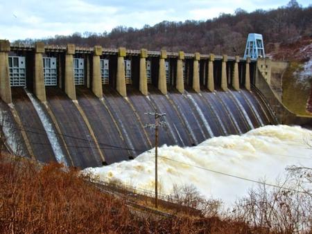
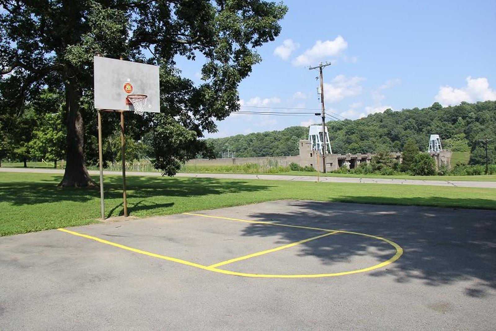
Visitors will find picnic pavilions, a playground, volleyball court, a basketball court, horseshoe pits, nature trails, an outdoor fitness center and an information center all within the day use area. While in the day use area, take some time to study Conemaugh Dam from multiple overlooks. Fishing access is just a short walk down Fisherman’s Trail. A short drive (1/4 mile) from the pavilions is the Tunnelview Historic Site and a canoe launch that leads to Conemaugh River. Power boating is prohibited on Conemaugh Lake. However, electric motor boats can access the lake via the carry-in launch at Aultman’s Run or the accessible launching area on Bow Ridge. Permits for the accessible boat launch on Bow Ridge may be obtained at the park office.
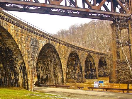
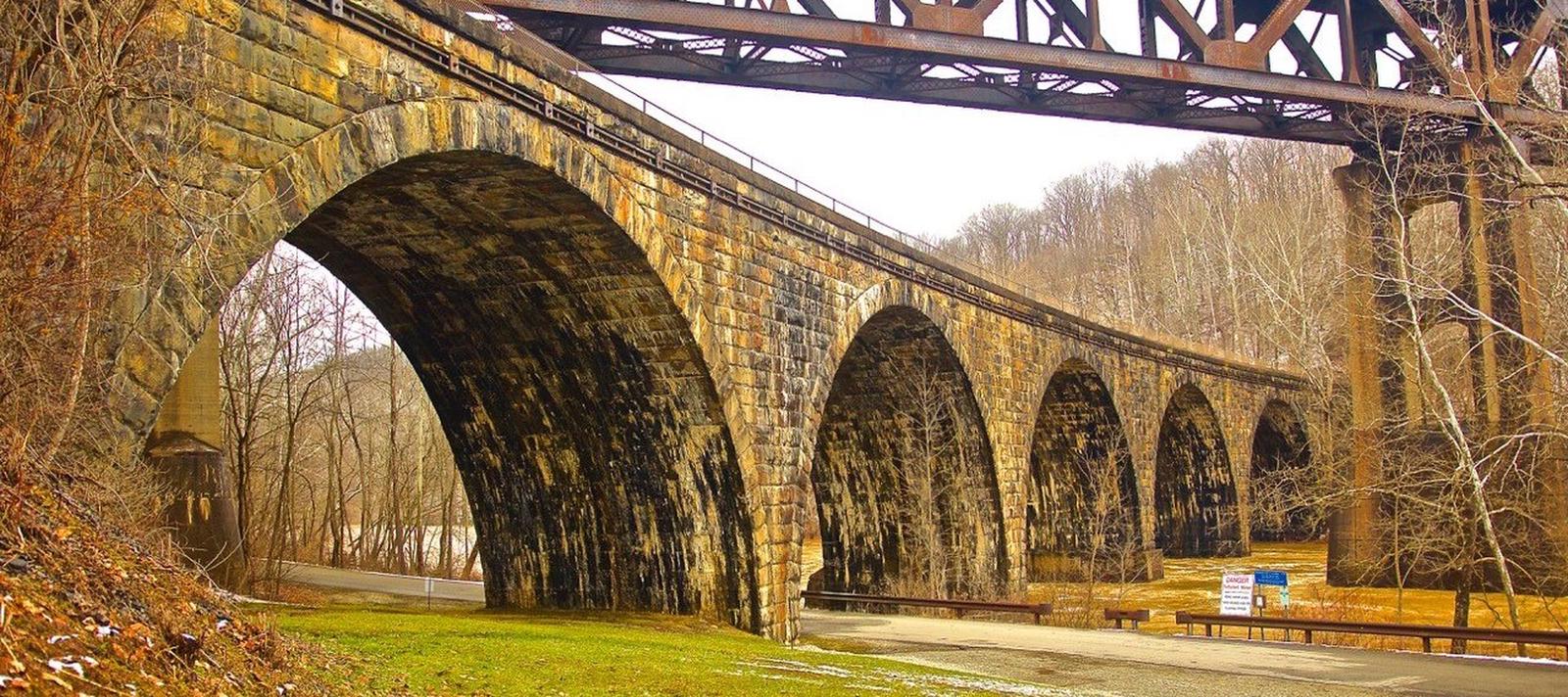
Wildlife viewing and birding are popular activities. Hunting is also permitted in designated areas only. The Pennsylvania Game Commission leases 6,756 acres of land around the lake for wildlife management and hunting. Tunnelview Historic Site, directly downstream of the dam, provides a self-guided historic walk along a section of the restored Main Line Canal that once connected Philadelphia to Pittsburgh (1834-1854). The trail is maintained by the Indiana County Parks Department.
Facilities
The Day Use Area of Conemaugh River Lake is spread out across a large, flat area making it great for any type of gathering. There are two pavilions on site that are available for rental. Each pavilion is equipped with electrical outlets, lights, single and double charcoal grills and access to a water spigot. There are seven picnic tables within the pavilion and are surrounded by at least seven additional tables. Both pavilions are accessible and are within a short walking distance from a restroom with flush toilets. Livermore pavilion is closest to the playground and Social Hall is closest to the restroom. There is an extensive playground area that is suitable for all ages and an outdoor fitness center for those over the age of 13.
Natural Features
Lake fishermen have an excellent prospect of landing largemouth bass, pan fish or the occasional musky or northern pike. The outflow below the dam has a variety of fish populations including walleye, perch, several bass species, trout, carp, catfish and a selection of pan fish. Whether you’re baitcasting, fly fishing or spinning your chances of getting a bite here are good.
Adjacent to the dam, the Bow Ridge Recreation Area offers trails excellent for hiking and observing nature. The Woodchuck Nature Trail provides a 45-minute walk through the diverse Western Pennsylvania forest where one can observe native plants species or just take a peaceful walk.
Nearby Attractions
The West Penn Trail is a 14 mile riverside trail that offers great hiking and biking opportunities. The trail runs straight through the park. Kiski-Conemaugh River Trail is a good novice and family canoe or kayak river with numerous access points. There is one located just below Conemaugh’s Day Use area. It is a seven mile float from Conemaugh Dam to Saltsburg. Also, the Bush Recreation Campground is six miles away.