Directions
Refuge is located 50 miles southwest of Gainesville, Florida, at the terminus of State Road 24. The Refuge consists 13 small, off-shore islands surrounding the community of Cedar Key. The Refuge is accessible only by boat. A lauch ramp in the town of Cedar Key provides the closest access point. A fee is charged. There are also private vendors that rent boats or offer transportations to and around the islands. Because of its small size and importance to wildlife, the refuge can support only limited public use. The interiors of all islands, except for Atsena Otie Key, are closed to the public to protect wildlife and wildlife habitat. The beaches of all other islands are open for public use with the exception of Seahorse Key from March 1 through June 30 annually when it is closed to all public entry, including a 300 foot buffer surrounding the island, to protect nesting birds. Interiors of all islands have thick undergrowth as well as poisonous snakes.
When accessing the islands, it is important to pay attention to the weather and tide conditions. All islands are surrounded by shallow mud flats. During low tides, they become relatively inaccessible by boat.
Part of Seahorse Key, including the lighthouse, is leased by the University of Florid as a Marine Research Laboratory and classroom and is closed to the public. On the third weekend of October, the Refuge and University host an Open House where the public is invited to visit the lighthouse.
Phone
352/493-0238
Activities
WILDERNESS
Camping Reservations
Reserve your campsite at these camping areas:
Hiking Trails
Looking for nice hiking areas to take a hike? Choose from these scenic hiking trails:
Related Link(s)
The Cedar Keys Wilderness now contains a total of 379 acres and is managed by the Fish & Wildlife Service’s Cedar Keys National Wildlife Refuge. All of the Wilderness is in the state of Florida. In 1972 the Cedar Keys Wilderness became part of the now over 110 million acre National Wilderness Preservation System.
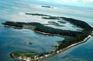
Twelve keys that have been earmarked as protected breeding grounds for colonial birds make up Cedar Keys National Wildlife Refuge. These keys, low islands rising just above the sea, are in fact one of the largest nesting areas in north Florida. The four outermost islands have been designated as Wilderness: Seahorse Key, North Key, Snake Key, and Bird Key (also known as Deadman’s Key). Most of the keys were used as fishing camps or villages by ancient cultures thousands of years ago.
A prominent sandy ridge distinguishes Seahorse Key, recalling the island’s past life as a huge sand dune (granted this was hundreds of thousands of years ago). The ridge crests at 52 feet above sea level, making it the highest point on Florida’s Gulfcoast. The other keys barely make it to 20 feet above the waves. An upland forest of cabbage palm, red bay, live oak, and laurel oak covers the ridge, with an understory of saw palmetto, yaupon, wild olive, prickly pear, eastern red cedar, and Spanish bayonet. Salt marsh and estuarine waters dotted with mangrove dominate the lower elevations.
The most abundant species are white ibis, great egret, double-crested cormorant, snowy egret, tricolored heron, brown pelican, and great blue heron. Reptiles are common as well, including a dense population of cottonmouth snakes. Due to the shortage of fresh water, however, mammals are scarce.
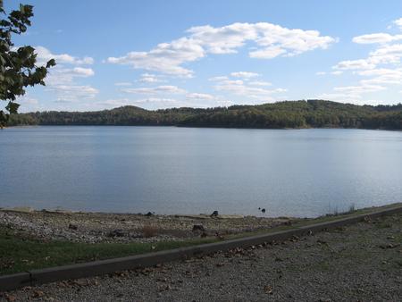
Visitors may use the beaches year round for beachcombing and bird watching, except Seahorse Key. Seahorse Key and a 300 foot buffer zone around the island is closed to all entry from March 1 through June 30 to protect colonial nesting birds. Camping is not permitted on any of the refuge islands.