Directions
Approximately 349 miles southeast of Salt Lake City.
25 miles west of Bluff along US 163, west on SR 261, then southwest on SR 316
Phone
435-678-3348
Activities
CAMPING, HIKING, PICNICKING, DAY USE AREA, PHOTOGRAPHY
Camping Reservations
Reserve your campsite at these camping areas:
Hiking Trails
Looking for nice hiking areas to take a hike? Choose from these scenic hiking trails:
Related Link(s)
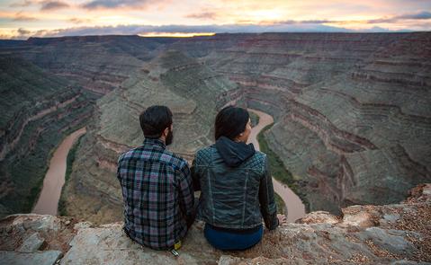
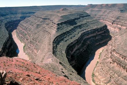
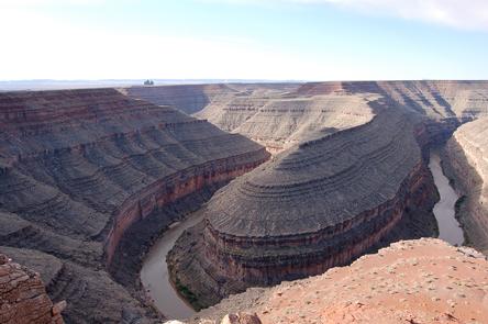
The goosenecks of the San Juan are a rare and amazing geologic formation. And this view point of the river is easy to get to. Take the paved road right to the park and check out how the river has carved a gorge into the plateau. Peer down 1,000 feet to the river below and extend your view outwards to formations as far away as Arizona. The walls of the canyon are made from shale and limestone and are more than 300 million years old.
The river loops several times from the main vantage point. Over 1.5 miles as the crow flies, the river actually flows six miles due to the crooked bends in the San Juan. While there are no hiking trails within the park, there is a rugged and challenging path into the canyon at the nearby Honaker Trail.
The park is about 50 minutes from Monument Valley Navajo Tribal park to the south and Natural Bridges National Monument to the north, so is an excellent stop on Utah’s Road to Mighty.