

Directions
Creekside Terrace Trailhead is just off Highway 68 near the intersection of Reservation Road and Portola Road. Badger Hills Trailhead is just off Highway 68 six miles east of Salinas, CA.
Phone
831-582-2200
Activities
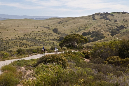
BIKING, INTERPRETIVE PROGRAMS, HIKING, HORSEBACK RIDING, WILDLIFE VIEWING, ENVIRONMENTAL EDUCATION, PHOTOGRAPHY
Camping Reservations
Reserve your campsite at these camping areas:
Hiking Trails
Looking for nice hiking areas to take a hike? Choose from these scenic hiking trails:
Related Link(s)
More California Recreation Areas
Voices of the Coast @ Fort Ord
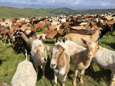
A rich history, diverse habitat and bountiful recreation opportunities await you at the Fort Ord National Monument. Another coastal gem with more than 86 miles of trails provides opportunities to hike, bike or ride your horse through rolling hills, pockets of chaparral, and oak woodlands. You will see a huge diversity of plant life and animals in habitats that include stream side corridors, grasslands, maritime chaparral, oak woodlands and seasonal pools.
Fort Ord is cherished for its link to the heroism and dedication of men and women who served our nation and fought in the major conflicts of the 20th century. This area remained undeveloped thanks to its role as a U.S. Army facility from 1917-1994. During the Vietnam War, it served as a leading training center and deployment staging ground. As many as 1.5 million American troops trained at Fort Ord.
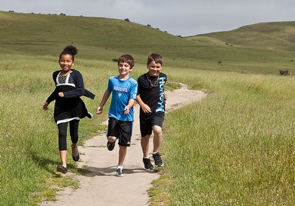
Fort Ord is an official “Hands On the Land” outdoor classroom that brings young students outdoors for learning experiences. Approximately 2,000 kids participate each year.
It’s all in the heart of the Monterey area, with abundant natural resources and beautiful access to the California Coast and Salinas Valley.