Directions
From the hamlet of Bruneau, Idaho head east on Hot Springs Road for 15.6 miles to wilderness kiosk, take a right (west) at kiosk for three miles to the Bruneau River overlook.
Phone
208-735-2060
Activities
CAMPING, FISHING, HIKING, HORSEBACK RIDING, HUNTING, WILDLIFE VIEWING, WILDERNESS, PHOTOGRAPHY, PADDLING
Camping Reservations
Reserve your campsite at these camping areas:
Hiking Trails
Looking for nice hiking areas to take a hike? Choose from these scenic hiking trails:
Related Link(s)
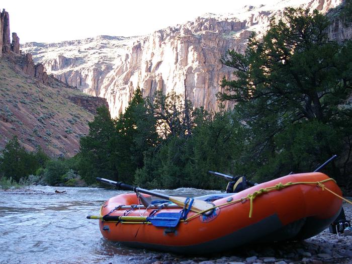
BLM manages more than 90,000 acres of public lands in the Bruneau-Jarbidge Rivers Wilderness. The Owyhee Canyonlands is a huge and remote area of eastern Oregon, southwestern Idaho and northern Nevada. Hidden within this vast high desert plateau are deep canyons carved by the Owyhee, Bruneau and Jarbidge Rivers. The rivers of the Owyhee and Bruneau-Jarbidge systems offer something for nearly every level of boating experience. The Owyhee and Bruneau-Jarbidge river systems provide visitors with unsurpassed solitude in canyons of unique beauty and form. From placid pools to turbulent whitewater; from vertical cliffs to steep grassy slopes; and from wildlife, such as California bighorn sheep to wildflowers, including the Bruneau River flox, these rivers and their canyons present visitors with challenging and extraordinary experiences. The rivers offer challenging whitewater boating in an isolated setting. The canyons and plateau provide ample opportunity for those who wish to explore the area on foot. Sportsmen will find excellent fishing for trout and hunting for upland birds and some big game. The truly adventurous can explore 180,000 acres of pristine lands in two nearby Wilderness Study Areas. The upper canyon is the most scenic part and the easiest floating. Boaters can take out near the scenic overlook at Rogerson, but you have to climb out of the steep canyon. The second half, through Five Mile Rapids and Hot Springs Creek is rocky and requires a lot of maneuvering. Only experienced boaters should attempt the lower part of the Bruneau, especially at high water. The drive to the put-in is an experience in itself, and you should be prepared. Go with someone who knows the way, or hire a shuttle driver in Bruneau. From the confluence of the two rivers to south of Bruneau is 56 miles of class II-IV rapids.


