Directions
To reach Quivira NWR from Wichita, Kansas, and points east, take K96 west to Hutchinson. Take Highway 50 west approximately 14 miles to Highway 14 north. Go 5 miles north to 4th street, turn left and go 17 miles west to the Refuge headquarters. From Great Bend and points north, take Highway 281 south to 70th Street, and then head east 13 miles to the Refuge headquarters. From Pratt and points south take Highway 281 north past St. John to 70th Street. Take 70th Street east 13 miles to the Refuge headquarters. From Macksville and points west, take Highway 50 east to Stafford. Drive north through Stafford and continue 6 miles north to the four-way stop sign. Turn east 6 miles to the Refuge headquarters.
Phone
620-486-2393
Activities
AUTO TOURING, INTERPRETIVE PROGRAMS, FISHING, HIKING, HUNTING
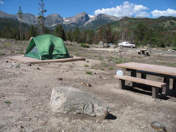
Camping Reservations
Reserve your campsite at these camping areas:
Hiking Trails
Looking for nice hiking areas to take a hike? Choose from these scenic hiking trails:
Related Link(s)
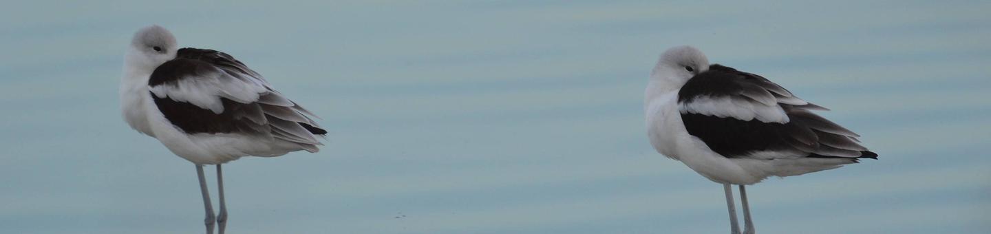
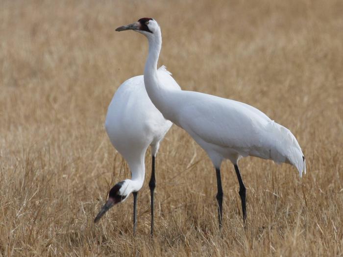
Quivira National Wildlife Refuge (NWR) was established in 1955 to provide wintering and migration stopover habitat for migratory birds along the Central Flyway of North America. The name “Quivira” comes from a Native American tribe that lived in the area when the explorer, Coronado, visited in 1541. It is believed to mean “raccoon eyes” in reference to tattoos that resembled a raccoon’s mask around the eyes of the area’s Native Americans. For years, the marshes of Quivira NWR have attracted thousands of migrating waterfowl. These marshes, together with a wide diversity of other habitats, provide food, cover, and protection for wildlife. Wetlands, large and small, are present throughout the Refuge; there are approximately 7,000 acres of wetlands with slightly to moderately saline water. Thousands of Canada geese, ducks, and other migratory birds, such as sandhill cranes and shorebirds, use these wetlands as they pass through the Refuge on their annual migrations.