Directions
From I-15 Exit 8 turn onto St George Blvd heading east. Travel 0.2miles, and turn right on River Road. Travel 1.8 miles, and turn left on 1450 South. Continue 2 miles and turn left on 1580 South. Travel 1.5 miles and turn right on Washington Fields Road. Travel 2 miles and take a left onto the Warner Valley Road. Travel 5.5 miles and turn left at the sign for Fort Pearce. Travel 0.5 miles to Fort Pearce Historic Site parking area.
Phone
435-688-3200
Activities
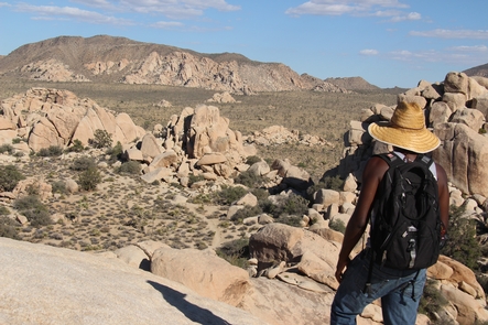
BIKING, HIKING, WILDLIFE VIEWING, PHOTOGRAPHY
Camping Reservations
Reserve your campsite at these camping areas:
Hiking Trails
Looking for nice hiking areas to take a hike? Choose from these scenic hiking trails:
Related Link(s)
Recommended Users: Hikers. Singletrack Trail. 0.05 miles in length. Difficulty: Easy. This short trail leads you to the Fort Pearce Historic Site in Warner Valley. It also offers views of the Virgin River and colorful desert landscape of the surrounding area.