Directions
14 miles west of Hanksville along State Route 24
Phone
(435) 542-3461
Activities
HIKING
Camping Reservations
Reserve your campsite at these camping areas:
Hiking Trails
Looking for nice hiking areas to take a hike? Choose from these scenic hiking trails:
Related Link(s)
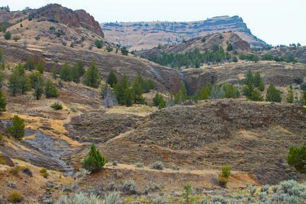
One of the more unique views in all of Utah is found by hiking up and onto South Caineville Mesa. This is a somewhat strenuous hike and exposes hikers to some very steep sidehills. The views are worth it. The eroding mountains and mesa’s have cut ravines that fan out dramatically at the base. The trail is about two and a half miles long to the top of the Mesa where there is a register box to sign in. Some might be satisfied with reaching the top, but while you are there, it’d be worth the time to walk south across the Mesa to see the old rock cabin that was built by some of the earliest ranchers.