Directions
To the northern portion of the river: from Naturita, travel east on Highway 145, and then turn left onto Highway 90. To the southern portion of the river: from Naturita, travel east on Highway 145. After Norwood, look for river access points.
From Placerville, take State Highway 145 north along Uniweep-Tabeguache Scenic Byway for about 33 miles to Naturita. There are several access points for fishing along the way. The northern part of the Special Management Area is accessible via the river, or from the State Highway 90 turn-off, 3 miles east of Naturita.
Phone
970-240-5300
Activities
AUTO TOURING, BOATING, CAMPING, FISHING, WATER SPORTS, WILDLIFE VIEWING
Camping Reservations
Reserve your campsite at these camping areas:
Hiking Trails
Looking for nice hiking areas to take a hike? Choose from these scenic hiking trails:
Related Link(s)
More Colorado Recreation Areas
San Miguel River Recreation Area
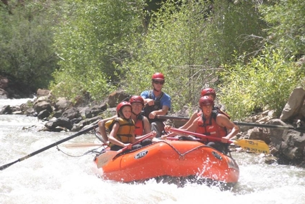
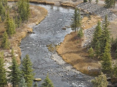
San Miguel River Recreation Area features diverse ecosystems of rare riparian plant communities. The corridor is a fragile ecosystem containing outstanding riparian, recreational, scenic, and wildlife values. A scenic drive along the corridor provides beautiful views, several access points to the river and a BLM campground along the way.Brown and rainbow trout thrive here, and a number of access points along the river provide excellent fishing opportunities. With whitewater classes ranging between II and IV, boaters can enjoy a variety of river trips. The water’s consistent gradient and continuous flow through a boulder-strewn course make for exciting rides. Visitors of this area can travel along the Unaweep-Tabeguache Scenic and Historic Byway.
The San Miguel River begins in the San Juan Mountains above Telluride, Colorado and ends at the confluence with the Dolores River 72 miles downstream (near Uravan). While the San Miguel is more or less free-flowing, diversion dams dot the river and alter its flow. The San Miguel drops over 7,000 feet from an alpine to a desert ecosystem. The riparian corridor is lush and contains numerous globally rare riparian plant communities.
San Miguel Leopard to Deep Creek The San Miguel offers the whitewater boater a variety of runs, all within the class II+ to III range. The consistent gradient and continuous flow of the river provide the boater with an abundance of whitewater, none of which is overly difficult. While the river should be easily negotiable by the intermediate whitewater boater, numerous strainers and downed wood from spring floods can make the river more challenging than its rating would suggest. Use caution in maneuvering around these ever-changing obstacles. For more information, please contact the Uncompahgre Field Office.
Flow Guidelines:
Flow 250-550 cfs Recommendation: Canoes, kayaks, inflatable kayaks, rafts 12ft or smaller River is less “pushy” but rapids become more technical with exposed rocks and narrow passages Beware of submerged and exposed rocks This flow is good for less experienced rafters and paddlers.
Flow 550-1200 cfs Recommendation: Canoes, kayaks, inflatable kayaks, rafts 14ft or smaller Best level for beginner to intermediate rafters. Challenging for intermediate kayakers.
Flow 1200-2000 cfs Recommendation: Canoes, kayaks, inflatable kayaks, rafts 14ft or smaller Solid Class III with some IV possible River becomes pushy and fast as flows approach 3,000 cfs. Many rapids will wash out while others will form. Beware of overhanging trees and strainers.
Flow 2000+ cfs (rare) Recommendation: Canoes, kayaks, inflatable kayaks, and rafts 14 ft. recommended for expert boaters only.


