Directions
Getting there: Take the Alta exit off I-80 East, thirty miles northeast of Auburn. Turn south on Casa Loma Road to the trailhead. Put-in is a two (2) mile walk from the trailhead. To take-out, take the Canyon Way exit off I-80 at Colfax to the Colfax-Iowa Hill Road.
Phone
916-941-3101
Activities
FISHING, HIKING, PICNICKING, WILDLIFE VIEWING, PHOTOGRAPHY, PADDLING
Camping Reservations
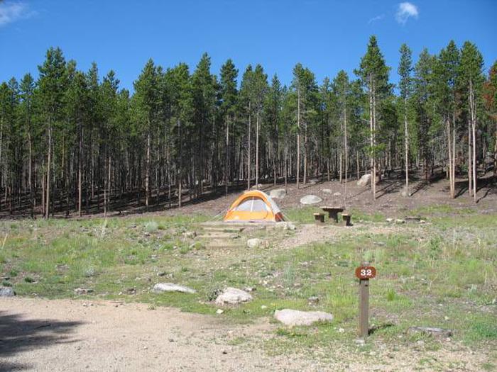
Reserve your campsite at these camping areas:
Hiking Trails
Looking for nice hiking areas to take a hike? Choose from these scenic hiking trails:
Related Link(s)
More California Recreation Areas
North Fork American River Flickr Album
North Fork American River – National Conservation Lands Special Designation
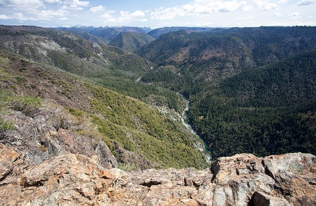
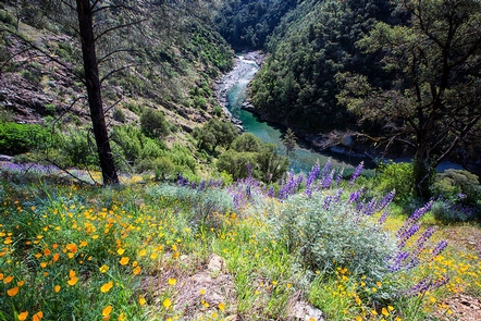
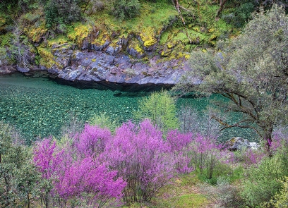
The North Fork American River lies within a deeply incised canyon with the river itself being 2,000 feet to 2,400 feet below the canyon rim. This segment of the river is a Congressionally-designated Wild River and a State-designated Wild Trout Stream. Features include scenic, recreation, cultural and water quality values. Ponderosa pine forest occupies much of the area with some steep hillsides occupied by oak woodland and chaparral. Historical features along the North Fork include the Stevens Trail, American View, and Cape Horn.
Visitors to the North Fork enjoy a semi-wilderness setting. River access is possible at the lower end near the Colfax-Iowa Hill bridge, or by a strenuous descent by trail from a few locations along the canyon rim. Trails leading to the North Fork are used by hikers, backpackers, pack and saddle stock users, gold panners, and by whitewater recreationists gaining access to the river at Euchre Bar. Whitewater rafting, hiking, backpacking, swimming, recreational gold panning, fishing, nature study and picnicking are among the most popular activities.
Whitewater recreation through this segment of river is Class V which means experts only, and only under certain conditions of flow. Typically, the whitewater run of the North Fork Wild River segment termed the Giant Gap Run is possible only during the spring and early summer.
Please note: This river is not recommended for the inexperienced boater.
Put-In: Euchre Bar – a two (2) mile walk from the trailhead
Take-Out: Iowa Hill-Colfax Bridge
River Class: IV-V
Please also visit our webpages for:
South Fork American River
Stevens Trail
Hunting and Shooting Info – North Fork American River SRMA
- All public lands located in MDM, T. 15 N., R. 9 E., Sec. 26 are CLOSED to target shooting. This area is known as “Burnt Flat” located off Carpenter Road and Interstate-80 north of the Steven’s Trail.
- Hunting is allowed, in accordance with State law, unless a specific area is signed CLOSED by the BLM.
NOTE: All California game species are regulated by the California Department of Fish and Wildlife (CDFW). Rules, regulations, and seasons are controlled by CDFW, and it is the hunter™s responsibility to verify and comply with proper species, seasons, zones, regulations, and legal location if hunting on public lands.
FGC 3004 “ It is unlawful for any person to hunt or discharge while hunting, any firearm or other deadly weapon within 150 yards of any occupied dwelling house, residence, or other building or any barn or other outbuilding used in connection therewith. The 150 yard area is a “Safety Zone.”
Learn more about the importance of gun safety.
Helpful Links:
Where to Shoot
California Department of Fish & Wildlife
Hunting, Fishing and Recreational Shooting on Public Lands, BLM California
Return To: BLM, Mother Lode Field Office