

Directions
From Estacada, Oregon: Follow Oregon Highway 224 East for 9.5 miles to the Memaloose Bridge.
Phone
503-815-1100
Activities
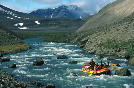
AUTO TOURING, BIKING, FISHING, HIKING, HUNTING
Camping Reservations
Reserve your campsite at these camping areas:
Hiking Trails
Looking for nice hiking areas to take a hike? Choose from these scenic hiking trails:
Related Link(s)
Photo Album: Clackamas Wild and Scenic River
Interactive Video: 360° drive along the Clackamas Wild and Scenic River
Clackamas Wild and Scenic River at rivers.gov
Cascading Rivers Scenic Bikeway
Overview:
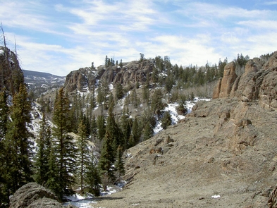
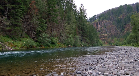
The Clackamas River is located to the west of the Cascade Range and to the south of the Columbia River Gorge in northern Oregon. Flowing northwest from its sources high in the Cascade Mountains, the designated portion of the river, which is 47 miles (75.6 km) in length, runs from Big Spring (headwaters area) to Big Cliff, just south of the town of Estacada. This most picturesque region is entirely within the Mt. Hood National Forest and encompasses forested lands, wetlands, riparian areas and rock cliffs.
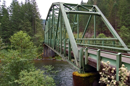
Of the 47 miles of the river that carry the wild and scenic designation, the Bureau of Land Management manages a small-but-important portion: six-tenths of a mile of river adjacent to Oregon State Hwy. 224, from a point west of the U.S. Forest Service™s Lazy Bend Campground to a half mile above the river™s bend westward at Big Cliff. The area is most recognizable by the green Pratt truss bridge at Memaloose Road, now closed to vehicular traffic, which sits atop the river and connects walkers to the day-use area on the river™s south side.
Know Before You Go:
- There are no facilities on the Bureau of Land Management portion of the river; however the Forest Service™s seasonal Lazy Bend campground and Big Eddy Picnic Area offer nearby amenities.
- State Highway 224, following the Clackamas River, enjoys two designations: Cascading Rivers State Scenic Bikeway and the West Cascades National Scenic Byway.
- Don’t Move Firewood: Please protect Pacific Northwest forests by preventing the spread of invasive species. Firewood can carry insects and diseases that can threaten the health of our western forests. You can make a difference by obtaining and burning your firewood near your camping destination.
Point of Interest:
The area is most recognizable by the green Pratt truss bridge at Memaloose Road, now closed to vehicular traffic, which sits atop the river and connects walkers to a primitive day-use area on the river’s south side.