

Directions
The recommended route to the park is from Highway 191 in Chinle then turning east on Route 7. The park entrance and Visitor Center is about 3 miles from Highway 191. An alternative is entering the park on the East side via Route 64. There are 3 overlooks to stop at along Route 64 before getting to the Visitor Center. Travel on Route 7 from the East is NOT RECOMMENDED since the road is unpaved and unmaintained between Sawmill and the Spider Rock turnoff.
Phone
(928) 674-5500
Activities
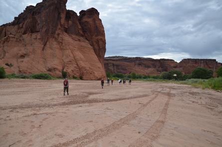
AUTO TOURING, CAMPING, HIKING
Camping Reservations
Reserve your campsite at these camping areas:
Hiking Trails
Looking for nice hiking areas to take a hike? Choose from these scenic hiking trails:
Related Link(s)
Canyon de Chelly National Monument Official Website
Canyon de Chelly National Monument Map
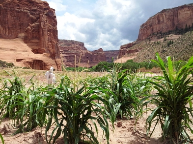
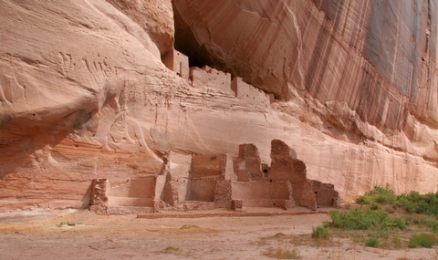
For nearly 5,000 years, people have lived in these canyons – longer than anyone has lived uninterrupted anywhere on the Colorado Plateau. In the place called Tsegi, their homes and images tell us their stories. Today, Navajo families make their homes, raise livestock, and farm the lands in the canyons. A place like no other, the park and Navajo Nation work together to manage the land’s resources.