Directions
From Albuquerque, head north on I-25 and take the exit for Santo Domingo/Cochiti Lake Recreation Area (Exit 259) off I-25 onto NM 22. Follow the signs on NM 22 to Cochiti Pueblo and Kasha-Katuwe Tent Rocks National Monument.
From Santa Fe, head south on I-25 and take the Cochiti Pueblo Exit 264 off I-25 onto NM 16. Turn right off NM 16 onto NM 22, and follow the signs to Cochiti Pueblo and the National Monument.
Note, following the GPS coordinates may take you through tribal lands that are not accessible. Please follow the directions above and access the Monument from I-25.
Phone
Monument: 505-331-6259, Field Office: 505-761-8700
Activities
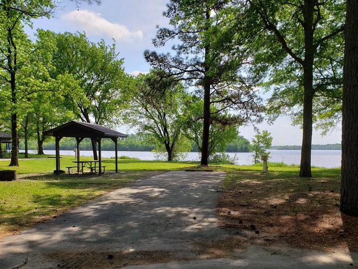
HIKING, WILDLIFE VIEWING, DAY USE AREA
Camping Reservations
Reserve your campsite at these camping areas:
Hiking Trails
Looking for nice hiking areas to take a hike? Choose from these scenic hiking trails:
Related Link(s)
More New Mexico Recreation Areas
BLM New Mexico YouTube Channel
BLM New Mexico YouTube Channel
Kasha-Katuwe Tent Rocks National Monument Weather Alert
The Kasha-Katuwe Tent Rocks National Monument has reopened Slot Canyon and Cave Loop Trail. The Veterans™ Memorial Scenic Overlook remains closed and will open as soon as muddy conditions allow. Visitors should wear sturdy hiking shoes on their visit and be prepared for some icy conditions.
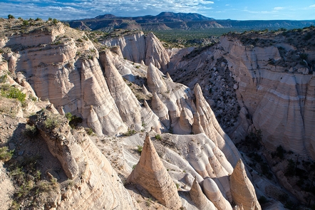
The Kasha-Katuwe Tent Rocks National Monument is a remarkable outdoor laboratory, offering an opportunity to observe, study, and experience the geologic processes that shape natural landscapes. The National Monument, on the Pajarito Plateau in north-central New Mexico, includes a national recreation trail and ranges from 5,570 feet to 6,760 feet above sea level. It is for foot travel only, and contains two segments that provide opportunities for hiking, birdwatching, geologic observation, and plant identification.
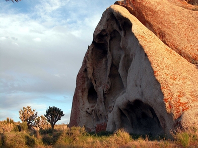
The cone-shaped tent rock formations are the products of volcanic eruptions that occurred 6 to 7 million years ago and left pumice, ash, and tuff deposits over 1,000 feet thick. Tremendous explosions from the Jemez volcanic field spewed pyroclasts (rock fragments), while searing hot gases blasted down slopes in an incandescent avalanche called a pyroclastic flow.
Precariously perched on many of the tapering hoodoos are boulder caps that protect the softer pumice and tuff below. Some tents have lost their hard, resistant caprocks, and are disintegrating. While fairly uniform in shape, the tent rock formations vary in height from a few feet up to 90 feet.
Please note that dogs are not allowed in the Monument.
Hours of Operation
Entry into the Monument between 8:00 a.m. and 4:00 p.m.
Closing procedures begin at 3:30pm to clear the Monument by 5pm.
Visitors must be out of the fee booth gated area by closing time.
During the summer months, the Monument experiences increased visitation. Please be aware that visitors may experience entrance delays starting at 9am due to increased visitation and lack of available parking. Wait times may range from 30 to 90 minutes. As parking is made available, new visitors will be allowed entry.
The monument will be closed on Jan. 6; the Friday before Easter; Easter Sunday; the Monday after Easter; May 3; July 13-14; July 25; Nov. 1; Thanksgiving Day; Christmas Day; and New Year™s Day to allow for Pueblo de Cochiti cultural observances and routine BLM maintenance.