Directions
Trinity River National Wildlife Refuge is located in Liberty County, TX, approximately 45 miles northeast of Houston and 45 miles west of Beaumont. The physical address is 601 FM 1011, Liberty, TX, 77575.
Refuge Headquarters
From Houston: Take I-10 east to TX-146 (Mont Belvieu exit). Go north on TX-HWY 146 for 16 miles to US 90. Turn right on US 90 and go six miles to Liberty. At Main St. (traffic light at McDonald’s), turn left and go 3.3 miles to FM 1011. Turn left and continue 0.6 miles. The office is on the left.
From Beaumont: Take I-10 west to FM 563/Anahuac/Liberty exit. Turn right and go 17.4 miles. Turn left on US 90 and go 0.8 miles to Main Street (traffic light at McDonalds). Turn right and go 3.3 miles to FM 1011. Turn left and continue 0.6 miles. The office is located on the left.
Phone
936-336-9786
Activities
FISHING, HIKING, HUNTING, WILDLIFE VIEWING, PHOTOGRAPHY
Camping Reservations
Reserve your campsite at these camping areas:
Hiking Trails
Looking for nice hiking areas to take a hike? Choose from these scenic hiking trails:
Related Link(s)
Trinity River National Wildlife Refuge
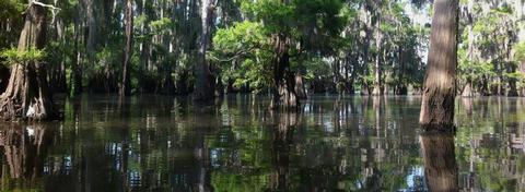
Trinity River National Wildlife Refuge was established on January 4, 1994 with an initial purchase of 4,400 acres. Since that time, the refuge has acquired additional acreage which now totals 30,000 acres. The primary purpose of establishing this refuge is to protect a portion of the bottomland hardwood forest ecosystem along the Trinity River located in southeastern Texas. The refuge, which is a remnant of what was once a much larger natural area is a broad flat floodplain made up of numerous sloughs, oxbow lakes, artesian wells, and tributaries.


