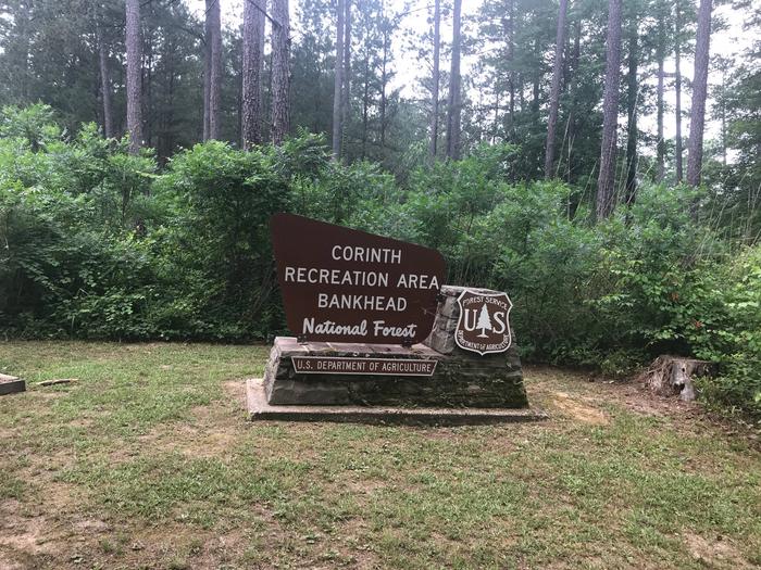
CORINTH RECREATION AREA, AL Campground Reservation, Info, Images, Map, Directions

CORINTH RECREATION AREA, Alabama Campground Images, Info & Reservations

Directions

From Double Springs, travel 8 miles east on Hwy 278; turn right at Corinth Recreation Area sign on County Road 57. 

Phone

205-300-1463

Activities

BIKING, BOATING, CAMPING, INTERPRETIVE PROGRAMS, FISHING, HIKING, RECREATIONAL VEHICLES, WATER SPORTS, DAY USE AREA, SWIMMING SITE, PHOTOGRAPHY, PADDLING, SWIMMING, CANOEING, WATER ACCESS

Keywords

CORI,NFs IN ALABAMA – FS

Related Link(s)

Rec Area Info & Images

Forest Service Concessionaire

Alabama State Road Conditions

Alabama State Tourism

Overview

The Corinth Recreation Area is a modern state-of-the art campground located on the shores of Lewis Smith Lake. It offers facilities for individual and group camping, picnicking, swimming, and boat launching. Two camping loops contain 52 campsites, with electrical, water, and sewer hookups. There are four bathhouses, with warm showers, serving the camping areas. A boat ramp is provided for campers. In addition, 10 tent campsites are provided. The day-use area contains dressing rooms and warm showers, 29 picnic sites, a 100-person pavilion, a swimming beach, and a double lane boat ramp. ADA accessible sites are available.

Recreation

  • Day-use visitors and campers have access to a boat ramp and swim beach.  
  • The lake provides excellent fishing for Kentucky Spotted Bass and Hybrid Striped Bass.  
  • Hikers can access the 1.3-mile Bobwhite Trail.  
  • Interpretive programs are hosted during the summer.

Facilities

  • All facilities are wheelchair accessible. 
  • Flush toilets, drinking water and showers are offered for both campers and day-use visitors.  
  • The campground offers spacious standard sites with full hookups that can accommodate RVs of any size. 
  • Sites contain paved parking spurs, picnic tables, grills and tent pads. 
  • There is a reservable group picnic shelter that can accommodate up to 100 people, as well as 29 first-come, first-served picnic sites.

Natural Features

Bankhead National Forest is located in northwestern Alabama, and its prominent feature is the Sipsey Wilderness. Known as “The Land of a Thousand Waterfalls,” it’s an area of abundant streams, old-growth forests, limestone bluffs and lush canyons. Lake Lewis Smith boasts more than 500 miles of shoreline marked by high rock bluffs. The water is clear and deep and provides excellent fishing.

Nearby Attractions

Three nearby attractions within Bankhead National Forest are: 

  • The Little Natural Bridge 
  • The 19th-century Pine Torch Church
  • The Houston Civil War Jail

Reservation

More from CampingHiking.net:

PICKLE GULCH, Colorado Campground Images, Info & Reservations

Directions From Interstate 25 in Denver, travel west on 6th Avenue to State Highway 6 and continue through Clear Creek Canyon. Turn on State Highway 119 toward Black Hawk and Central City. Follow the highway 4 miles north of Black Hawk, to the campground. Phone 801-226-3564 Activities BIKING, CAMPING, FISHING,

WOLF CREEK CALIFORNIA, California Campground Images, Info & Reservations

Directions From Placerville, get on Highway 50 and head east for 21 miles to Icehouse Road. Turn left 21 miles to turnoff. Then go three-quarters of a mile to campground. Phone 831-245-6891 Activities BIKING, BOATING, CAMPING, FISHING, HIKING, WATER SPORTS, WILDLIFE VIEWING, SWIMMING SITE, BIRDING, WATER SKIING Keywords WOLA,ELDORADO NF

LAKE POWHATAN, North Carolina Campground Images, Info & Reservations

Directions From Asheville, take I-26 to exit 33. Go south approximately 2 miles on State Route 191 to the Lake Powhatan Recreation Area sign. Turn right and follow signs to the campground. Phone 828-552-8040 Activities BIKING, BOATING, CAMPING, INTERPRETIVE PROGRAMS, FISHING, HIKING, PICNICKING, DAY USE AREA, SWIMMING SITE, ENVIRONMENTAL EDUCATION,

SANTA ROSA ISLAND, California Campground Images, Info & Reservations

Directions Boat transportation can be arranged with Island Packers from Ventura Harbor. Air transportation can be arranged with Channel Islands Aviation from Camarillo airport. To park headquarters in Ventura, California: Highway 101, exit Victoria or Seaward to Ventura Harbor. Phone 805-658-5730 Activities BOATING, HISTORIC & CULTURAL SITE, CAMPING, INTERPRETIVE PROGRAMS,

LONESOMEHURST CAMPGROUND, Montana Campground Images, Info & Reservations

Directions From West Yellowstone, travel west on Highway 20 for eight miles, then continue four miles north on Hebgen Lake Road (Denny Creek Road). Phone 406-646-1012 Activities BIKING, BOATING, CAMPING, FISHING, HIKING, WILDLIFE VIEWING, PHOTOGRAPHY, SWIMMING, KAYAKING, CANOEING, BERRY PICKING, STAR GAZING, BIRDING, WATER ACCESS, BACKPACKING Keywords None Related Link(s)