
Directions
Directions from the North: Take Interstate 65 to Exit 53 (Cave City Exit). Turn right onto KY-70. Follow 70/255 as it becomes the Mammoth Cave Parkway in the park. Follow the Mammoth Cave Parkway towards the Visitor Center. Turn left on the Green River Ferry Road. Cross the ferry and follow the signs to Maple Springs. Turn left onto Maple Springs Loop. Maple Spring Campground will be on the left. For trailers or large vehicles, use alternate directions. Vehicles boarding the ferry must not exceed 8 tons and have a length no more than 16 feet.
Alternate Directions from the North:Take Interstate 65 to Exit 53 (Cave City Exit). Turn right onto KY-70. Follow 70/255 as it becomes the Mammoth Cave Parkway in the park. Turn left on HWY 70 to Brownsville. Make a right on HWY 259. Turn right onto HWY 728 which becomes HWY 1827. Then turn right onto HWY 1352 and follow signs to Maple Springs Group Campground. Turn right onto Maple Springs Loop. Maple Spring Campground will be on the left.
Directions from the South: Take Interstate 65 to Exit 48 (Park City Exit). Turn left onto KY-255 and follow 255 as it becomes the Park City Road into the park. Follow Park City Road until it joins the Mammoth Cave Parkway; turn left. Follow the Mammoth Cave Parkway towards the Visitor Center. Turn left on the Green River Ferry Road. Cross the ferry and follow the signs to Maple Springs. Turn left onto Maple Springs Loop. Maple Spring Campground will be on the left. For trailers or large vehicles, use alternate directions. Vehicles boarding the ferry must not exceed 8 tons and have a length no more than 16 feet.
Alternate Directions from the South: Take Interstate 65 to Exit 48 (Park City Exit). Turn left onto KY-255 and follow 255 as it becomes the Park City Road into the park. Follow Park City Road until it joins the Mammoth Cave Parkway; turn left. Turn left on HWY 70 to Brownsville. Make a right on HWY 259. Turn right onto HWY 728 which becomes HWY 1827. Then turn right onto HWY 1352 and follow signs to Maple Springs Group Campground. Turn right onto Maple Springs Loop. Maple Spring Campground will be on the left.
Phone
270-758-2424
Activities
BIKING, CAMPING, HIKING, HORSEBACK RIDING, PICNICKING, DAY USE AREA, PHOTOGRAPHY, HORSE CAMPING, MOUNTAIN BIKING, STAR GAZING, BIRDING, SCENIC DRIVE, BACKPACKING, MUSHROOM PICKING
Keywords
CG42,Mammoth Cave,Horse Campground,Horse Sites,Group Camping,Maple Spring
Related Link(s)
National Park Services Concessionaire
Kentucky State Road Conditions
Overview
At Maple Springs, visitors can enjoy the serenity of the campground and surrounding backcountry trails, or spend their days exploring Mammoth Cave. Campers can explore up to ten miles of the cave through a variety of tours available at the Visitor Center. With more than 400 miles (644 km) of mapped passageways, Mammoth Cave ranks as the world’s longest known cave system. Mammoth Cave is named for its grand size and scale. Visit the Rotunda for an idea of just how large this underground world is. The World Heritage Site was explored by Native Americans more than 2,000 years ago, and Europeans discovered its existence at the turn of the 19th century.
Recreation
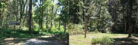
Avid horseback riders head to Maple Springs to explore the lush backcountry trails. Hikers will also find these trails enjoyable.
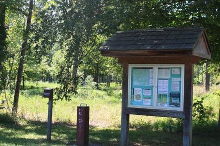
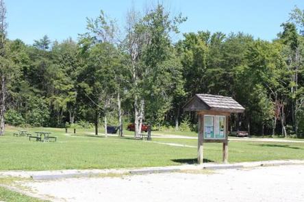
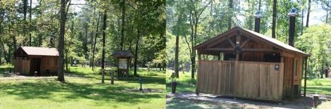
Facilities
Access to the primitive campground is best by ferry. The ferry is six miles from the Mammoth Cave Visitor Center and fits three cars. Ferry rides are free and take only a few minutes. Driving to the campground takes a couple minutes, whereas driving to the site takes a 45 minute loop around. Call (270) 758-2166 for information, ferry schedules and standards for trailers.
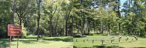
Horse ties are behind the campsites. A small amphitheater is on site and a large fire pit is available for groups on a first come, first served basis.
Natural Features
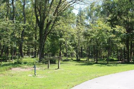
This campground is part of Mammoth Cave National Park, a 52,800-acre park that includes the Green River Valley, rolling Kentucky hillsides, and the expansive Mammoth Cave with grand-scale chambers and long, winding passageways. This remote campsite is quiet, peaceful and ideal for those who want to be immersed in nature. Wildlife includes deer, turkey, and coyotes.
Nearby Attractions
Take a tour of Mammoth Cave and see landmark cave areas like the Cathedral Domes and Mammoth’s famous formation, Frozen Niagara. Or hike above the caverns to explore sinkholes like Cedar Sink.
Charges & Cancellations
For rules and reservation policies please follow the link below:
https://www.recreation.gov/rules-reservation-policies