CADIZ, KY Campground Reservation, Info, Images, Map, Directions

CADIZ, Kentucky Campground Images, Info & Reservations

Listen

Directions

From Nashville, Tennessee,or St. Louis take I-24 to the Cadiz, Exit 65, travel west on St. HWY 68/80 6 miles. Turn right onto KY 139 for 1.5 miles. turn left on Jefferson St

Phone

270-362-4236

Activities

BOATING, FISHING, PICNICKING, DAY USE AREA

Keywords

CADI,LAKE BARKLEY,BARKLEY LOCK & DAM

Related Link(s)

Rec Area Info & Images

Kentucky State Road Conditions

Kentucky State Tourism

Overview

Cadiz Park is located on the beautiful Lake Barkley near the town of Cadiz, Kentucky. The day-use area is a great spot for barbecuing, boating and fishing.

Fun fact: the largest yellow bass caught in Kentucky, weighing in at one pound one ounce, was caught in Lake Barkley.

Recreation

Visitors enjoy boating, fishing, and swimming among many other activities. Bring the family and some food and enjoy a fun-filled day in sun at Cadiz.

Facilities

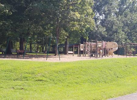
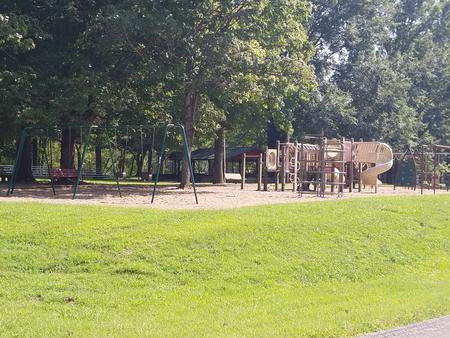
The picnic shelter is ideal for groups of up to 100 guests. Amenities include a boat ramp, playground, paved parking and grills. Shopping, grocery stores, and gas stations are conveniently close.

Natural Features

Lake Barkley covers 57,900 acres with 1,004 miles of shoreline. Summer water temperatures are a comfortable but refreshing 70 to 80 degrees Fahrenheit.

Nearby Attractions

Visit the Lake Barkley State Resort Park for miles of hiking trails and horseback riding stables.

Reservation

More from CampingHiking.net:

DEEP BAY CABIN, Alaska Campground Images, Info & Reservations

Listen Directions Deep Bay Cabin is located on the south end of Deep Bay on the northeast corner of Zarembo Island. The cabin is a short walk from Deep Bay and about 1/4 mile from Roosevelt Harbor just off of the Zarembo Beach Road FSR 6590. The cabin is only

Linville Falls Campground, North Carolina Campground Images, Info & Reservations

Listen Directions From I-40 East, take Highway 221 north to the Blue Ridge Parkway at Linville Falls. Go north for one mile to Linville Falls Spur Road, located at Milepost 317, and continue a half mile to the campground. Phone 828-765-7818 (MAY-OCTOBER) Activities CAMPING, INTERPRETIVE PROGRAMS, FISHING, HIKING, PICNICKING, VISITOR

DEER CREEK LAKE DAY USE, Ohio Campground Images, Info & Reservations

Listen Directions From Columbus, Ohio, take Highway 62 south to Mt. Sterling. Turn south on Route 207 and continue for 8 miles to the lake. Turn at the intersection; picnic shelter is on Crownover Mill Road. Phone 740-869-2243 Activities BOATING, CAMPING, FISHING, HIKING, HUNTING, SWIMMING SITE Keywords DCBD,BELOW DAM AREA,PICNIC

DEERLICK CREEK, Alabama Campground Images, Info & Reservations

Listen Directions From I-59 in Alabama, take Exit 73 (MacFarland Boulevard). Go west on MacFarland Blvd./Highway 82 for approximately 4.2 miles. Veer right onto Rice Mine Road. At the stoplight turn left onto Rice Mine Rd. Then, turn right at the stoplight onto New Watermelon Road and follow it for

NORTH DICKEY LAKE, Montana Campground Images, Info & Reservations

Listen Directions From Eureka, travel south on Highway 93 for approximately 13 miles to Fortine. Continue south on Highway 93 for over a mile to the campground. Phone 406-296-2536 Activities BIKING, BOATING, CAMPING, FISHING, HIKING, WATER SPORTS, SWIMMING SITE Keywords NODI,DICKEY LAKE,KOOTENAI NF – FS Related Link(s) Rec Area Info