RIDGE ROAD, GA Campground Reservation, Info, Images, Map, Directions

RIDGE ROAD, Georgia Campground Images, Info & Reservations

Directions

From I-20 take Exit 183 (Appling). Go north on HWY 221 approximately 6 miles. At 4-way stop, go left (GA HWY 47) and drive approximately 5 miles. Campground road is on right. Follow signs.

Phone

706-541-0282

Activities

CAMPING, SWIMMING SITE

Keywords

RIDG,J STROM THURMOND LAKE

Related Link(s)

Rec Area Info & Images

Georgia State Road Conditions

Georgia State Tourism

Overview

Ridge Road Campground is located on a scenic peninsula on J. Strom Thurmond Lake, and is one of the area’s first campgrounds.

The 70,000 acre lake and its 1,000+ miles of shoreline provide excellent boating, water skiing, swimming, fishing, hiking and picnicking.

Recreation

Thurmond Lake provides some of the best fishing, hunting, and water sports in the southeastern United States. Anglers fish for largemouth bass, bream, crappie, catfish and striped bass. The large lake offers endless boating, waterskiing, jet skiing, canoeing and swimming opportunities.

Many miles of hiking trails are available a few miles from the campground. Hikers enjoy the 1.8-mile Lake Springs Loop and the 27-mile Bartram Trail, which meanders along the scenic shoreline and through Wildwood Park. Shorter sections can be hiked from several intersecting trailheads.

Facilities

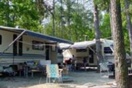
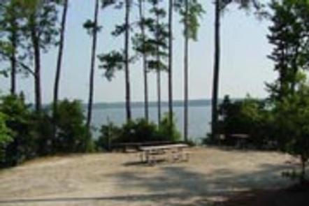
This wooded, waterfront campground has beautiful views of the lake. It contains 63 sites with water and 50-amp electrical service. Six sites are for primitive tent camping.

Amenities include flush and vault toilets, showers, drinking water, laundry facilities and a dump station.

A playground, boat ramp, dock, and fish cleaning station are located on-site.

Natural Features

Hot, humid summers and mild, pleasant winters characterize this heavily wooded area on the shore of Thurmond Lake. A mixed pine and hardwood forest covers the site, providing summer shade and fall color.

Wildlife is abundant around the lake. Visitors regularly see southern bald eagles, migratory waterfowl and wild turkeys. The Ridge Road area is home to many families of whitetail deer.

Nearby Attractions

Numerous parks and recreation areas lie around Thurmond Lake, providing additional boating, swimming, hunting, and hiking opportunities. Nearby cities house museums, art galleries, zoos, restaurants, and shopping areas.

The Augusta National Golf Club hosts the Masters Golf Tournament annually the first week of April.

Reservation

More from CampingHiking.net:

RED BLUFF CAMPGROUND, Missouri Campground Images, Info & Reservations

Directions From St. Louis, Missouri, take I-44 west to Cuba. Continue on Highway 19 south to Cherryville. Take 49 south to Highway V, turn left to Davisville and travel approximately 1 mile and turn left into the campground. Phone 573-743-6042 Activities CAMPING, FISHING, WATER SPORTS Keywords REDB,MARK TWAIN NF -FS

INDIAN VALLEY, California Campground Images, Info & Reservations

Directions From Downieville, take Highway 49 south for about 11 miles. The campground is on the left side of the highway. Phone (530)478-6253 Activities AUTO TOURING, BIKING, CAMPING, FISHING, SWIMMING, MOUNTAIN BIKING, CULTURAL ACTIVITIES, SCENIC DRIVE, RAFTING, TUBING Keywords INVA,TAHOE NF – FS Related Link(s) Rec Area Info & Images

BIG SHAHEEN CABIN, Alaska Campground Images, Info & Reservations

Directions Access to the cabin is by float plane or canoe with portage. It is about a 45-minute flight from Juneau. By canoe and portage, it is about 10 miles from Mole Harbor. Click here for information about Admiralty Island Canoe Route and portage. This cabin is in a designated

MAY QUEEN, Colorado Campground Images, Info & Reservations

Directions From Leadville, Colorado, head west on County Road 4. Continue on the paved road about 9 miles to May Queen Campground on the right. Phone 719-486-0749 (FOR INFORMATION ONLY, NO RESERVATIONS Activities BOATING, HISTORIC & CULTURAL SITE, CAMPING, FISHING, HIKING, SWIMMING SITE Keywords MAYQ,TURQUISE LAKE,TURQUOISE LAKE,PIKE AND SAN ISABEL

BLUE LAKE CAMPGROUND, Colorado Campground Images, Info & Reservations

Directions From Colorado Highway 12 south of the Town of Cuchara, take FSR 422 4 miles west to the campground. Phone FOR RESERVATIONS CALL (877) 444-6777, FOR OTHER, NON REAL TIME INFORMATION, CALL (719) 269-8500. Activities BIKING, CAMPING, FISHING Keywords Related Link(s) Rec Area Info & Images Colorado State Road

SNOW PEAK CABIN, Washington Campground Images, Info & Reservations

Directions Winter access: From Seattle take Highway 2 east to Wenatchee, Highway 97 north to Tonasket, and Highway 20 east to Republic. From Republic, travel east on State Highway 20 to the Kettle Crest Trailhead located on top of Sherman Pass. Follow the Kettle Crest Trail No. 13 south for