
Directions
From Comanche, Texas, take Highway 67/377 east for 12 miles to the town of Proctor. Turn left on FM 1476 west and continue 2 miles to Recreation Road 6. Turn left and continue for 1/2 mile to the park entrance.
Phone
254-879-2322
Activities
BOATING, CAMPING, FISHING, HIKING, SWIMMING SITE
Keywords
SOWE,PROCTOR LAKE,LAKE PROCTOR,SOLE CREEK,SEWELL CREEK,PROCTOR LAKE
Related Link(s)
Overview
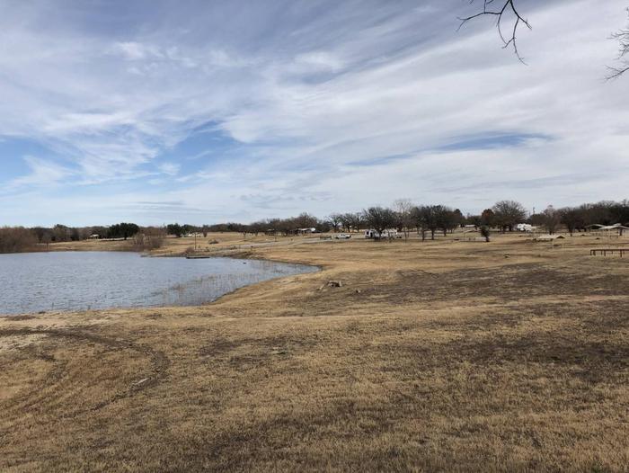
Sowell Creek Park is nestled within the beautiful Cross Timbers Region of Texas and located on the east side of Proctor Lake. Sowell Creek appeals to sportsmen, birdwatchers, naturalists or those simply wanting to relax in the outdoors.
Recreation
Sowell Creek offers families and friends with an excellent venue to enjoy the outdoors. The park offers overnight camping as well as two day-use areas for picnicing and several swim beaches for folks to soak up the sun and enjoy the beautiful lake water. Fishing is Proctor Lake’s main attraction: anglers enjoy the lake’s tremendous populations of Bass, Crappie, and Catfish. The lake is also recognized as one of the best Hybrid Striped Bass fishing areas in the state. Sowell Creek offers two boat ramps that provides guests with easy access to the lake. Also, two fishing docks are located within the park to provide guests with further fishing opportunities. High Point Park, located a few miles from Sowell Creek on FM 1496 (31.999944, -98.470486), offers more than 10 miles of hiking and equestrian trails.
Facilities
Sowell Creek offers 61 campsites and one group site during the summer (April – September); and 30 campsites during the winter (October – March). Campsites are equipped with electric hookups ranging from 50 amp, 30 amp, and 20 amp; water hookups; sewer hookups; and a covered picnic table. Amenities include flush and pit toilets, showers, drinking water and a dump station thus creating a comfortable camping environment for visitors.
Natural Features
Large, open grassy areas; Black Willow; and Buttonbush characterize the park:. Shade is sparse, but lake views are plentiful.
Nearby Attractions
The nearby town of Comanche, Texas offers historical attractions, antique stores. museums, events and more.