TOAD SUCK, AR Campground Reservation, Info, Images, Map, Directions

TOAD SUCK, Arkansas Campground Images, Info & Reservations

Directions

From Conway, Arkansas, travel west for 7 miles on SR-60 and follow signs into the campground.

Phone

501-759-2005

Activities

BOATING, CAMPING, FISHING, BIRDING

Keywords

TOAD,TOAD SUCK FERRY LOCK AND DAM-A,TOAD SUCK FERRY

Related Link(s)

Rec Area Info & Images

Arkansas State Road Conditions

Arkansas State Tourism

Overview

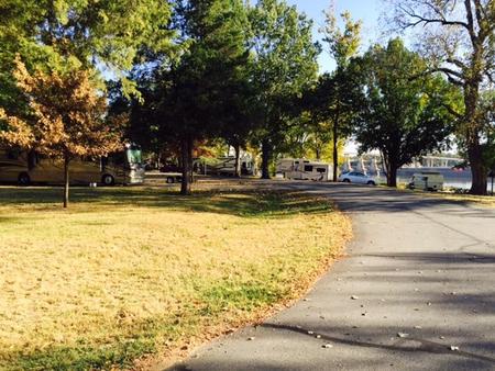
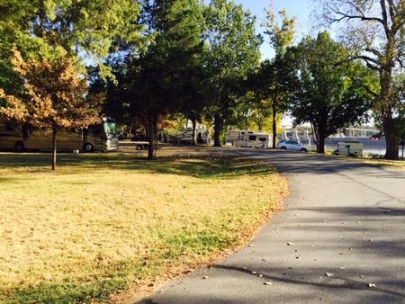
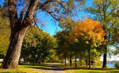
Toad Suck Campground, situated on the Arkansas River, is a popular destination for families and groups. Picnicking, boating and fishing all draw visitors to this shady campground.

Recreation

Fishing is excellent year-round, and record fish catches are common in the Arkansas River. The waters have an abundance of bream, crappie, white bass, largemouth bass and several species of catfish.

Facilities

Toad Suck provides 48 sites with electric and water hookups, plus five group picnic shelters. Additional amenities include hot showers, a playground and boat ramp.

Natural Features

Situated in the eastern edge of both the Ozark and Ouachita Mountains, the area is a haven for nature enthusiasts. Dogwood, redbud, wild plum and other native flowering trees offer breathtaking sights in springtime.

Nearby Attractions

The nearby Cadron Blockhouse in Cadron Settlement Park, a replica of a structure that was built in the late 18th century, is a popular tourist attraction.

The town of Conway hosts an annual Toad Suck Daze Festival, featuring a toad race competition.

Reservation

More from CampingHiking.net:

Dunewood Campground, Indiana Campground Images, Info & Reservations

Directions Please use this link to get to the directions page on our website. https://www.nps.gov/indu/planyourvisit/directions.htm Phone 219-395-1882 Activities BIKING, BOATING, CAMPING, INTERPRETIVE PROGRAMS, FISHING, HIKING, PICNICKING, VISITOR CENTER, WILDLIFE VIEWING, SWIMMING SITE, INFORMATION SITE, ENVIRONMENTAL EDUCATION, PHOTOGRAPHY, SWIMMING, KAYAKING, CANOEING, BEACHCOMBING, BIRDING, WATER ACCESS, EVENING PROGRAMS, GUIDED INTERPRETIVE WALKS, RECREATION

SQUIRREL MEADOWS CABIN, Idaho Campground Images, Info & Reservations

Directions From Ashton, ID, take Highway 47 a half-mile to Highway 32 and turn right (south). Travel 1 mile to Ashton-Flagg Ranch Road (#261). Turn left (east) and travel 22 miles to Road #032. Turn right (south) and go a half-mile to the cabin. Phone 208-652-7442 Activities CAMPING, HORSEBACK RIDING,

STILLHOUSE, Texas Campground Images, Info & Reservations

Directions From Interstate 35 in Belton, Texas take State Highway 190 west to the Simmons Road exit. Exit and turn left under 190 onto Simmons Road. Proceed about three miles to the park. Phone 254-939-6741 Activities BOATING, CAMPING, FISHING, SWIMMING SITE Keywords STIL,STILLHOUSE HOLLOW PARK,STILLHOUSE HOLLOW Related Link(s) Rec Area

CAMPTON CAMPGROUND, New Hampshire Campground Images, Info & Reservations

Directions From Highway 93 in central New Hampshire, take exit 28 and follow Highway 49 (Mad River Road) east for 2 miles. Phone 603-536-6100 Activities CAMPING, INTERPRETIVE PROGRAMS Keywords CAMP,WHITE MOUNTAIN NF -FS Related Link(s) Rec Area Info & Images Forest Service Concessionaire New Hampshire State Tourism New Hampshire State

WILSON VIEW CABIN, Alaska Campground Images, Info & Reservations

Directions Approximately 44 miles east of Ketchikan on the mainland, north of Wilson Arm. Cabin is located at the north end of Wilson Lake. Accessible by float plane only. This cabin is in a designated Wilderness area, and access by helicopter is illegal. Refer to USGS map Ketchikan B-2 and

COTTONWOOD (TX), Texas Campground Images, Info & Reservations

Directions From Interstate 10, take State Highway 385 south to Fort Stockton and into Marathon. From Marathon, drive 40 miles south on State Highway 385 to the north entrance of Big Bend National Park. Drive straight for 26 miles to Park Headquarters at Panther Junction. Turn right at the intersection