

Directions
From Reno, Nevada, travel north on Highway 395, then merge onto Highway 70 west and travel 5 miles to Chilcoot. Turn north on Highway 284 and continue for 8 miles to the Frenchman Lake Reservoir, then turn left before crossing the dam and travel 2.5 miles to the Cottonwood Campground.
Phone
408-489-3205 OFF SEASON / 530-832-1076 ON SEASON
Activities
BOATING, CAMPING, FISHING, HIKING, HUNTING, WATER SPORTS, WILDLIFE VIEWING, SWIMMING SITE, WATER ACCESS, WATER SKIING, SCENIC DRIVE
Keywords
COTT,COTTONWOOD SPRINGS,COTTONWOOD,FRENCHMAN LAKE,FRENCHMAN RESERVOIR,FRENCHMAN,CHILICOOT,PLUMAS NF – FS
Related Link(s)
California State Road Conditions
Overview
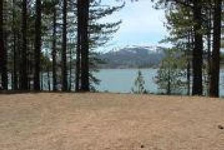
Cottonwood Springs Campground (5,700) is located on the southwest side of Frenchman Lake. The surrounding pine forest provides ample shade during summers’ hot afternoons. The lake, recreation area and surrounding forest and rangeland offer a wide variety of recreational opportunities and adventures.
Two group sites provide families and other groups the location to get together for you special outdoor experience. Hunting, fishing, boating, water sports and nature viewing are just some of the possibilities.
Recreation
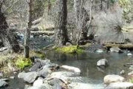
The nearby 1,580-acre Frenchman Lake provides ample opportunities for swimming, boating, water skiing, jet skiing and fishing. California sponsors two free fishing days every year, in April and September. There is also an accessible fishing trail within the campground. Public forest and range lands are open for you to visit. Plumas national Forest has an extensive road system for you to explore. Make sure you take a map, extra provisions dependable vehicle and plenty of fuel.
Facilities
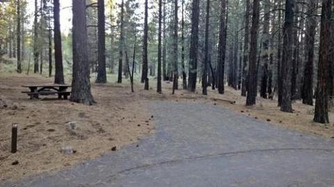
Cottonwood Springs Campground has 20 single-family campsites available for both tent and RV camping. Need a location for your family or group get together? There are two reservation group sites here. Group site B can accommodate up to 25 guests and six vehicles and Group site D up to 50 guests and 12 vehicles. Lunker Point Boat Launch Facility is about two miles away. An RV dump station is just outside the campground. All sites are equipped with paved parking, tables, campfire rings and grills. The campground has paved roads, hosts, accessible flush toilets and drinking water are also provided.
Natural Features
Frenchman Lake Recreation Area is located in the northeast corner of the Sierra Nevada. The area is characterized by a blending of desert and mountain ecosystems. For example, draught tolerant plants co-mingle with pine forest. There is less precipitation here than what areas to the west receive, more than areas to the east. Erosion and lava flows in the area tell the story of recent geologic activity.
Nearby Attractions
Little Last Chance Canyon Scenic Area
Sierra Valley – Largest valley in the Sierra Nevada
Stores and services in the towns of Chilcoot and Loyalton
Many forest roads to explore – take along a extra water, food, map, full tank and dependable vehicle.