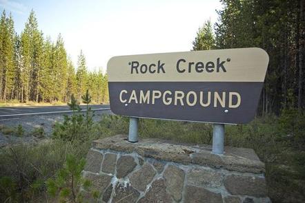
ROCK CREEK (OR), OR Campground Reservation, Info, Images, Map, Directions

ROCK CREEK (OR), Oregon Campground Images, Info & Reservations

Listen

Directions

From Portland, travel east on Highway 26 for 42 miles. Take the Highway 35 exit to Hood River and travel northeast for 3 miles. Turn right on Forest Road 48 and travel 22 miles. Turn left on Forest Road 4810 and continue to the campground.

Phone

503-630-5721

Activities

BOATING, CAMPING, FISHING, HIKING, VISITOR CENTER, WILDLIFE VIEWING, SWIMMING SITE

Keywords

ROKE,MT. HOOD NF – FS,ROCK CREEK,ROCK CREEK (OR),Rock Creek

Related Link(s)

Rec Area Info & Images

Forest Service Concessionaire

Oregon State Tourism

Oregon State Road Conditions

Overview

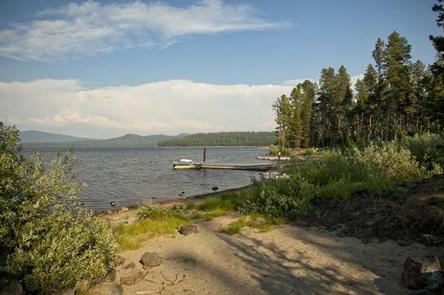
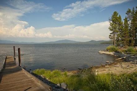
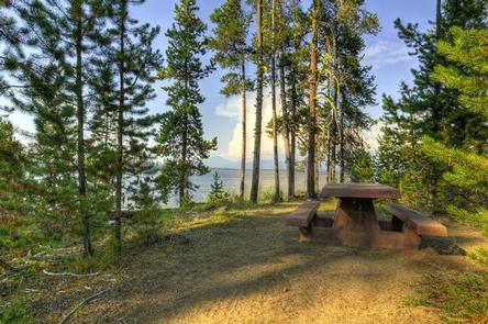
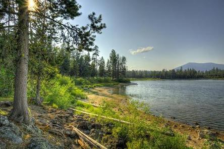
Rock Creek Campground sits on the shores of scenic Rock Creek Reservoir in the pine-covered mountains of Mt. Hood National Forest. It is a family-friendly campground with many sites right on the water’s edge. The campground provides access to a variety of recreational activities, as well as historic sites throughout the forest.

Recreation

The reservoir is a popular spot for fishing, canoeing and boating, however, boats must have electric motors. Anglers can expect a catch of bass and bluegill, and the lake is regularly stocked with rainbow trout.

An unmarked trail connects the campground to nearby Sportsman Campground, which offers a network of off-road vehicle trails.

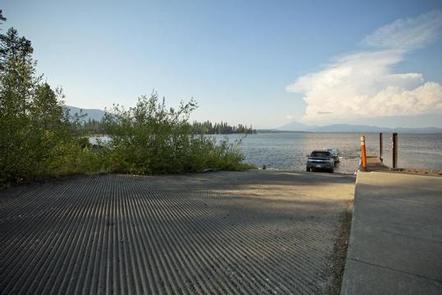
A boat ramp, picnic area and hiking trail are available at the adjacent day use area.

Facilities

The campground offers single-family sites for tent and RV camping. RVs over 35 feet are not recommended. Some sites are available on a first-come, first-served basis.

Each site is equipped with a table and campfire ring with grill. Vault toilets and drinking water are provided, but utility hookups are not available. Water disposal locations can be found throughout the campground. Parking surfaces are gravel. Firewood can be purchased from host.

Natural Features

The campground is situated in a stand of mixed oak and pine trees, along the southeastern shore of the 180-acre reservoir, which is rarely at capacity because it is used for irrigation purposes. At an elevation of about 4,600 feet, the campground provides scenic views of the adjacent lake and surrounding forest.

A variety of wildlife make its home in the area and eagles are commonly spotted nesting.

Nearby Attractions

The campground is about 30 miles from the town of Government Camp at the base of Mt. Hood. Year-round skiing, a variety of trailheads and many sightseeing opportunities can be found there.

Reservation

More from CampingHiking.net:

CIRCLE PARK CAMPGROUND, Wyoming Campground Images, Info & Reservations

Listen Directions From Buffalo, WY, take US Hwy 16 west for 13.4 miles to FS Road 20 (Circle Park Road), turn right, go 2.1 miles. Phone 406-587-9054 Activities BIKING, BOATING, FISHING, HIKING, MOUNTAIN BIKING, WATER ACTIVITIES, CANOEING, STAR GAZING, BIRDING, WATER ACCESS, SCENIC DRIVE, BACKPACKING Keywords Related Link(s) Rec Area

OAK GROVE CAMPGROUND, California Campground Images, Info & Reservations

Listen Directions From Interstate 15 take the 79 East. The campground is on the north side of the highway, across from the fire station. From Temecula, take State Rt. 79 south 24.1 miles and turn left at campground sign. Phone (760) 788-0250 Activities HISTORIC & CULTURAL SITE, CAMPING, FISHING, HIKING,

SITUK LAKE CABIN, Alaska Campground Images, Info & Reservations

Listen Directions The cabin is located 14 miles northeast of Yakutat on the eastern shore of Situk Lake. Access is by trail or floatplane. Please contact the Yakutat Ranger District for information at (907) 784-3359 prior to making reservations during these periods. The Situk Lake Trail starts at the end

DEER GROUP CAMP, California Campground Images, Info & Reservations

Listen Directions Travel I-10 east (State Highway 330) to Running Springs. Turn onto State Highway 18 and continue to Big Bear Lake Dam. Continue 3 miles on State Highway 18 and turn right on Tulip Lane. Turn right onto Mill Creek Road (Forest Route 2N10) for 1.6 miles, turn left

SWEETWATER, California Campground Images, Info & Reservations

Listen Directions From Fresno, California, take Highway 41 north. Turn northeast on Forest Road 200 and pass through North Fork. Take Minarets Road east and follow it 37 miles. Turn right on Mammoth Pool Road and follow it 2 miles to Sweetwater Campground. Phone 559-642-3212 Activities BOATING, CAMPING, FISHING, HIKING,

BEAVER SULPHUR, Oregon Campground Images, Info & Reservations

Listen Directions From Jacksonville, OR, travel south 8 miles on Highway 238 to Ruch, OR, and turn left on to Upper Applegate Road (County Road 859). Continue approximately 8.5 miles and turn left on to Forest Road 20. Continue 3 miles to Beaver-Sulphur Campground, the entrance is on the right.