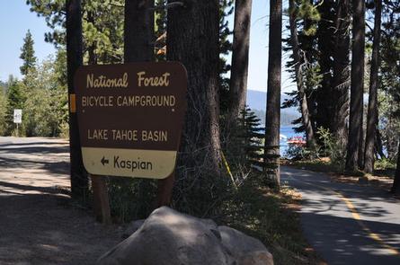
KASPIAN CAMPGROUND, CA Campground Reservation, Info, Images, Map, Directions

KASPIAN CAMPGROUND, California Campground Images, Info & Reservations

Directions

The campground is located 4 miles south of Tahoe City, on California Highway 89.

Phone

530-583-3642

Activities

BIKING, BOATING, CAMPING, INTERPRETIVE PROGRAMS, FISHING, HIKING, WATER SPORTS, SWIMMING SITE

Keywords

KASP,LAKE TAHOE,WEST SHORE,LAKE TAHOE BASIN – FS

Related Link(s)

Rec Area Info & Images

California State Road Conditions

California State Tourism

Forest Service Concessionaire

Overview

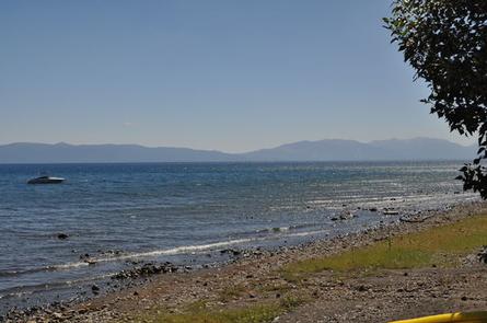
Kaspian Campground is located in a mature forest of pine trees overlooking the beautiful Lake Tahoe. Campers will be nestled in a sparse forest of pine trees and evergreen shrubs, just minutes from the bright blue water of Tahoe. The lake and its sandy beaches provides ample recreation opportunities.

Recreation

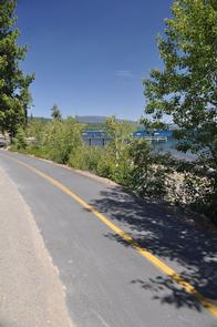
Kaspian Campground is ideal for visitors planning a full day of biking around Lake Tahoe. Bike trails that traverse the western shores of the lake begin near the campground.

Visitors enjoy water sports on the lake and relaxing on its sandy beaches.

Facilities

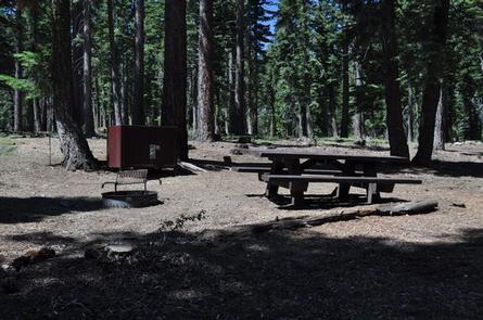
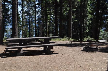
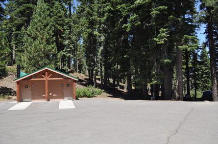
The campground offers multiple single-family sites for tent-only camping. Sites are equipped with tables and campfire rings with grills. Accessible flush toilets, drinking water and trash collection are provided.

Natural Features

The campground is situated in a former picnic area, across the street from the lake. Campsites are spaced for privacy and surrounded by tall ponderosa pine and white fir trees. Some sites offer spectacular views of Lake Tahoe through the trees.

Nearby Attractions

Kaspian Campground is less than 10 miles from the popular Meeks Bay.

Reservation

More from CampingHiking.net:

PANGUITCH LAKE, Utah Campground Images, Info & Reservations

Directions From Panguitch, Utah, take Highway 143 southwest 14 miles. Campground is on the north side of the highway. Phone 801-226-3564 Activities AUTO TOURING, BIKING, BOATING, CAMPING, FISHING, HIKING, WILDLIFE VIEWING, PHOTOGRAPHY, MOUNTAIN BIKING, OFF ROAD VEHICLE TRAILS, KAYAKING, CANOEING, STAR GAZING, SCENIC DRIVE, AMPHITHEATER Keywords PANG,DIXIE NF – FS

DEVILS CANYON, Utah Campground Images, Info & Reservations

Directions The campground is 13 miles south of Monticello, Utah and 9 miles north of Blanding, Utah on US Highway 19. The campground is approximately 1/4-mile off the highway. Phone 435-587-2041 Activities AUTO TOURING, BIKING, CAMPING, HIKING, PICNICKING, WILDLIFE VIEWING, INFORMATION SITE, STAR GAZING, SCENIC DRIVE Keywords DEVC,DRY WASH,JOHNSON CREEK,MANTI-LASAL

OLD HWY 41 NO 3, Georgia Campground Images, Info & Reservations

Directions From I-75 take exit 278 and turn south onto Glade Road. Turn right onto Highway 92/Lake Acworth Drive, then after a mile exit to the right which will loop around to Hwy 293/Main Street. At stop sign turn left onto Highway 293/Main Street and follow signs to the campground.

AXTEL, Kentucky Campground Images, Info & Reservations

Directions Begin at ramp onto I-64 West toward New Albany/St. Louis, traveling 22.3 miles. Take the IN-135, Exit Number 105, toward Palmyra/Corydon, onto IN-135 South toward Corydon, traveling 16.7 miles. Continue on Bypass Road KY-79 for 2.1 miles. Turn right onto KY-79, traveling 10.1 miles. Continue on 1st Avenue, KY-79S

WHITE BRIDGE, Utah Campground Images, Info & Reservations

Directions From Panguitch, Utah, take Highway 143 southwest for 12 miles. Campground is on the north side of the highway. Phone 801-226-3564 Activities CAMPING, FISHING, HIKING, HUNTING, WILDLIFE VIEWING Keywords WHIT,BRIAN HEAD RESORT,PANGUITCH LAKE,DIXIE NF – FS Related Link(s) Rec Area Info & Images Utah State Road Conditions Forest Service