


Directions
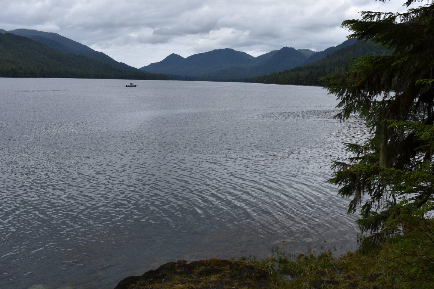
The cabin is located on the east shore of Helm Bay near the mouth of Helm Creek. It is about 24 miles from Ketchikan, west of the Clover Pass area. The cabin is accessible by float plane, kayak or boat, and a buoy is located directly in front of the cabin. Please consult Local tide tables in advance.
Phone
907-225-2148
Activities
BOATING, CAMPING, FISHING, WILDLIFE VIEWING
Keywords
HEEE,TONGASS NF – FS
Related Link(s)
Overview
Helm Creek Cabin is located on the east shore of Helm Bay near the mouth of Helm Creek. This rustic retreat is open year-round, offering opportunities for relaxation, sightseeing and recreation.
The site can be accessed by float plane, boat or kayak, depending on conditions. Guests are responsible for their own travel arrangements and safety, and must bring several of their own amenities.
Recreation
Helm Bay is especially known for excellent crabbing, as well as saltwater fishing for salmon, halibut and red snapper. Trout and Dolly Varden fishing is possible in nearby Helm Lake, but there is no trail to the lake.
Local tide tables should be consulted before taking a boat out on the bay. Sea kayaking is also possible.
Facilities
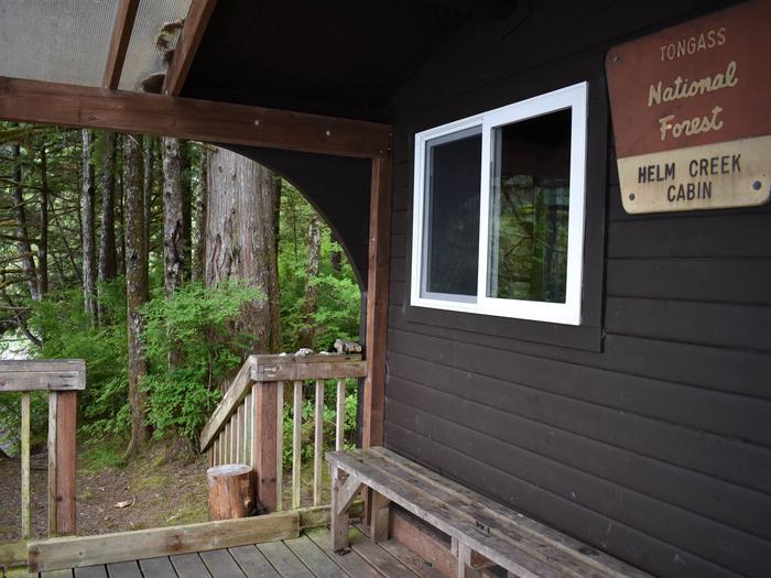
This 12-by-14 ft. (pan-abode style) cabin has two single and two double bunks, to sleep up to six people. It is also equipped with a table and benches, wood stove, splitting maul, broom and an outhouse. NOTE: Firewood may be available, but visitors are encouraged to contact the Ketchikan Misty Fjords Ranger District to check the status of the woodshed. A mooring float is available on a first-come, first-served basis. Water and electricity are not provided. Water is available from a nearby creek, but guests should be sure to treat water before drinking or cooking with it (water safety tips). It is recommended that guests bring their own water supply. Other items to pack include sleeping bags, sleeping pads, lanterns or flashlights, cookware, plates, utensils, food, toilet paper, garbage bags, a fire extinguisher and matches, among other necessities. Guests are expected to pack out trash and clean the cabin before leaving (click here for more cabin details).
Natural Features
The cabin faces northwest, with a good view toward the head of Helm Bay and the surrounding mountains. It is adjacent to a large saltwater tidal flat at the outlet of Helm Creek. A moderately steep sloping beach is located in front of cabin.
This area is home to black and brown bears, Sitka black-tailed deer and mountain goats (bear safety information). Seals, whales and other marine mammals may be seen in Helm Bay.