

Directions
The cabin is located approximately 55 air miles southeast of Ketchikan on the mainland south of Marten Arm. Accessible by floatplane. No moorage available. This cabin is in a designated Wilderness area, and access by helicopter is illegal. Refer to USGS Ketchikan A-3. In fall, winter and early spring, the cabin may be inaccessible due to frozen lake surface (floatplanes cannot land). Please contact the Ketchikan-Misty Fjords Ranger District for information prior to making reservations during these periods.
Phone
907-225-2148
Activities
BOATING, CAMPING, FISHING, HIKING, WILDLIFE VIEWING
Keywords
HUKE,TONGASS NF – FS
Related Link(s)
Overview
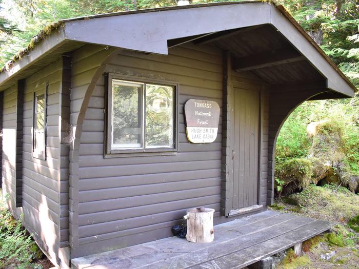
Hugh Smith Lake Cabin is located on the mainland within the Misty Fiords National Monument Wilderness. This rustic, secluded retreat is open year-round for relaxation and recreation in Alaska’s beautiful Inside Passage.
The site can be accessed by float plane, depending on conditions. Guests are responsible for their own travel arrangements and safety, and must bring several of their own amenities.
Recreation
There is a working fish weir near the outlet of the lake. Anglers can fish for cutthroat, Dolly Varden and sockeye salmon. Guests can use the cabin’s 14-foot aluminum skiff with oars, but they must provide their own life jackets.
An abandoned cannery site sits at the east end of the lake, inviting exploration. Hikers will find a trail leading to saltwater.
Facilities
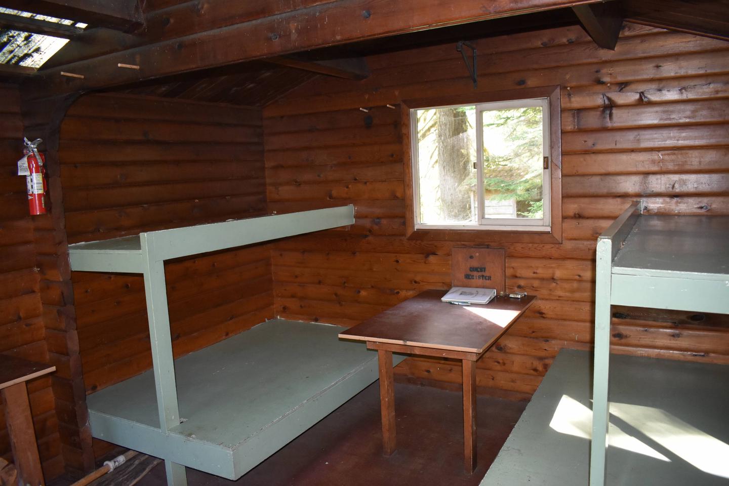
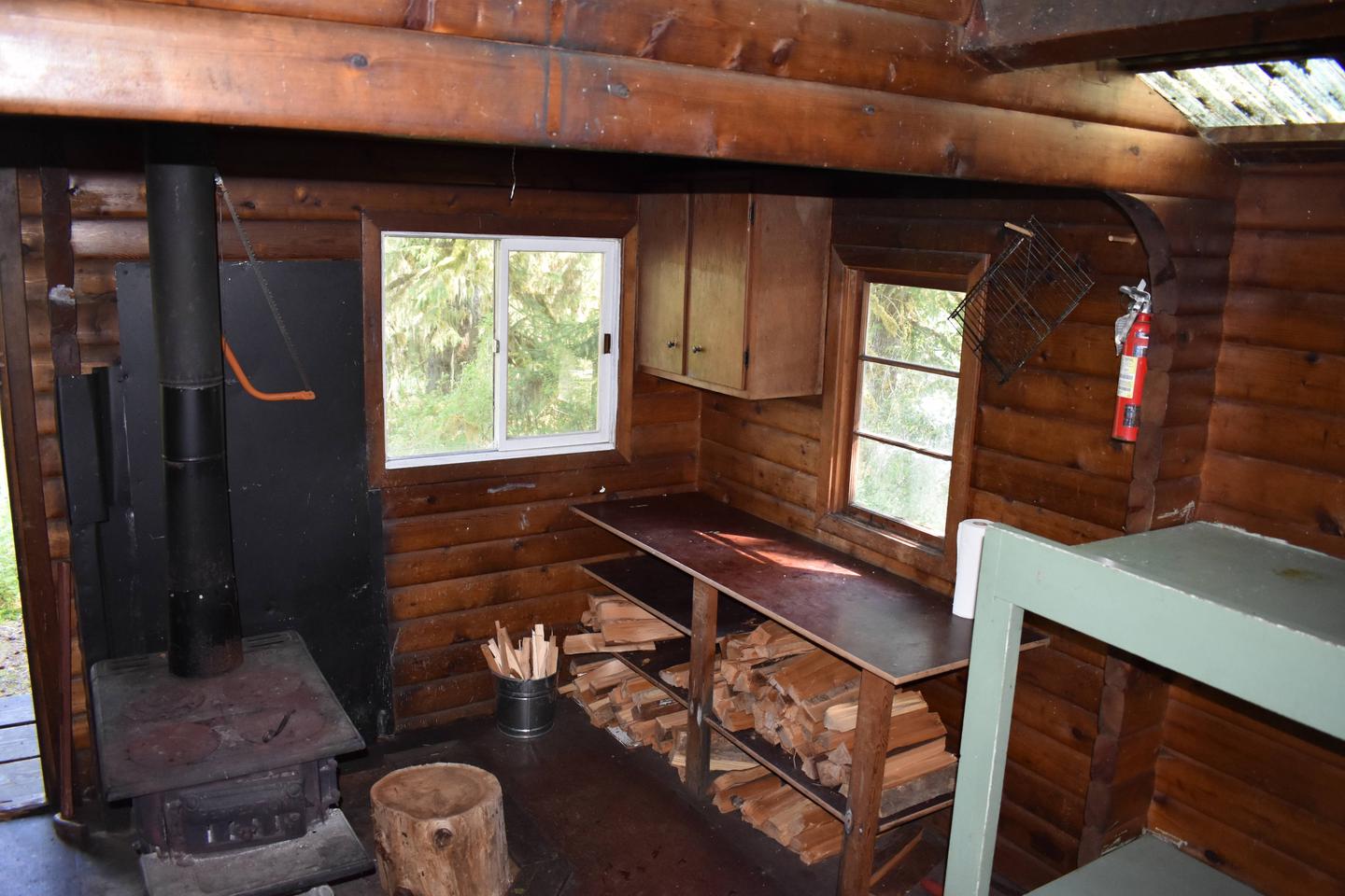
This 12×14-ft. pan-abode style cabin sleeps six and comes equipped with two single bunks, two double bunks, a table and benches, wood stove, splitting maul, broom and an outhouse. NOTE: Firewood may be available, but visitors are encouraged to contact the Ketchikan Misty Fjords Ranger District to check the status of the woodshed. Water and electricity are not provided. Water is available from the lake, but guests should be sure to treat water before drinking or cooking with it. It is recommended that guests bring their own water supply. Other items to pack include sleeping bags, sleeping pads, lanterns or flashlights, cookware, plates, utensils, food, toilet paper, garbage bags, a fire extinguisher and fire starter. Guests are expected to pack out trash and clean the cabin before leaving. Click here for more cabin details.
Natural Features
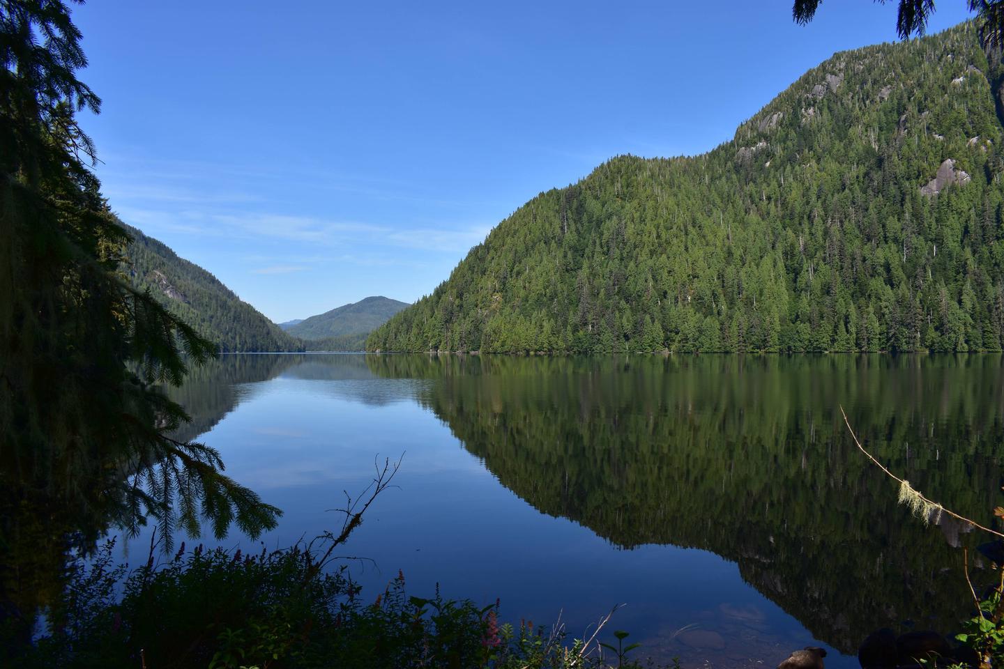
The cabin sits on a peninsula that extends into Hugh Smith Lake. It is surrounded by an old-growth forest of Sitka spruce, western hemlock and cedar. Guests have views of the lake and the gentle, forested slopes on the opposite shore.
This area is home to a large population of brown bears. Other species that make their home in the wilderness include Sitka black-tailed deer, wolves, martens and moose. A variety of waterfowl may be seen around the lake.