

Directions
Access by float plane is 22 miles from Petersburg, while access by by boat and hiking trail combination is 24 miles from Petersburg, then a 2.75-mile hike from the bay to the inland lake. A 18-foot tide is required for direct boat access to the trailhead. Please check current conditions prior to your trip. Click here for more information. Refer to USGS topographic map Petersburg C4. Maps are available online or by calling the Petersburg Ranger District at (907) 772-3871.
Phone
907-772-3871
Activities
CAMPING, FISHING, HIKING, HUNTING, WILDLIFE VIEWING
Keywords
KAHS,TONGASS NF – FS
Related Link(s)
Overview
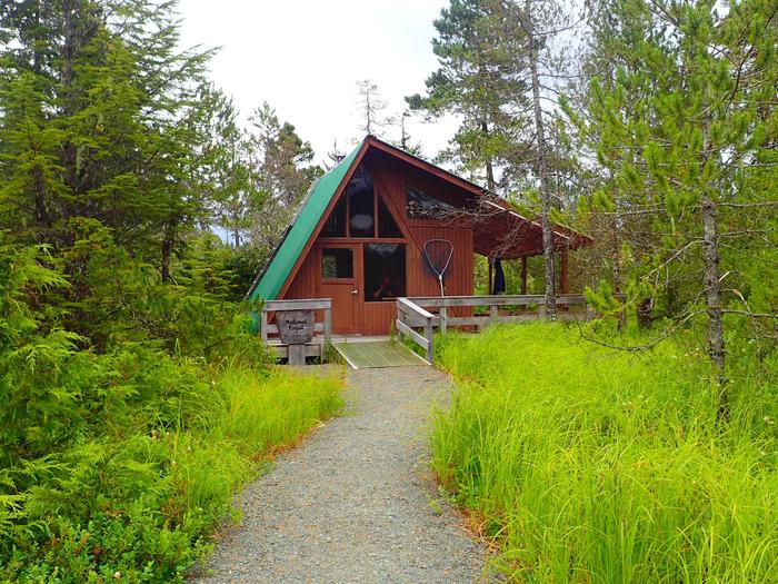
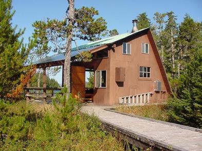
Kah Sheets Lake Cabin is an accessible, modified A-frame that was built in 1989. It is located on the south end of Kupreanof Island, above Kah Sheets Bay, in southeastern Alaska. It provides access to a secluded location, where fishing, hunting and wildlife viewing opportunities are abundant.
The cabin is accessible by float plane or by a boat and hiking trail combination. Guests are responsible for their own travel arrangements and safety and must bring several of their own amenities.
Recreation
Kah Sheets is a Tlingit Indian term meaning "by the fisheries," as the area is well-known for fine salmon and trout fishing. Lake and stream fishing is available right outside the cabin’s door. Two small rowboats with oars are provided, however, guests must bring their own life jackets. Guests may also choose to bring a small outboard motor. Hunting is also available in season in designated areas.
The Kah Sheets Lake Trail begins behind the cabin and traverses muskeg and forest throughout its 2.75-mile length, ending at Kah Sheets Bay and the cabin. Off the main trail, two spur trails lead to sections of the creek. The upper spur follows a boardwalk, ending at a viewing platform complete with a bench. The entire route, rebuilt in 1995, is an easy walk.
Facilities
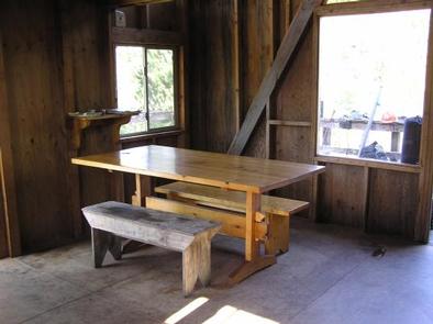
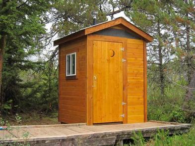
The modified A-frame cabin has two single wooden bunks, as well as a loft to accommodate up to seven people. It is equipped with an oil heater and an outdoor toilet. The cabin, outhouse and boardwalk are accessible to guests in wheelchairs.
Guests will need to bring their own sleeping bags and pads, cook stove and cooking gear, towels, food, clothing and garbage bags, among other necessities. Guests will also need to bring No. 1 heating oil for the clean-burning oil heater. Water for drinking, cooking and cleaning purposes can be filtered or treated from the lake, however, it might be a good idea for guests to bring their own.
Click here for more cabin details and maps.
Natural Features
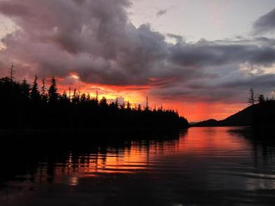
The cabin is located at the southeast end of Kah Sheets Lake at an elevation of 156 feet. The surrounding area is a mixture of muskeg and forest. The cabin is situated in an open area along the lake shore, near the outlet.
The area’s abundant muskegs support a large variety of berries and wildflowers. Wildlife viewing is quite good, especially for those interested in bears and waterfowl; learn about bear safety.