


Directions
The lake is typically frozen from December through early May (floatplanes cannot land on the lake). Located 27 air miles northeast of Sitka, near northeast coast of Baranof Island. Travel by floatplane is 25 minutes one-way from Sitka. For geographic features surrounding cabin, refer to USGS topographic map Sitka B-4.
Please consult local tide tables before departing for the cabin.
Phone
907-747-6671
Activities
BOATING, CAMPING, FISHING, HIKING
Keywords
LAEK,TONGASS NF – FS
Related Link(s)
Overview
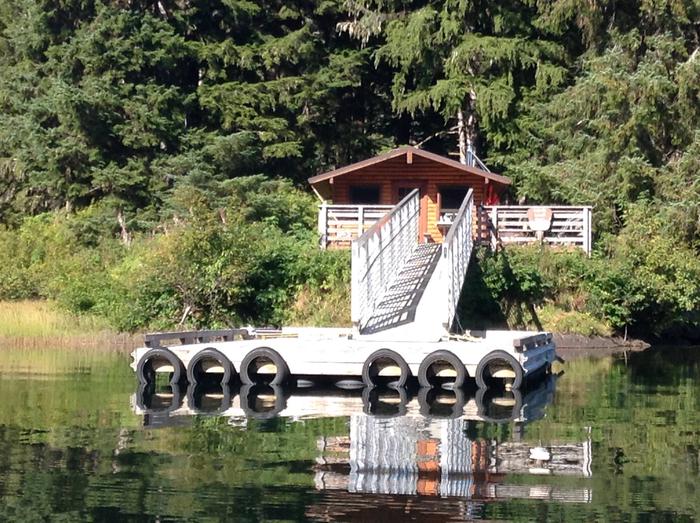
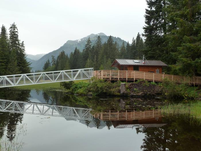
Lake Eva Cabin is an accessible facility located 27 miles northeast of Sitka, Alaska, near the northeast coast of Baranof Island. Lake Eva is 1.7 miles long and sits at an elevation of 194 feet. It’s available year round via a 25-minute floatplane ride from Sitka, weather permitting, and makes an excellent base for experiencing and exploring this corner of Alaska on foot or by boat.
For boat or air charters, contact the Sitka Convention and Visitors Bureau at 907-747-5940 or www.Sitka.org.
Recreation
Lake Eva offers great fishing opportunities. Cutthroat and Dolly Varden are found in lake year-round, with the best fishing April to late June. The outlet stream has a spring run of steelhead in April to June, sockeye in mid July to August and coho salmon in September and October.
Hikers enjoy the Lake Eva-Hanus Bay Trail. It stretches about a mile to saltwater, and can be reached by boat from the cabin. This trail is open, but hikers may experience some obstacles along the way. Cabin guests may encounter tour groups using the trail.
Facilities
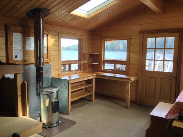
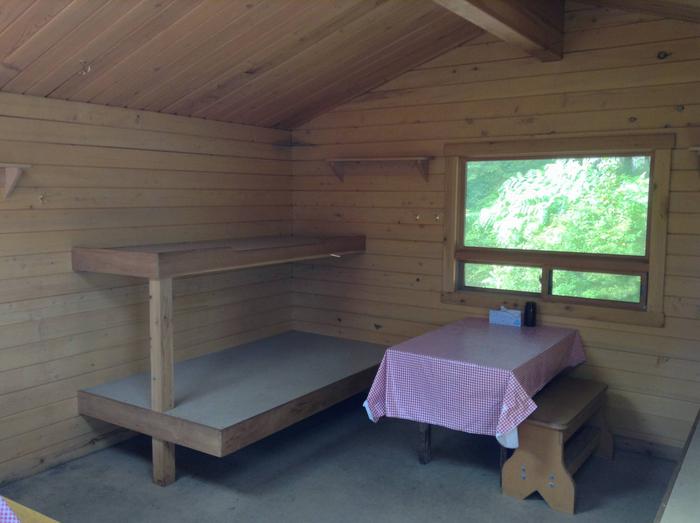
This primitive Pan-abode style cabin is accessible and equipped with wooden bunks, a table, benches, cooking counter, cupboard and an oil stove for heat. In addition, the cabin’s accessible enhancements include a boardwalk, picnic table, dock and an accessible outhouse. Water is available from the lake or nearby inlet stream.
This cabin has no mattresses or cooking utensils. Guests should bring sleeping bags, pads, a cook stove, cooking gear, lantern, plates, utensils, food, toilet paper, garbage bags, raingear and boots.
The cabin is equipped with an oil stove for heat. It uses #1 diesel fuel oil. Guests should bring 10 gallons for a 3-day stay, more or less depending on the time of year. Transport oil in an FAA-approved container or jerry can in a non-tip box.
A skiff with oars is provided for cabin guests only; bring personal flotation devices. A 2-10 HP longshaft outboard motor enhances use of the skiff, but is not provided. Be sure the plug is in before launching the boat. Tie the skiff well up on the shore and pull the plug before leaving so the boat does not fill with rain water.
Click here for more cabin details and maps.
Natural Features
The setting for the cabin is within a spruce and hemlock forest overlooking Lake Eva, with snow-capped peaks visible to the southwest.
Deer and brown bear inhabit the area. Learn about bear safety and precautions.