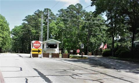
HEBER SPRINGS, AR Campground Reservation, Info, Images, Map, Directions

HEBER SPRINGS, Arkansas Campground Images, Info & Reservations

Directions

From Heber Springs, AR, travel 2 miles west on SR-110, then .5 miles north on the paved access road. Follow signs to campground.

Phone

501-250-0485

Activities

BOATING, CAMPING, SWIMMING SITE

Keywords

HEBE,GREERS FERRY LAKE,GREERS FERRY LAKE

Related Link(s)

Rec Area Info & Images

Arkansas State Tourism

Arkansas State Road Conditions

Overview

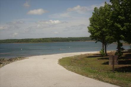
Heber Springs Campground is located on Greers Ferry Lake in the beautiful Ozark Mountains of north-central Arkansas. The environment provides the ideal location for family camping, fishing, boating and hiking.

Recreation

Greers Ferry Lake is an outdoor enthusiasts’ dream, with boating, sailing, water skiing, swimming, scuba diving, and fishing opportunities. Hikers enjoy the area’s three National Nature Trails and one multi-purpose, fitness trail.

The William Carl Gardner Visitor Center is just west of the dam, with exhibits, a children’s touch table, and a replica of the world record 40 lb. 4 oz. brown trout caught in the Little Red River downstream of the center.

Facilities

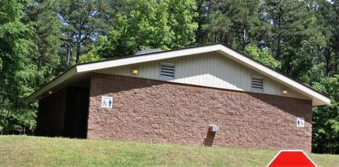
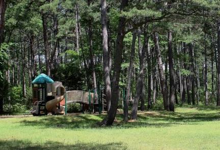
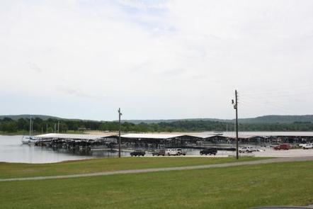
This campground offers 136 sites, 101 of which have electrical hookups. Additional amenities include flush and vault toilets, showers, a dump station, playground and a boat ramp.

Natural Features

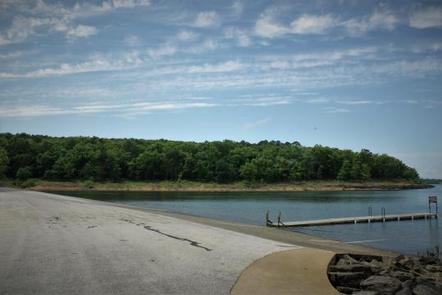
Greers Ferry Lake is known for it’s deep, clean waters. The visibility is so clear, scuba diving is a popular pastime.

A dense mix of red cedar, black gum, red oak, elm, pecan and sweet gum trees forest the area, providing shade in the summer months and beautiful fall color in autumn.

Wildlife is plentiful around Greers Ferry Lake. Visitors commonly see white-tailed deer, wild turkeys, rabbits, squirrels and a wide variety of birds.

Nearby Attractions

With over 30,000 acres of water surface, the lake serves as a playground for all kinds of water sports. Eighteen parks around the shoreline provide modern campgrounds, boat ramps, swim areas and marinas.

Reservation

More from CampingHiking.net:

PRAIRIE RIDGE (RATHBUN LAKE), Iowa Campground Images, Info & Reservations

Directions From Moravia, IA, travel 4 miles west on Highway J18, then south 2.5 miles on 200th Avenue (gravel). Follow signs into campground. Phone FOR CAMPGROUND INQUIRIES DURING MAY-SEPTEMBER PLEASE CALL 641-724-3103. DURING CLOSED SEASON OCTOBER-APRIL PLEASE CALL 641-647-2464 Activities BIKING, BOATING, CAMPING, FISHING, HIKING, PICNICKING, WILDLIFE VIEWING, DAY USE

QUINN SPRINGS PAVILION, Tennessee Campground Images, Info & Reservations

Directions The Quinn Springs Pavilion is located on Highway 30 about 6 miles south of Etowah, TN, and 6 miles north of Benton, TN. From Highway 411, turn on to Highway 30; pavilion is 0.3 miles on the right. Phone 423-338-3300 Activities CAMPING, FISHING, HIKING, WILDLIFE VIEWING, KAYAKING, CANOEING, NON-MOTORIZED

WASHUNGA BAY, Oklahoma Campground Images, Info & Reservations

Directions From Kaw City, Oklahoma, travel nearly 3 miles east on Highway 11, turn north onto County Road. Follow signs for about 5 miles to the campground. Phone 580-762-5611 Activities BOATING, CAMPING, FISHING, WILDLIFE VIEWING Keywords WABA,KAW LAKE,KAW LAKE Related Link(s) Rec Area Info & Images Oklahoma State Road Conditions

CRANE VALLEY, California Campground Images, Info & Reservations

Directions From Fresno, California, take Highway 41 north through Oakhurst. Turn right on Forest Road 222, towards Bass Lake. Keep right for 3.5 miles to the campground. Phone 559-642-3212 Activities BOATING, CAMPING, INTERPRETIVE PROGRAMS, FISHING, HIKING, WATER SPORTS, SWIMMING SITE Keywords CRVA,BASS LAKE OAKHURST AR,SIERRA NF – FS Related Link(s)