

Directions
Accessible year round, weather permitting. Located 5.5 miles south of Sitka, on the shore of Samsing Cove off Sitka Sound. Access is by boat only, and takes about 20 minutes from Sitka. For geographic features surrounding the cabin, refer to USGS topographic maps Port Alexander D-5 and D-4.
Please consult local tide tables before departing for the cabin.
Phone
907-747-6671
Activities
BOATING, CAMPING, FISHING, WILDLIFE VIEWING
Keywords
SAMS,TONGASS NF – FS
Related Link(s)
Overview
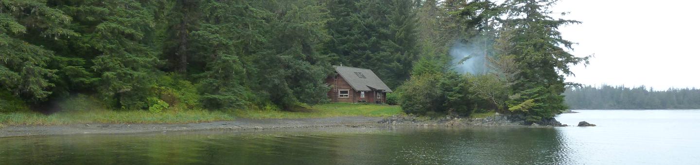
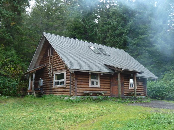
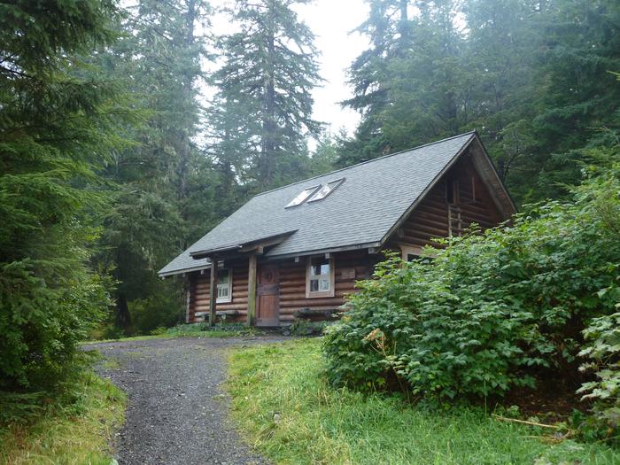
Samsing Cove Cabin is located 5.5 miles south of Sitka, Alaska off Sitka Sound on Baranof Island. The log cabin was built in 1991 by crews from S&S General Contractors of Sitka and many local businesses, individuals and volunteers. Roger and Judy Sudnikovich, owners of S&S General Contractors, donated the cabin, which replaced a log cabin built in 1941 by the Forest Service and the U.S. Navy for enlisted personnel and the public.
This is a remote site. The cabin is generally available year-round, weather permitting, and can be accessed by boat only, a 20-minute ride from Sitka. Visitors are responsible for their own travel arrangements and safety, and must bring their own amenities.
Recreation
Recreational opportunities at Samsing Cove Cabin include saltwater fishing, kayaking (visitors must provide their own kayaks), photography, wildlife viewing and beachcombing.
For information about fishing permits and seasons, visit the Alaska Department of Fish and Game website.
Facilities
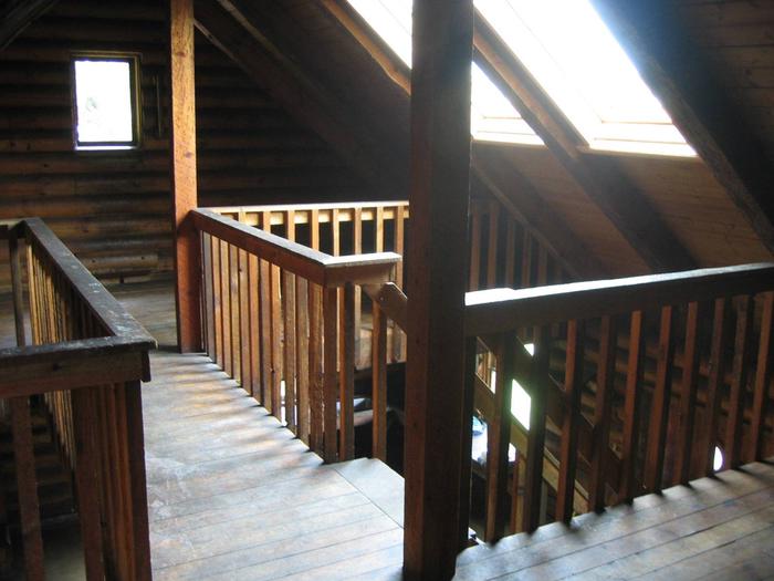
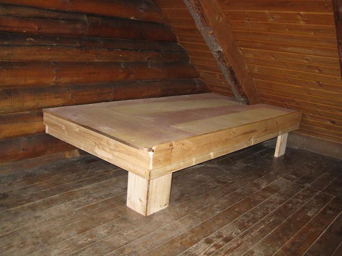
This two-story log cabin measures 24 by 30-ft and sleeps up to 15 people. There are two separate open sleeping lofts, reached by a single stairway. Each loft contains a double plywood bunk and lots of floor space. Downstairs, the sleeping accommodations include two sets of single bunks over double bunks.
The cabin includes an oil stove for heat, two large tables with benches and cooking counters with open shelving above one counter. An outhouse toilet is close to the cabin.
A mooring buoy is available for boat anchorage on a first-come, first-served basis. The cabin reservation does not include exclusive use of the buoy. Good anchorage is also available without using the mooring buoy. Mooring buoys are configured using a 4200-lb concrete block with 90 feet of 7/8th-inch stud link chain. Mariners are responsible for determining how suitable an anchoring system is for the size of their craft.
The cabin does not include heating oil, mattresses or cooking utensils. Visitors should bring sleeping bags and pads, a cooking stove, pots, pans, plates, utensils, food, toilet paper, a lantern, garbage bags, a fire extinguisher and fire starter. Rain gear and boots are recommended.
Bring #1 diesel fuel oil for the stove. Since this cabin has such a large open space to heat, it can take five gallons during the first 24 hours. After the first day, it will take two to five gallons daily to heat the cabin, depending on the time of year, heat setting chosen and outside temperature.
Water is available from a nearby inlet stream, but must be treated before using. It’s recommended that visitors bring their own water.
Click here for more cabin information and maps.
Natural Features
The cabin sits within a small cove off Sitka Sound on a short, gently rising slope amid a rocky shoreline, surrounded by a hemlock and spruce forest. At low tide, a small gravel beach unfolds, offering beachcombing possibilities. At high tide, the small cove is a protected place for novice kayakers. On clear days, the mountain peaks above Sitka are visible through the trees and islands to the north.
The Sitka Sound area is home to an abundance of wildlife and sea life. Visitors may spot orca whales and humpback whales, puffins, sea otters and sea lions. Brown bear frequent the area.