

Directions
The cabin is accessible by shallow draft boat or float plane (plus a short walk), 10 miles from Wrangell or 10 miles from the boat ramp on the south end of Mitkof Island. Tides affect access to this cabin. Please consult local tide tables . A tide of 18 feet or higher is required for float plane landings or a shallow draft boat.
Phone
907-874-2323
Activities
BOATING, CAMPING, HUNTING, WILDLIFE VIEWING, PADDLING, BIRDING
Keywords
SERG,TONGASS NF – FS
Related Link(s)
Overview
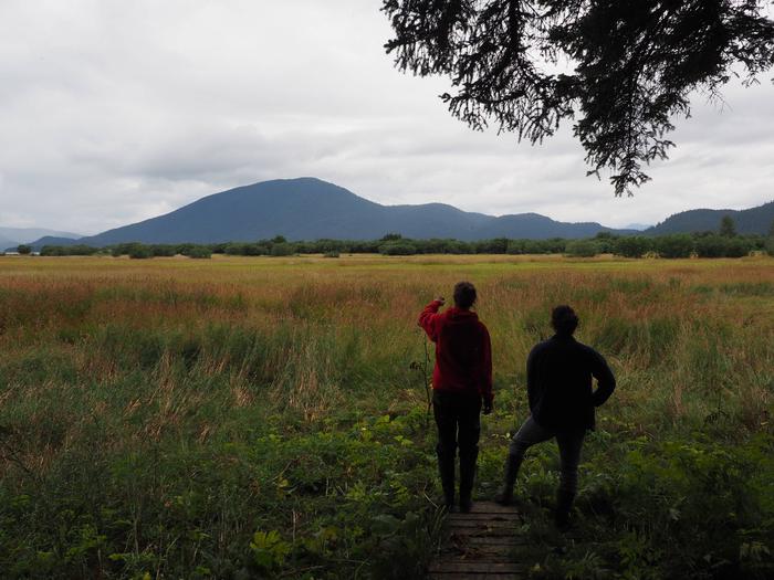
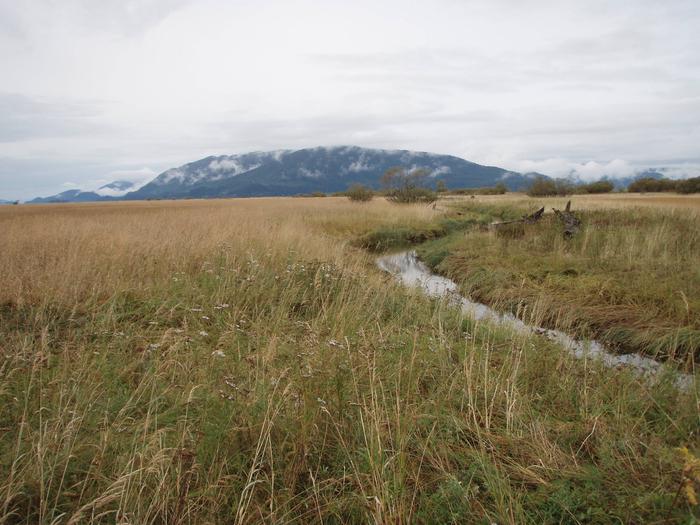
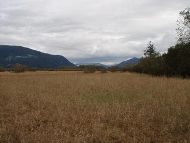
Sergief Island Cabin is located on the northwest side of Sergief Island on the Stikine River delta, and makes an ideal base camp for exploring the surrounding Stikine-LeConte Wilderness. The delta tideflats provide for a different experience from the usual rainforest setting of Southeast Alaska and offer opportunities for paddling, wildlife watching and hunting. The site can only be accessed by a shallow draft boat or float plane, depending on conditions. The tide must be a minimum of 18 feet in order to access the cabin. Visitors are responsible for their own travel arrangements and safety, and must bring several of their own amenities.
Recreation
The waters around the cabin are ideal for exploring by kayak or canoe during high tide. The Forest Service does not provide boats, and guests must also bring their own flotation devices. Tide tables should be consulted before any boating excursion. This cabin is also in a prime location for waterfowl hunting in the fall.
Facilities
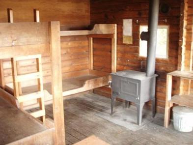
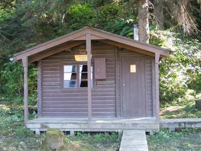
The 12-by-14 cabin (pan-abode style) was built in 1962 and has two single and two double bunks, to sleep up to four people. The cabin is also equipped with a table and benches, broom, oil heater and an outhouse. A wooden cooler box for food storage is located on the covered deck. Water and electricity are not provided. Water may be available from a rain catchment bucket, but guests should be sure to treat water before drinking or cooking with it ( water safety tips ). It is recommended that guests bring their own water supply. Heating oil is not supplied by the Forest Service. In addition to bringing a supply of No.1 stove oil, guests should pack sleeping bags, sleeping pads, a cooking stove, lanterns or flashlights, cookware, plates, utensils, food, toilet paper, garbage bags, a fire extinguisher and matches, among other necessities. Guests are expected to pack out trash and clean the cabin before leaving ( click here for more cabin details).
Natural Features
The cabin is situated between tidal grass flats and a forest of spruce and hemlock. A small stream flows about 75 feet away, and behind the cabin are low-forested hills. The surrounding area is relatively flat with grass, shrubs, willow and alder. Wildflowers are prominent in May and June. This area is home to brown and black bears, bald eagles, hawks and moose ( bear safety information ). The Stikine River tidal flats are a major stopover spot for waterfowl and shorebirds during the spring and fall migrations.