
Directions
The cabin is located 14 miles northeast of Yakutat on the eastern shore of Situk Lake. Access is by trail or floatplane. Please contact the Yakutat Ranger District for information at (907) 784-3359 prior to making reservations during these periods. The Situk Lake Trail starts at the end of East Gate Road and is 3 miles to the cabin. The trail can be very wet.
Phone
(907) 784-3359
Activities
BOATING, CAMPING, FISHING, HIKING, HUNTING, WILDLIFE VIEWING
Keywords
SITU,TONGASS NF – FS
Related Link(s)
Overview
Situk Lake Cabin is located 14 miles northeast of Yakutat. It is situated on the eastern shore of Situk Lake, within the Russell Fjord Wilderness. The cabin is open for year-round enjoyment, offering opportunities for recreation and wildlife watching. The site can be accessed by floatplane or by hiking forest service maintained trails. Visitors are responsible for their own travel arrangements and safety, and must bring several of their own amenities.
Recreation
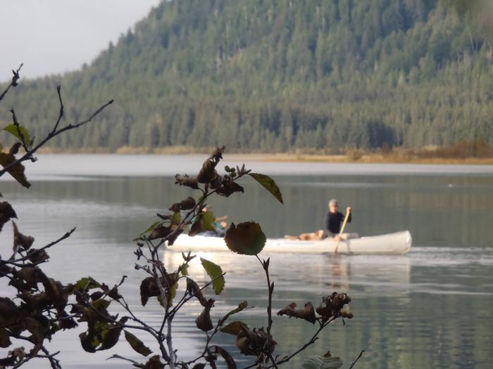
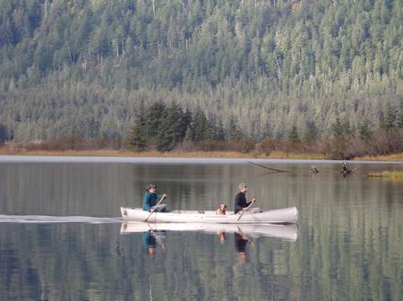
The lake offers outstanding fishing for king, sockeye, coho and pink salmon, as well as steelhead, rainbow trout and Dolly Varden. Visitors can use the cabin’s skiff with oars, but must provide their own flotation devices. The Mountain Lake Trail starts from the cabin for a round-trip hike of 4 miles. The trail features numerous mountain streams and lakes, old-growth Sitka spruce forest and access to the Brabazon Mountains and Mountain Lake. Hunting is allowed in this area in designated seasons with a permit.
Facilities
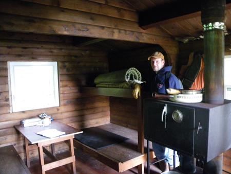
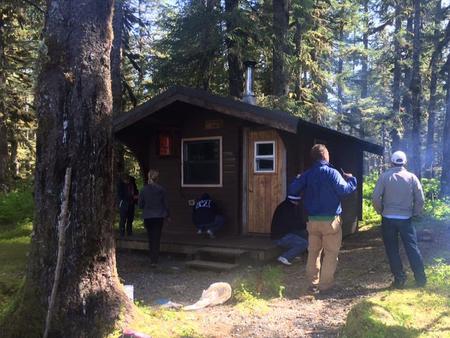
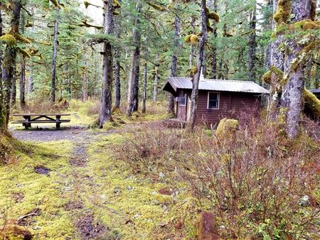
This 16×12-ft. pan-abode style cabin sleeps four people with four single bunks. The cabin also has a table and benches, broom, axe, picnic table and outhouse. A multi-fuel stove is provided for heat that burns either oil or wood. Water, heating oil and electricity are not provided. Water can be taken from Situk Lake, but it should be treated before using. Visitors must supply #1 diesel oil or kerosene for the heater, and an empty 5-gallon fuel tank is provided. Other items to bring include sleeping bags, sleeping pads, food, a cooking stove, cookware, plates, utensils, lanterns, flashlights, toilet paper, garbage bags, first aid kit, a fire extinguisher and fire starter. Visitors are expected to pack out trash and clean the cabin before leaving. Click here for more cabin details.
Natural Features
The cabin sits on relatively flat terrain surrounded by a forest of old-growth Sitka spruce. On a clear day, Mount St. Elias can be seen from the lake. A shallow beach sits in front of the cabin, and a small stream is to the right. The Situk Lake Trail winds 3 miles through old-growth forest and muskeg and offers views of the Brabazon Mountains as hikers make their way to the cabin. Local wildlife includes brown and black bears, moose, bald eagles and trumpeter swans. Situk Lake attracts a variety of nesting waterfowl.