
Directions
From Reedsport, drive north 7.5 miles on Highway 101. Campground is on the west (left) side of Highway 101.
Phone
541-271-6000
Activities
BOATING, CAMPING, FISHING, WILDLIFE VIEWING, SWIMMING SITE, BIRDING
Keywords
TAHK,OREGON DUNES,SIUSLAW NF – FS
Related Link(s)
Overview
Tahkenitch Campground is a beautiful campground located in the Oregon Dunes National Recreation Area, 8 miles north of Reedsport. The campground offers some very secluded sites with local coastal shrubbery and some sites that are more open. Three hiking trails can be accessed next to the campground, leading to Threemile Lake and the Tahkenitch Dunes. Across the road is Tahkenitch Lake. The name Tahkenitch means “lake of many fingers.” Fishing here can be relaxing and rewarding.
Recreation
The day-use area marks the trailhead for Tahkenitch Dunes Trail, Threemile Lake Trail and Threemile Lake South Trail. All 3 trails are good for sand play and scenery. Tahkenitch Dunes Trail goes through a mile of conifer forest, opening onto the dunes with views of the ocean. The trail then enters a smaller stand of shore pine and completes the journey at the Pacific Coast.
Boating and swimming are popular in the lake. Fishing may reap cutthroat and steelhead trout, largemouth bass and yellow perch.
Facilities
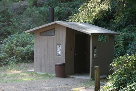
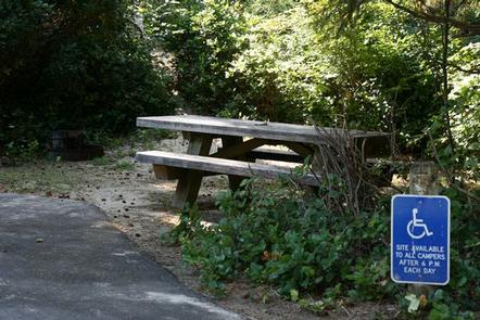
This facility has 30 sites and 1 host, some sites are available on a first come first serve basis. The campground is equipped with campfire rings, drinking water, flush toilets and picnic tables. Parking aprons are paved and the nearest waste station is at Honeyman State Park, about 10 miles north of campground. No electric hookups are available.
Natural Features
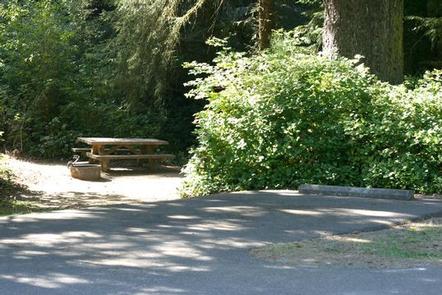
The campground is within reach of coastal forests, expansive dunes, Tahkenitch Lake and the Pacific Ocean. Many sites are heavily wooded and secluded, separated by a thick understory. Douglas fir and wild berries are can be seen throughout Tahkenitch. The lake spans 1,674 acres. Roosevelt elk, pelicans, sea lions and bald eagles are just some of the wildlife that live in this area as well as the nearby beach.
Nearby Attractions
The campground is a few miles from off-road vehicle trails on the dunes.