

Directions
From San Francisco, travel north on Highway 101, 5 miles past Ukiah, then take Highway 20 east and go right on Marina Drive (Lake Mendocino will also be on the right). Continue past the north boat ramp and Kyen Campground. The entrance to Pomo Day Use Area is on the left.
From Sacramento, travel north on I-5 and take Highway 20 west, toward Clearlake. Continue on Highway 20 past Clearlake for approximately 40 miles. Turn left on Marina Drive (Lake Mendocino will also be on the left). Continue past the north boat ramp and Kyen Campground. The entrance to Pomo Day Use Area is on the left.
Phone
(707) 467-4200
Activities
BIKING, HISTORIC & CULTURAL SITE, CAMPING, HIKING, SWIMMING SITE
Keywords
None
Related Link(s)
California State Road Conditions
Overview
Pomo Day-Use Area is situated on Lake Mendocino in California’s Mendocino Range, where the redwood forests meet California wine country.
The lake is formed by the Coyote Dam on the Russian River. A wide variety of recreational opportunities are available, including boating, swimming, water skiing, fishing, hiking and horseback riding.
Recreation
The 1,822-acre lake provides abundant boating, swimming and water skiing opportunities. Anglers will find sunfish, smallmouth bass, striped bass, crappie, white and channel catfish, bluegill and perch.
Several miles of trails wind around Lake Mendocino, including the 3-mile Shakota Trail, which begins at the Pomo Cultural Center and offers beautiful views of the lake.
Facilities
Pomo Day Use Area is located near Kyen Campground and offers three group picnic shelters that each accommodate up to 50 people. Picnic shelters, tables and grills are provided, as are flush toilets and drinking water.
Pomo Site A is open year round, but during winter months it is available on a first come, first served basis only. Pomo Sites B and C and the Pomo Cultural Center are only open during the recreation season.
The Pomo Cultural Center is within the day-use area. It is operated by the Coyote Valley Band of Pomo and the U.S. Army Corps of Engineers. The center is modeled after a traditional Pomo roundhouse and offers displays about Pomo hunting, dancing and basketry, as well as local fish, wildlife and plants.
Natural Features
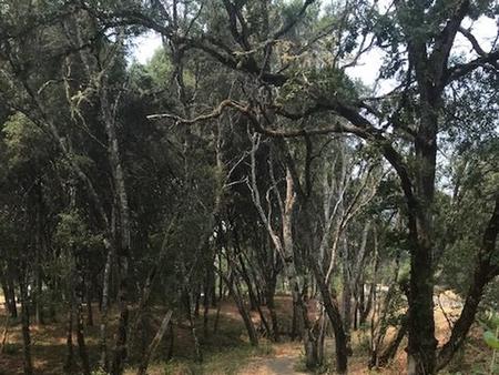
Lake Mendocino lies in the scenic rolling hills of Coyote Valley. Groves of oak mixed with manzanita and pines forest the area, offering limited shade but excellent bird and wildlife habitats.
Nearby Attractions
The charming city of Ukiah, less than 15 minutes away, offers a variety of shopping and dining opportunities, museums and golf courses.
The Ukiah Farmer’s Market runs Saturday mornings and Tuesday evenings throughout the summer, offering fresh produce, local wines, arts and crafts and live music.