WINNIE CAMPGROUND, MN Campground Reservation, Info, Images, Map, Directions

WINNIE CAMPGROUND, Minnesota Campground Images, Info & Reservations

Listen

Directions

Take Highway 2 six miles east of Cass Lake. Turn north on County Road 10 and drive two miles to County Road 91. Turn right onto County Road 91 and continue for just over three miles, to Forest Road 2171. Drive six miles northeast on Forest Road 2171 to Forest Road 2168, then four miles south to the campground.

Phone

218-835-4291

Activities

BOATING, CAMPING, FISHING, HIKING, WATER SPORTS

Keywords

WICA,West Winnie Campground

Related Link(s)

Rec Area Info & Images

Minnesota State Tourism

Minnesota State Road Conditions

Overview

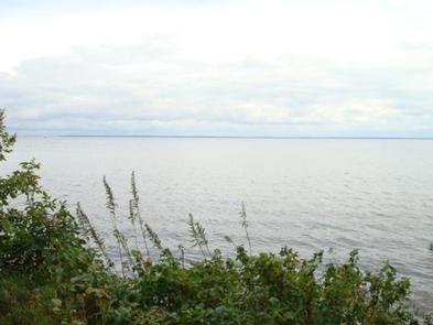
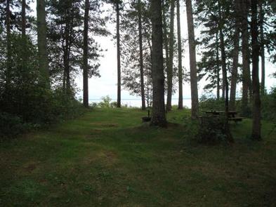
Winnie Campground is remotely located on the west side of Lake Winnibigoshish in the heart of the Chippewa National Forest. Visitors come to the area to enjoy boating, trophy muskie fishing and beautiful scenery.

Recreation

Lake Winnie offers excellent fishing opportunities for walleye, perch and muskie. It is one of Minnesota’s premier fisheries. Boating on this 67,000-acre lake is also very popular. A boat ramp and harbor are located next to the campground.

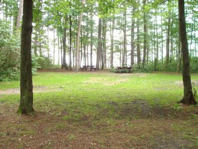
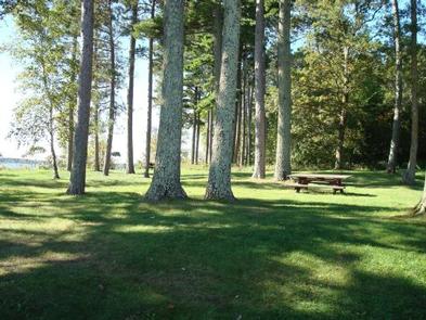
Many hiking and biking trails meander around the lake and its 141 miles of shoreline. A picnic area is adjacent to the campground. Hunting areas can be found in the surrounding forest.

Facilities

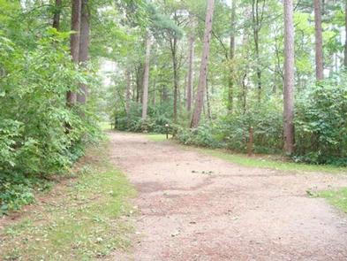
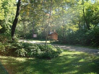
The campground offers 33 reservable sites, some of which are very large and suitable for groups. Each site is equipped with a picnic table and campfire ring. Vault toilets, hand-pumped drinking water and recycling services are provided. Firewood may be purchased when the host is available.

Natural Features

The campground is situated on the western shore of the lake in a scenic forest of mature red and white pine. Some sites have lake views.

Nearby Attractions

The town of Cass Lake, Minnesota is 25 miles west of the campground, offering restaurants, a bank, grocery and hardware stores, a movie theater and museum.

Reservation

More from CampingHiking.net:

OLD POST ROAD, Arkansas Campground Images, Info & Reservations

Listen Directions From SR-7, take Lock and Dam Road for one mile and follow signs into campground. Phone 479-968-7962 Activities BOATING, CAMPING, FISHING, VISITOR CENTER, MOUNTAIN BIKING, BIRDING, DISC GOLF, SOCCER FIELDS Keywords OLDP,DARDANELLE LAKE – ARK.RIV.NAV.,DARDANELLE LAKE Related Link(s) Rec Area Info & Images Arkansas State Tourism Arkansas State

COYOTE GROUP, California Campground Images, Info & Reservations

Listen Directions From Auburn, Calif., take Highway 80 to the Foresthill Road, then travel 20 miles east to Foresthill. Turn right on Mosquito Ridge Road and continue east for 42 miles, to the French Meadows Reservoir. Follow signs to the campground. Phone 530-367-2224 Activities BIKING, BOATING, CAMPING, FISHING, HIKING, SWIMMING

COPPERAS CREEK, Texas Campground Images, Info & Reservations

Listen Directions From Comanche, Texas, take HWY 67/377 northeast for 5 miles, then turn left on FM 2861. Follow for 2.5 miles to the park entrance. Park entrance is on the North side of FM 2861. Phone 254-879-2498 Activities BOATING, CAMPING, FISHING, HIKING, HUNTING Keywords COPP,PROCTOR LAKE,LAKE PROCTOR,COPPERAS COVE,PROCTOR LAKE

SLOUGH CREEK, Kansas Campground Images, Info & Reservations

Listen Directions From Highway 24 in Perry, Kansas, take Ferguson Road north for 7 miles, then turn onto Slough Creek Road and follow signs to the campground. Phone 785-876-3127 Activities BIKING, BOATING, CAMPING, FISHING, HIKING Keywords SLOU,PERRY LAKE,PERRY LAKE Related Link(s) Rec Area Info & Images Kansas State Tourism Kansas

KIOWA PARK I, Oklahoma Campground Images, Info & Reservations

Listen Directions From Waurika, Oklahoma, take Highway 5 northwest for 8 miles. Turn right onto County Road 2750 N and proceed three miles to the park entrance. Phone 580-963-9031 Activities BOATING, CAMPING, FISHING, HUNTING, SWIMMING SITE Keywords KIOW,WAURIKA LAKE,WAURIKA LAKE Related Link(s) Rec Area Info & Images Oklahoma State Tourism