

Directions
From Helena, take U.S. Highway 12, and travel west for 7 miles to Rimini county road. From this intersection, take Rimini Road to the south approximately 4 miles to the cabin. It is located on the east side of the road just past the entrance to Moose Creek Campground. Parking is available to the north of the cabin. A footbridge across Moose Creek provides access from the parking area to the cabin. Vehicles are not allowed within the fenced area. Please make sure you park well off the road.
Phone
406-449-5201
Activities
BIKING, HISTORIC & CULTURAL SITE, CAMPING, FISHING, HIKING, HUNTING, WINTER SPORTS
Keywords
Related Link(s)
Overview
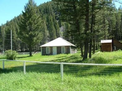
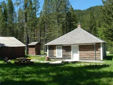
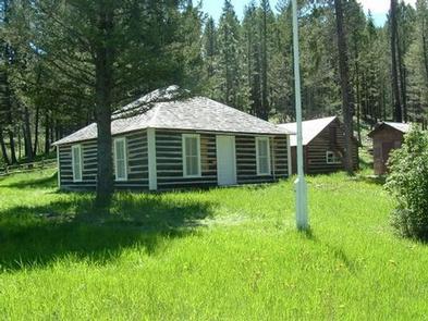
Moose Creek Cabin is situated in an grassy clearing surrounded by conifer forest in the Tenmile Creek drainage west of Helena, Montana. The cabin was constructed in 1907 and used by the Forest Service during the early history of the agency. It has served as a Forest Service Ranger Station, guard station, and work center for the Civilian Conservation Corps.
Today, the cabin is a rustic retreat for guests seeking relaxation and recreation. The cabin is accessible by car, but guests should park on the adjacent road and cross a footbridge to get to the cabin. Many amenities are offered at the cabin, so guests only need to bring a few of their own supplies.
Recreation
Hikers and backpackers can access the Continental Divide National Scenic Trail from trails found near the cabin. This is a non-motorized trail with spectacular views and a variety of terrain, open to mountain bikers, stock users, backpackers and day hikers. The trail transitions through thick forest to above tree line and offers spectacular views both east and west of the Continental Divide.
Moose Creek is a stream located just 11.4 miles from Helena. The creek supports a variety of fish, including redear sunfish, rainbow trout and brook trout. Whether spinning, fly fishing or baitcasting, chances of getting a bite here are good.
Winter play includes cross-country skiing, snowmobiling and snowshoeing.
Facilities
Moose Creek Cabin has electricity and is designed for up to 4 guests. One bedroom is furnished with a queen size bed and the other with 2 twin beds, all with mattresses. The kitchen is equipped with a table and chairs, dishes, utensils, cookware and propane cook stove, that include a stove and lights. The living room has a fireplace. An outhouse with vault toilet is located on-site. A picnic table and campfire ring offer comfortable outdoor dining. Firewood is stocked and stored outside in the woodshed. There is no water on site, so guests must bring a sufficient supply for drinking, cooking and washing. Guests should bring their own sleeping bags, lanterns or flashlights, towels, dish soap, matches, toilet paper and garbage bags. All garbage must be packed out, and guests are expected to clean the cabin before leaving. No firewood provided from June 1st – August 31.
Natural Features
The area around the cabin offers a variety of landscapes, from river banks to subalpine terrain. Valley bottoms, dense forests, meadows and barren ridges are mixed with streams, rivers, and lakes.
Wildlife in the area abounds. Elk, deer, squirrels and a variety of birds are commonly seen. The more elusive badger, mountain lion and lynx find habitat in nearby areas as well.