
Directions
From I-81 North, take Exit 175 just south of Natural Bridge. Go north on U.S. Highway 11 toward Natural Bridge (left turn facing the Exxon station). From Natural Bridge, follow Route 130 East at the intersection with U.S. Highway 11 (right turn at the Natural Bridge parking lot). Continue east on Route 130 for approximately 4 miles to Natural Bridge Station. Turn right onto State Route 759 and continue for approximately 3 miles to the intersection with Route 781 and Petites Gap Road. Continue 1.6 miles ahead on Route 759 / Hopper Creek Road. Turn left into the recreation area entrance.
Phone
540-291-2188
Activities
CAMPING, FISHING, HIKING, HUNTING, KAYAKING, CANOEING, BACKPACKING
Keywords
HCGC,Hopper Creek,Hopper Creek Group Camp
Related Link(s)
Virginia State Road Conditions
Overview
Hopper Creek Group Camp offers a rustic atmosphere under the trees for group camping. Nestled in the Blue Ridge Mountains, the area welcomes visitors to enjoy the natural beauty and relaxing atmosphere.
Recreation
A mowed, grassy area is available for games and organized activities. Hiking trails surround the area offering everything from short walks in and around Cave Mountain Lake to a full day hike along the nearby ridges. Backpacking opportunities are also available on the nearby Appalachian National Scenic Trail, in the James River Face Wilderness or in the Thunder Ridge Wilderness.
Facilities
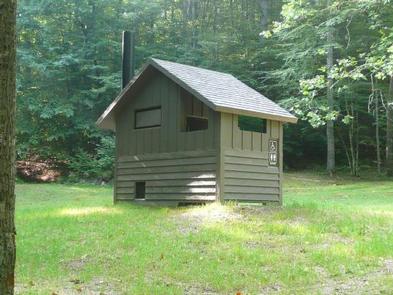
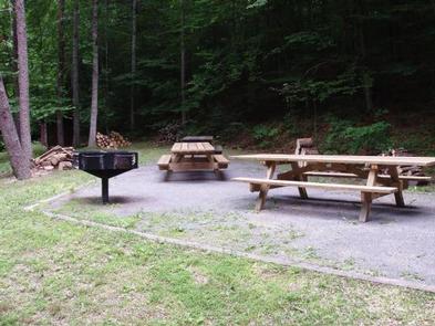
The group camp can accommodate up to 50 people. It is designated for tent camping only, and tent pads are provided. The site is equipped with 12 picnic tables, a pedestal double grill, a large campfire circle and a vault toilet. Drinking water is not provided; campers must bring their own supply. Showers are available at nearby Cave Mountain Lake Recreation Area at the beach bathhouse. The day use fee for Cave Mountain Lake would be applicable.
Natural Features
A small stream gurgles past the camping area flowing downstream into Hopper Creek on its way to the James River. The campground sits at an approximate elevation of 1,100 feet at the base of Thunder Ridge.
Nearby Attractions
Hopper Creek is 3 miles from Cave Mountain Lake, which offers a day use area with sandy beach, designated swimming area and covered picnic shelter. Natural Bridge State Park is within an 8 mile drive and offers visitors views of the 215 foot tall Natural Bridge and limestone gorge, 6 miles of hiking trails, a Monacan Indian village and the 30 foot cascades of Lace Falls. Canoeing, kayaking and fishing are available in the nearby James River.