


Directions
From Bend, travel 23 miles south on Highway 97 to Forest Road 21. Turn onto Forest Road 21 and go about 17 miles east. Take Forest Road 300 north for 0.5 miles.
From La Pine, go 5 miles north on Highway 97 to Forest Road 21. Take Forest Road 21 east about 17 miles. Take Forest Road 300 north for 0.5 miles.
Phone
541-383-5300
Activities
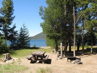
BIKING, BOATING, CAMPING, FISHING, HIKING
Keywords
CINH,Cinderhill,Cind,Cinder,Cinder Hill,Cinder Hill Campground,Cinder Hill Campground (OR)
Related Link(s)
Overview
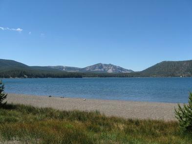
Cinder Hill Campground sits at the edge of beautiful East Lake in the caldera of Newberry Volcano. The area is part of the Newberry National Monument in Deschutes National Forest. The area is popular for its geological significance and multitude of recreational activities, making it an ideal individual and family camping excursion.
Recreation
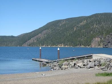
Visitors can take advantage of boating, kayaking, swimming and fishing on East Lake. A boat ramp is located in the campground, and the lake has a 10 mph speed limit.
For anglers, the lake provides the perfect setting to fish from boat or the shoreline. It supports rainbow trout, brown trout and Kokanee salmon. In September, the outlet of adjacent Paulina Lake may be choked with Kokanee moving to spawn in Paulina Creek.
The Crater Rim Trail, considered one of the finest high country trails in the area, boasts vast stretches of forest, deserts and mountains. The trail has many access points and connectors to other trails.
Facilities
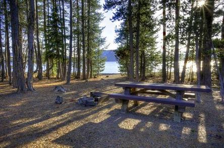
Cinder Hill Campground offers several sites close to the shore or within easy walking distance to the beach. It is an ideal campground for those hauling trailers, but it also has plenty of sites perfect for tents. Sites are equipped with tables and campfire rings with grills. Flush toilets and drinking water are also available.
Natural Features
East Lake is located within the collapsed crater, or caldera of Newberry Volcano. Nearly five miles in diameter, the caldera encircles the basins of East Lake and Paulina Lake. East Lake covers 1,044 acres and is 180 feet at its deepest point.
Paulina Creek flows from the lake and has chiseled a narrow gorge through the caldera’s west wall creating a remarkable twin waterfall. Thermal vents and hot springs along the lake’s northeast edge help create a highly productive ecosystem.
The surrounding undeveloped wilderness, clean streams and diverse forests support a variety of wildlife, including black bear, bighorn sheep, deer, native fish and migratory birds.
Nearby Attractions
Big Obsidian Flow Trail offers a 1-mile interpretive trail that climbs up and onto this impressive lava flow of obsidian (black volcanic glass) and pumice. The Big Obsidian Flow is 1300 years old, the youngest lava flow in Oregon.
Lava Lands Visitor Center in nearby Bend, Oregon, is a great starting point for visitors to learn about the diverse landscape and history of the area through educational programs and exhibits.
Lava River Cave, also located in the Newberry National Volcanic Monument, is nearly a mile long. The northwest section of the cave is the longest continuous lava tube in Oregon.
A nearby resort, operating under a special use permit from the Deschutes National Forest offers visitors lodging, last minute essentials and boat rentals.