MARION LAKE GROUP SITE, MI Campground Reservation, Info, Images, Map, Directions

MARION LAKE GROUP SITE, Michigan Campground Images, Info & Reservations

Listen

Directions

Marion Lake Group Camping site is accessed most easily from U.S. Highway 2. Turn north from US-2 onto Marion Lake Road, also known as Forest Road 3980. Travel approximately 1.5 miles north and then turn right onto Forest Road 3985. Travel until road makes a Y, where a location map is located there to show you the layout of the campground.

Phone

906-358-4724

Activities

BIKING, BOATING, CAMPING, FISHING, WATER SPORTS, WILDLIFE VIEWING, SWIMMING, BIRDING

Keywords

MLGS,Marion Lake Group Site,Marion Lake

Related Link(s)

Rec Area Info & Images

Michigan State Tourism

Michigan State Road Conditions

Overview

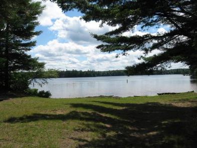
The sparkling Marion Lake offers breathtaking and exciting camping for your next family trip. Live it up on the water with your jet skis or wake board, or tone down the pace with a full day of fishing. The Marion Lake Group Site is an ideal way to spend time with friends and family for all the water activities you can imagine. Marion Lake is in the Ottawa National Forest, a protected area in the Western Upper Peninsula of Michigan. It stretches from the Lake Superior shoreline to the Wisconsin border, and attracts deer and many types of migrating birds.

Recreation

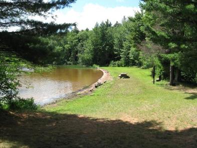
A swim beach is adjacent to the group site.

Facilities

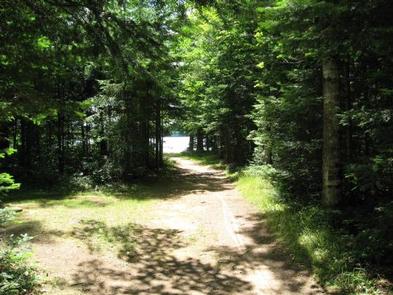
A convenient path leads to the lake and boat launch. Water is not available on-site, but is a short walk away.

Natural Features

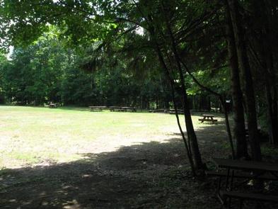
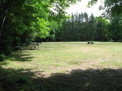
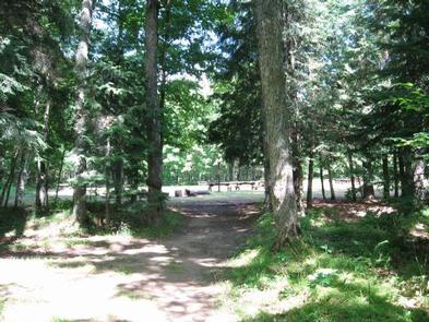
The campground is in a large, grassy field surrounded by hemlock and hardwood trees with an opening to Marion Lake. The altitude is 1,627 feet, with lightly rolling hills stretched between the many other lakes in the area.

Nearby Attractions

Hiking enthusiasts will find scenic trails throughout the Sylvania Wilderness area, a region to the west with old-growth forests and 34 named lakes. On the way, stop by the Ottawa Visitor Center in Watersmeet for some interesting exhibits.

Reservation

More from CampingHiking.net:

CHAVEZ CROSSING, Arizona Campground Images, Info & Reservations

Listen Directions 201 Oak Creek Cliffs Dr. Sedona, AZ 86336 If coming from Flagstaff, take I-17 south to Hwy 89A. Go south on 89A through Oak Creek Canyon to Sedona. Left to State Highway 179. Go South on Hwy 179 approximately 2 miles. Turn right on Oak Creek Cliffs Dr.

BLOODY DICK CABIN, Montana Campground Images, Info & Reservations

Listen Directions From Dillon, travel south on I-15 for about 19 miles and exit at Clark Canyon Reservoir (Hwy 324). Travel 17 miles west on Highway 324 through Grant, MT. Proceed west and turn north onto Bloody Dick Road/Forest Road 181. Continue about 18 miles following road signs. The Bloody

THIRTY MILE, Colorado Campground Images, Info & Reservations

Listen Directions From Alamosa, go west on US 160 to South Fork. Turn northwest on State Highway 149 through Creede. Continue on Highway 149 to mile marker 41, turn west (gravel road) on Rio Grande Reservoir Road and continue for 12 miles to Thirty Mile Campground. Phone 719-658-0829 Activities CAMPING,

NARROWS (CO), Colorado Campground Images, Info & Reservations

Listen Directions From Fort Collins, take Highway 14 northwest for 32 miles. Phone 970-295-6700 Activities BIKING, BOATING, CAMPING, FISHING, HIKING, WATER SPORTS, WILDLIFE VIEWING, MOUNTAIN BIKING, KAYAKING, CANOEING, BIRDING, RAFTING, WHITEWATER RAFTING Keywords NARS,NARROWS,LOWER NARROWS,UPPER NARROWS,ARAPAHO AND ROOSEVELT NF – FS Related Link(s) Rec Area Info & Images Colorado State

BATTLE RUN, West Virginia Campground Images, Info & Reservations

Listen Directions From U.S. Highway 19, turn west on State Route 129 and travel 3 miles to the campground. Phone 304-872-3459 Activities BIKING, BOATING, CAMPING, FISHING, HIKING, PHOTOGRAPHY, MOTOR BOAT, KAYAKING Keywords BATT,SUMMERSVILLE LAKE,SUMMERSVILLE LAKE Related Link(s) Rec Area Info & Images West Virginia State Road Conditions West Virginia State