
Directions
From Cody, Wyo., follow Sheridan Avenue west through Cody until the road leaves town, and becomes the Buffalo Bill Cody Scenic Byway (U.S. Highway 14/16/20). The campground is 32 miles west of Cody, on the south side of the highway and next to the river.
Phone
307-527-6921 – THIS NUMBER IS NOT FOR RESERVATIONS. FOR RESERVATION OR INQUIRIES ABOUT RESERVATION STATUS, GO TO RECREATION.GOV 1-877-444-6777
Activities
CAMPING, FISHING, HIKING, WILDLIFE VIEWING
Keywords
None
Related Link(s)
Overview
Clearwater Campground is located along the Buffalo Bill Scenic Byway, about 32 miles west of Cody, in northwestern Wyoming. It is 20 miles east of the east entrance to Yellowstone National Park. The surrounding area offers many outdoor recreational opportunities, including fishing, hiking and viewing local wildlife.
Recreation
Great opportunities for hiking, fishing, scenic driving and wildlife viewing are available around the campground. The North Fork of the Shoshone River is a popular fly-fishing location for rainbow and Yellowstone cutthroat trout.
Facilities
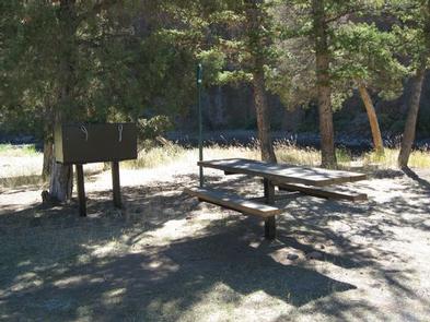
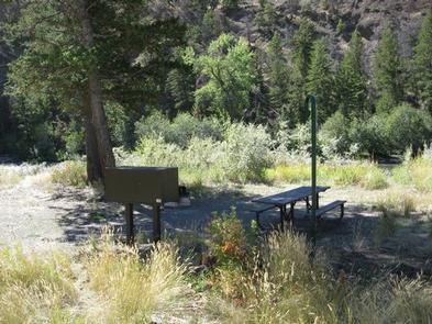
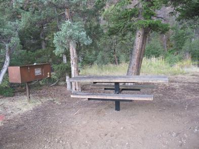
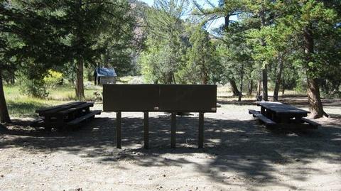
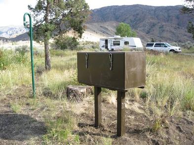
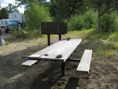
The campground offers one group camping area, which consists of sites 9, 10 and 11. Additionally, 11 single-family campsites are available on a first-come, first-served basis. Each campsite is equipped with a picnic table, campfire ring and food storage locker. A group area provides private parking, three large picnic tables, two food storage lockers and campfire circle. Vault toilets and trash collection are provided, but drinking water is not available. Campers may gather firewood from the area.
Natural Features
The campground is situated on the banks of the North Fork of the Shoshone River and has beautiful views of the surrounding mountains. Douglas fir and large juniper trees cover the campground, which sits at an elevation of 6,000 feet.
A wide variety of wildlife lives in the area. Visitors often glimpse grizzly bears, deer, elk, bison, moose, fox, coyotes and bald eagles.
Nearby Attractions
Pahaska Tepee, west of the campground, is home to Buffalo Bill’s original hunting lodge, built in 1904. Tours are offered daily between Memorial Day and Labor Day. Pahaska also offers guided horseback rides, a gift shop, restaurant and lodging.
Yellowstone National Park’s east entrance is 25 miles from the campground via the Buffalo Bill Cody Scenic Byway. The park offers unparalleled wildlife viewing opportunities, as well as breathtaking scenery and unique geological features.
The small, historic city of Cody offers a variety of dining, lodging and shopping options. The Buffalo Bill Historical Center offers extensive displays of Greater Yellowstone natural history, Plains Indians artifacts, western art, firearms, Buffalo Bill memorabilia and a wild sheep exhibit.