ESHOM CAMPGROUND, CA Campground Reservation, Info, Images, Map, Directions

ESHOM CAMPGROUND, California Campground Images, Info & Reservations

Listen

Directions

To Eshom Campground from Fresno: Go East on HWY. 180 to HWY. 245, turn right, go to Badger, and turn left on Whitaker Forest Drive. Go approximately 9 miles to Eshom Campground .It will be on the right-side of the road.

Phone

559-335-2232

Activities

BIKING, CAMPING, FISHING, HIKING, WILDLIFE VIEWING, SWIMMING SITE

Keywords

None

Related Link(s)

Rec Area Info & Images

Forest Service Concessionaire

California State Tourism

California State Road Conditions

Overview

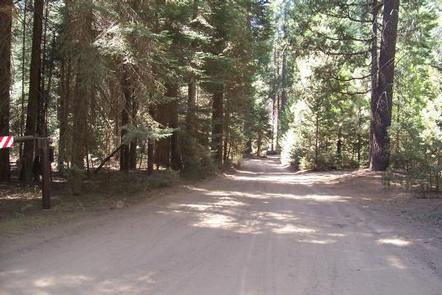
Located in the Giant Sequoia National Monument at 4,800 feet in elevation, this facility is nestled among ponderosa pine, cedar, Sequoia and other conifers. This Forest Service campground is part of the Hume Lake Ranger District in Sequoia National Forest. It is located approximately 80 miles northeast of Fresno, CA, near Kings Canyon and Sequoia National Parks.

Recreation

Opportunities abound in this beautiful forest setting for hiking, biking and off-road exploring outside of the wilderness area. Trails lead into the Redwood Mountain/Whitaker forest grove of Giant Sequoias.

Facilities

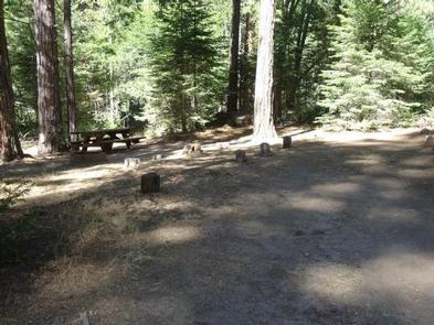
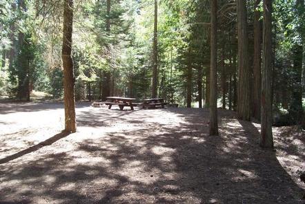
Eshom Campground is a developed facility with 23 multi-family sites. The campground has two sections, east and west. Vault toilets are provided.

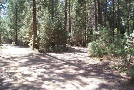
The west section is comprised of two loops, while the east section has a spur ending in a loop. In the west section, campsites 2 through 5 are best suited for slide-ins and tents; potable water spigots are available throughout the loops. Access to Eshom Creek can be found off the west section, where an old road is open to foot traffic only and leads to the creek.

The east section is more rustic. Sites have irregular and informal parking aprons, stone fire rings and no grills. The facility amenities are favorable for a family destination.

Natural Features

The Sequoia’s landscape is as spectacular as its trees. Soaring granite monoliths, glacier-torn canyons, roaring whitewater and more await discovery at the Sierra Nevada’s southern end.

The Sierra Nevada Mountains support populations of black bears, mule deer, and a variety of squirrels and other small mammals. Many bird species can also be seen.

Eshom Creek runs adjacent to the campground, and many of the sites border the water.

Nearby Attractions

Sequoia and Kings Canyon National Parks are located 25 miles from the campground using Hwy 245, offering more chances to explore the natural beauty of the area.

Reservation

More from CampingHiking.net:

NEMO LANDING, Missouri Campground Images, Info & Reservations

Listen Directions From Springfield, MO, take US 65 north past Louisburg, MO, to NN Highway. Follow NN Highway south to Nemo, MO. Turn south at the 4-way stop and find the entrance to Nemo Landing on the left side of the highway. Phone 417-993-5529 Activities CAMPING, SWIMMING SITE Keywords NEMO,POMME

ACKERMAN CAMPGROUND, California Campground Images, Info & Reservations

Listen Directions From Weaverville, take Highway 3 north for 7 miles. Turn right on Rush Creek Road for 9 miles. Turn left on Trinity Dam Boulevard for 7.5 miles. Phone 530-275-8113 Activities BOATING, CAMPING, FISHING, HIKING, WILDLIFE VIEWING Keywords Lewiston Lake Related Link(s) Rec Area Info & Images California State

CEDAR RIDGE (TX), Texas Campground Images, Info & Reservations

Listen Directions From Interstate 35 in Temple, Texas take State Highway 36 west towards Gatesville. Turn left on Cedar Ridge Park Road and continue into the park and campground area. Phone 254-986-1404 Activities BOATING, CAMPING, SWIMMING SITE Keywords CEDR,BELTON LAKE,LAKE BELTON,BELTON LAKE Related Link(s) Rec Area Info & Images Texas

SOUTH SANDUSKY CAMPGROUND, Illinois Campground Images, Info & Reservations

Listen Directions From I-57 take exit 71 and turn west onto Route 14. After 3 miles turn right on Rend City Road, then continue for 6 miles to the campground entrance on the right. Phone 618-724-2493 Activities BIKING, CAMPING, INTERPRETIVE PROGRAMS, FISHING, HIKING, WILDLIFE VIEWING, SWIMMING SITE, STAR GAZING Keywords

PLATTER FLATS, Texas Campground Images, Info & Reservations

Listen Directions From Colbert, Oklahoma, travel 5 miles north on US 75, turn west 5 miles to Platter Flats, OK, then follow signs to the campground. Physical address: 867 Trail Ride Road, Platter, OK 74753. Phone 580-434-5864 Activities CAMPING Keywords PLAT,TEXOMA LAKE,TEXOMA LAKE Related Link(s) Rec Area Info & Images

CHALLENGE CABIN, Montana Campground Images, Info & Reservations

Listen Directions From Hungry Horse, travel east on Highway 2 for 51 miles, then 8 miles south on Skyland Road 569. Park in the plowed area along Highway 2, then hike, snowmobile, ski or snowshoe approximately 8 miles along the groomed trail. The cabin is not accessible by car. Phone