NORTH WALDO, OR Campground Reservation, Info, Images, Map, Directions

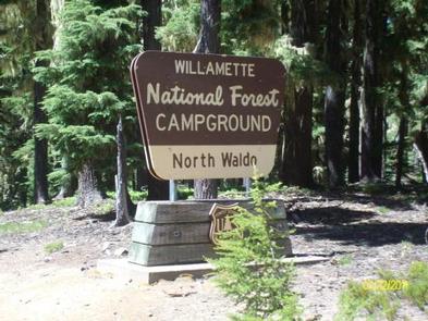
NORTH WALDO, Oregon Campground Images, Info & Reservations

Directions

From Oakridge, follow Hwy 58 east for 25 miles to the Waldo Lake Road (FS Road 5897). Follow Waldo Lake Road for 11 miles to FS Road 5898. Follow FS Road 5898 to FS Road 5895. Continue on FS Road 5895 to North Waldo Campground.

Phone

801-226-3564

Activities

BOATING, FISHING, HIKING, DAY USE AREA, SWIMMING

Keywords

Waldo Lake,Waldo

Related Link(s)

Rec Area Info & Images

Oregon State Tourism

Forest Service Concessionaire

Oregon State Road Conditions

Overview

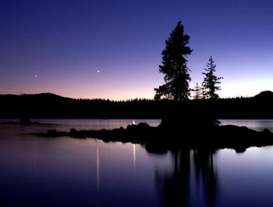
Waldo Lake is one of the largest natural lakes in Oregon. It offers a uniquely peaceful setting on the water and along remote shorelines, surrounded by forests of Douglas fir and mountain hemlock. Recreation in the area is abundant with the lake an ideal location for water activities like sailing, canoeing and swimming.

Recreation

Waldo Lake is circled by the Jim Weaver Loop, 20 miles of trail for hiking and biking. Bikes are allowed on the trails, but not in the nearby Waldo Lake Wilderness. There is also easy access to the Pacific Crest Trail and North Waldo is also a popular starting point for many wilderness trails and lakes, most notably the Rigdon, Wahanna and Torrey Lakes. There is a 1-mile Shoreline Trail between North Waldo Campground and Islet Campground which provides a short and pleasant hike along the lakeshore.

Facilities

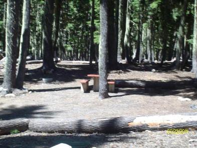
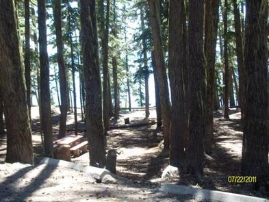
North Waldo is the most popular of the Waldo Lake Campgrounds. There are 58 sites with fire rings and tables, 34 are reservable. The boat launch is somewhat deeper than the others on the lake, which is more accommodating for large sailboats. The drier environment supports fewer mosquitoes, but they are still plentiful in season. This facility is operated by American Land & Leisure. We appreciate hearing from you. Comment cards are available from campground hosts or online at www.americanll.com.

Natural Features

Situated high on the western slopes of the Oregon Cascades at 5,400 feet in elevation, Waldo Lake is one of the purest lakes in Oregon (9.8 square miles with a maximum depth of 427 feet). It has no permanent inlet to bring nutrients into the lake for plant growth. The lack of plant life contributes to its purity, allowing you to see to depths of 120 feet on a calm day.

Reservation

More from CampingHiking.net:

SAN MIGUEL ISLAND, California Campground Images, Info & Reservations

Directions Boat transportation can be arranged with Island Packers from Ventura Harbor. Air transportation can be arranged with Channel Islands Aviation from Camarillo airport. To park headquarters in Ventura, California: Highway 101, exit Victoria or Seaward to Ventura Harbor. Phone 805-658-5730 Activities BOATING, HISTORIC & CULTURAL SITE, CAMPING, INTERPRETIVE PROGRAMS,

SOUTH JETTY SAND CAMPING, Oregon Campground Images, Info & Reservations

Directions From Florence, Oregon, travel south on Highway 101 for 1 mile to South Jetty Road. Turn right and proceed 1 ½ miles to Goosepasture Staging on the left. Phone 541-271-6000 Activities CAMPING, FISHING, WILDLIFE VIEWING, BEACHCOMBING Keywords STJY,GOOSEPASTURE,FLORENCE,ODNRA,OREGON DUNES,Sand Dunes,Sand camps,South Jetty ODNRA,SIUSLAW NF – FS Related Link(s) Rec

BUCKBOARD, Utah Campground Images, Info & Reservations

Directions Located in Southeast Utah, six miles west of Monticello on paved Forest Road 105. Phone 435-587-2041 Activities AUTO TOURING, BIKING, CAMPING, FISHING, HIKING, HUNTING, PICNICKING, WILDLIFE VIEWING, PHOTOGRAPHY, MOUNTAIN BIKING, STAR GAZING, SCENIC DRIVE, OFF HIGHWAY VEHICLE TRAILS Keywords BUCB,BUCKBOARD,BLUE MTN. CAMPGROUND,MANTI-LASAL NF -FS Related Link(s) Rec Area Info

GREEN VALLEY, California Campground Images, Info & Reservations

Directions From Running Springs, travel east on Highway 18 about 3 miles to Green Valley Lake Road. Turn left and continue about 6 miles to the campground. Phone 909-866-8550 Activities BOATING, CAMPING, FISHING, HIKING, SWIMMING SITE Keywords GREV,GREEN VALLEY San Bernardino,SAN BERNARDINO NF – FS Related Link(s) Rec Area Info

FENSKE LAKE CAMPGROUND, Minnesota Campground Images, Info & Reservations

Directions From Ely, Minnesota, travel east on State Highway 169 North (toward Winton) for about 1 mile. Turn left onto County Road 88 and travel about 2 miles. Turn right onto Echo Trail and continue about 7 miles to the campground entrance on the right. Phone KAWISHIWI RANGER DISTRICT: 218-365-7600,

ROARING RIVER (GROUP), Oregon Campground Images, Info & Reservations

Directions From Eugene, Oregon, take I-105 east to McKenzie Highway 126 just past Milepost 45. Turn South on Aufderheide Drive/Forest Service Road 19 and travel for 22 miles to campground. Entry is through a locked gate with a combination. Phone 541-822-3381 Activities CAMPING, FISHING Keywords ROAR,WILLAMETTE NF -FS Related Link(s)