BRIDGEVIEW (RATHBUN LAKE), IA Campground Reservation, Info, Images, Map, Directions

BRIDGEVIEW (RATHBUN LAKE), Iowa Campground Images, Info & Reservations

Directions

From Moravia, IA, travel 10 miles west on Highway J18 and follow signs into the campground.

Phone

FOR CAMPGROUND INQUIRIES DURING MAY-SEPTEMBER PLEASE CALL 641-724-3062. DURING CLOSED SEASON PLEASE CALL 641-647-2464

Activities

BIKING, BOATING, CAMPING, FISHING, HIKING, PICNICKING, WILDLIFE VIEWING, DAY USE AREA, INFORMATION SITE, SWIMMING, KAYAKING, CANOEING, WATER ACCESS, ICE CLIMBING, SAILING

Keywords

BRIG,RATHBUN LAKE,BRIDGEVIEW RATHBUN LAKE,RATHBUN LAKE

Related Link(s)

Rec Area Info & Images

Iowa State Road Conditions

Iowa State Tourism

Overview

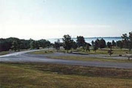
Bridgeview Park is located on beautiful Rathbun Lake, just 13 miles northwest of Centerville, Iowa. Camping, boating, swimming, fishing and picnicking are popular activities at this waterfront recreation area.

Recreation

The 11,000-acre lake provides a variety of fishing opportunities for any angler. Crappie, channel catfish, walleye and largemouth bass are most common.

Whether power boating or sailing, Rathbun Lake, also known as Iowa’s Ocean, has something to offer everyone. In particular, the water’s prevailing winds make it one of the best sailing lakes in Iowa.

Facilities

This large campground offers 106 family sites, 95 of which have electric hookups. A day-use group picnic shelter for up to 24 people is also available. Amenities include flush and pit toilets, showers, drinking water, a dump station, boat ramp, playground and horseshoe pits.

Natural Features

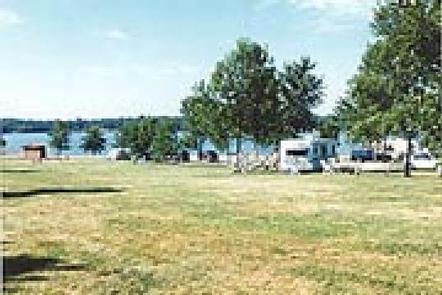
Rathbun Lake is situated in the gently rolling hills of the Chariton River Valley in southeast Iowa. The campground consists of open grassy areas dotted with trees.

Bald eagles, white-tailed deer, Canada geese, wild turkey, and other wildlife can be found at Rathbun Lake.

Nearby Attractions

Southern Iowa’s only Off Highway Vehicle Park is just three miles from the campground. It is located on the south bank of the South Fork Chariton River and encompasses nearly 125 acres of an abandoned rock quarry.

The Rathbun Fish Hatchery is located near the main dam, and offers self-guided tours Monday through Friday year-round. Hundreds of thousands of catfish and walleye are produced here each year.

Reservation

More from CampingHiking.net:

INDIAN CELINA LAKE, Indiana Campground Images, Info & Reservations

Directions From St. Crois, Indiana, travel south on State Route 37 about 2 miles to the Indian-Celina Recreation Area sign. Turn right and continue to the campground. Phone 812-843-4880 Activities BOATING, HISTORIC & CULTURAL SITE, CAMPING, HIKING, HUNTING Keywords INDL,HOOSIER NF – FS Related Link(s) Rec Area Info & Images

CHALK LAKE, Colorado Campground Images, Info & Reservations

Directions From Buena Vista, Colorado, take Highway 285 south to Nathrop. Turn west on County Road 162 and travel 8 miles to the campground. Phone CAMPGROUNDS DO NOT HAVE PHONE SERVICE, CALLING TO CHECK AVAILABILITY PRIOR TO ARRIVAL IS NOT POSSIBLE. FOR RESERVATIONS CALL: 1-877-444-6777 Activities HISTORIC & CULTURAL SITE,

MANISTIQUE – RAPID RIVER DISPERSED CAMPSITES, Michigan Campground Images, Info & Reservations

Directions All driving directions are listed by lake. Please check campsite details. Phone 906-474-6442 Activities BIKING, BOATING, CAMPING, FISHING, HIKING, HORSEBACK RIDING, WATER SPORTS, WILDLIFE VIEWING, DAY USE AREA, SWIMMING SITE Keywords Dispersed campsites,Manistique,Rapid River,lyman lake,swan lake,bass lake,bear lake,camp cook,carr lake,chicago lake,clear lake,crooked lake,east lake,gooseneck lake,ironjaw lake,jackpine lake,lake nineteen,leg lake,little

SPEEGLEVILLE PARK, Texas Campground Images, Info & Reservations

Directions From I-35, take exit 330B Hwy 6 N toward Meridian for about 6 miles. After passing over the Lake on the Twin Bridges, take the first exit toward Lake Waco/Speegleville Park. Take a left on the access road. You will continue past the Twin Bridges Park about a quarter

CRESCENT MOON, Arizona Campground Images, Info & Reservations

Directions 333 Red Rock Crossing Rd. Sedona, AZ 86336 From Phoenix, take I-17 north to State Highway 179. Go north on 179 for 13 miles to Sedona, then turn left on Highway 89A and continue south for 4 miles. Turn left on Upper Red Rock Loop Road and proceed another