CHARBONNEAU PK, WA Campground Reservation, Info, Images, Map, Directions

CHARBONNEAU PK, Washington Campground Images, Info & Reservations

Directions

From Pasco, Washington, take Highway 12 east. After crossing the Snake River Bridge, take the first exit and proceed to Highway 124. Continue east through Burbank, Washington. Turn north on Sun Harbor Drive and follow for 1.5 miles, then take a left on Charbonneau Road. Campground is on the right.

Phone

509-547-2048

Activities

BOATING, CAMPING, FISHING, DAY USE AREA, SWIMMING SITE

Keywords

CHARB,ICE HARBOR,LAKE SACAJAWEA,ICE HARBOR LOCK & DAM

Related Link(s)

Rec Area Info & Images

Washington State Road Conditions

Washington State Tourism

Overview

Charbonneau Park in Eastern Washington was named one of America’s Top 100 Family Campgrounds. It is located on Lake Sacajawea, formed by Ice Harbor Lock and Dam on the Lower Snake River. The park was named for Toussaint Charbonneau, an interpreter for Lewis and Clark and husband of Sacajawea, the famous Shoshone interpreter on the Corps of Discovery. The park provides excellent recreational opportunities for boaters, campers, upland and waterfowl hunters and anglers.

Recreation

The lake provides great boating and swimming opportunities, and a boat ramp is provided for guests. Fishing is also a popular pastime, and anglers will find excellent salmon and steelhead fishing on the lake.

Facilities

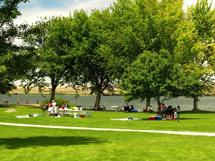
The park offers 52 family sites and two day-use group picnic shelters, all with electric hookups.

Natural Features

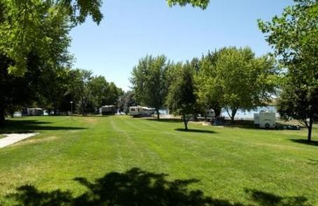
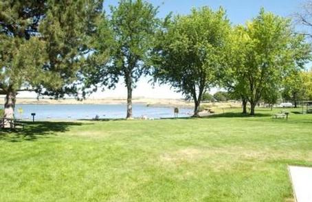
The campground is situated on the banks of Lake Sacajawea, and several of its waterfront sites have scenic views of the lake. The park is characterized by its open grassy areas dotted with a few large shade trees.

Reservation

More from CampingHiking.net:

OWENS CREEK CAMPGROUND, Maryland Campground Images, Info & Reservations

Directions For GPS Use Only: The street address is 15882 Foxville Deerfield Road, Sabillasville, MD. This is not the mailing address. The Park mailing address is: Catoctin Mountain Park, 6602 Foxville Road, Thurmont, MD 21788. From Washington DC Take the George Washington Memorial Parkway north to I495 to I270 north

PEAVY CABIN, Oregon Campground Images, Info & Reservations

Directions North of Baker City, take U.S. Hwy 30 (Elkhorn Drive Scenic Byway) to Haines. At Haines, turn west on County Rd 1146, staying with the Scenic Byway to Anthony Lakes. Continue on the Scenic Byway (now Forest Service Road 73) past the Elkhorn Summit for approximately 8 miles. Turn

DEERLICK CREEK, Alabama Campground Images, Info & Reservations

Directions From I-59 in Alabama, take Exit 73 (MacFarland Boulevard). Go west on MacFarland Blvd./Highway 82 for approximately 4.2 miles. Veer right onto Rice Mine Road. At the stoplight turn left onto Rice Mine Rd. Then, turn right at the stoplight onto New Watermelon Road and follow it for 3.4

TULE, California Campground Images, Info & Reservations

Directions Take state highway 99, to east on Hwy 190 for 25 miles until you arrive to campground enterance. Please follow the signs. Phone 559-784-0215 Activities BIKING, BOATING, CAMPING, INTERPRETIVE PROGRAMS, FISHING, HIKING, HORSEBACK RIDING, HUNTING, PICNICKING, DAY USE AREA, OBSERVATION SITE, INFORMATION SITE, SWIMMING, MOTOR BOAT, RANGER STATION, PADDLE

KATHLEEN LAKE CABIN, Alaska Campground Images, Info & Reservations

Directions Access to the cabin is by floatplane. It is about a 30-minute flight from Juneau. In fall, winter and early spring, the cabin may be inaccessible due to frozen lake surface (floatplanes cannot land). The lake is normally ice free from mid-May through November. Refer to USGS topographic map