


Directions
From Brainerd, Minnesota on Highway 25, turn right on County Road 3 and travel north to Crosslake, Minn. The campground entrance is to the left, at the intersection of County Roads 3 and 66.
Phone
651-290-5793
Activities
BIKING, BOATING, CAMPING, INTERPRETIVE PROGRAMS, FISHING, PICNICKING, VISITOR CENTER, SWIMMING, CANOEING
Keywords
CROS,RONALD LOUIS CLOUTIER RECREATI,CORPS OF ENGINEERS CAMPGROUND,PINE RIVER DAM,PINE RIVER RESERVOIR,MISSISSIPPI HEADWATER,Crosslake Campground,Crosslake Recreation Area,Cross Lake Campground
Related Link(s)
Minnesota State Road Conditions
Overview
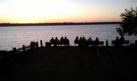
In Central Minnesota’s popular lakes area, the Cross Lake Recreation Area is best known for
its picturesque sunsets, beautiful beaches and well-maintained campsites. The campground provides a full menu of activities for camping enthusiasts, while being located just minutes from shopping and paved bike trails.
For a virtual tour go to: http://www.photographyoptions.net/images/headwaters/tour.html
Recreation
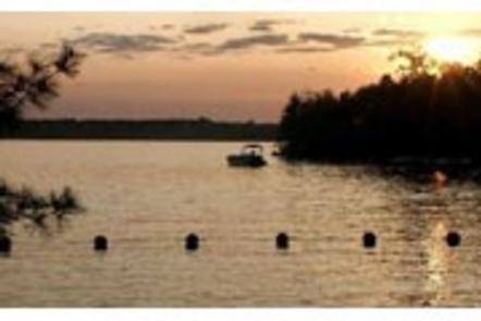
The recreation area provides plenty of water based entertainment like boating, canoeing, kayaking, water skiing and fishing. Two onsite beaches are convenient for swimming and sunbathing. Two accessible fishing piers provide angling opportunities on both Cross Lake and the Pine River.
Facilities
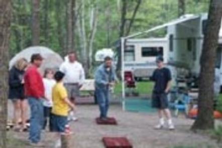
The sizable campground has 122 campsites including 97 with electric hookups. Additional amenities include two accessible hot shower facilities, two boat ramps, several playground areas, boat beaching, 2 picnic shelters, dump stations and accessible fishing piers.
Natural Features
Cross Lake Recreation Area is nestled among tall pines on the eastern banks of Cross Lake on the Whitefish Chain of Lakes. The area has tremendous appeal, with access to 13 natural lakes, 13,660 acres of water and 119 miles of scenic shoreline. The collection of lakes help form the Headwaters of the Mississippi River.
Nearby Attractions
The Recreation Area is located adjacent to the city of Crosslake and is just a short walk from shopping and a paved bike trail. It’s also near the Crow Wing State Park where visitors can view the Mississippi River from the historic “Chippewa Lookout.”
Charges & Cancellations
Reservations must check in within 24 hours of their scheduled arrival or risk their reservation being cancelled.