LITHIA SPRINGS, IL Campground Reservation, Info, Images, Map, Directions

LITHIA SPRINGS, Illinois Campground Images, Info & Reservations

Listen

Directions

From Shelbyville, Illinois, go three miles east of Shelbyville on State Route 16 to County Road 2200E. Turn left and go two miles to County Road 1500N. Turn left again and drive 1.4 miles to the campground.

Phone

217-774-3951

Activities

BOATING, CAMPING, FISHING, VISITOR CENTER, DAY USE AREA, SWIMMING SITE

Keywords

LISP,LAKE SHELBYVILLE

Related Link(s)

Rec Area Info & Images

Illinois State Road Conditions

Illinois State Tourism

Overview

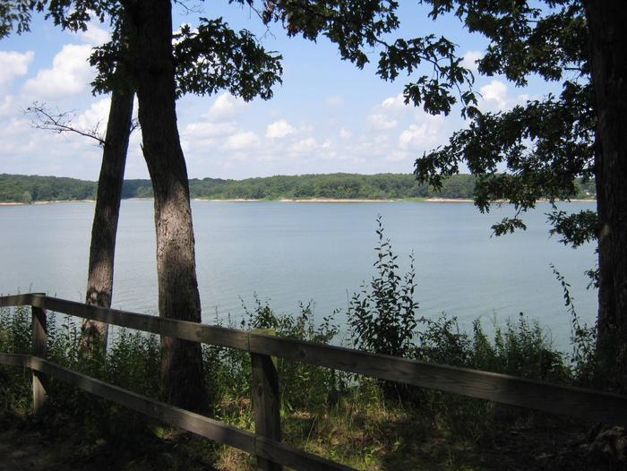
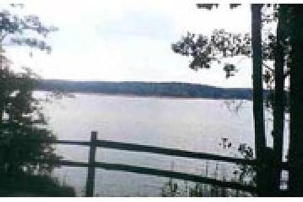
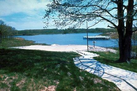
Lithia Springs Campground sits on the eastern shore of Lake Shelbyville in the heart of central Illinois.

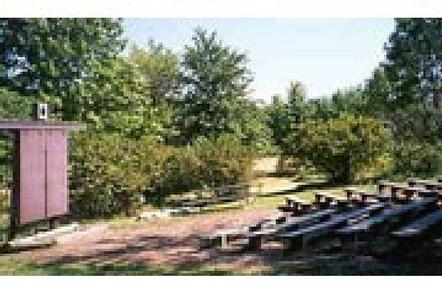
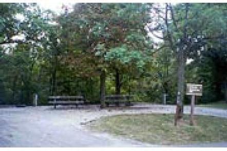
This facility has a variety of amenities and offers outdoor activities for people of all ages, including fishing, swimming, picnicking and simply relaxing.

Recreation

Lake Shelbyville offers a multitude of fishing opportunities for catfish, crappie, largemouth bass, muskie, walleye, white bass and bluegill. Lithia Springs provides a boat ramp, and for those without a boat, several ponds with farmed fish are available around the lake.

Hunting areas within a short drive offer numerous game species, including quail, rabbit, pheasant, deer, dove, turkey, waterfowl and woodcock.

Facilities

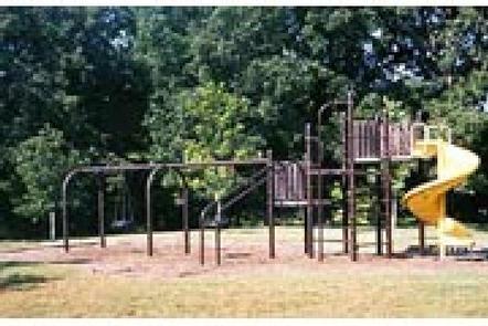
Lithia Springs has more than 100 campsites, all of which have electric hookups. Some campsites are on the lake shore within a short walk of the water. Amenities include flush toilets, showers, a playground, swimming beach, dump station and boat ramp. A full-service marina is located adjacent to the recreation area.

Natural Features

The campground lies in an oak and hickory forest. Foliage turns a variety of red, orange, purple and yellow each fall, while prairie flowers dot the landscape in spring and summer.

Numerous species of songbirds, shorebirds, waterfowl and raptors inhabit the lake area, as do mammals such as cottontail rabbit, white-tail deer, gray and fox squirrel, muskrat and mink.

Nearby Attractions

Wolf Creek State Park, Woods Lake Waterfowl Refuge and Okaw Bluff Wetlands Complex are popular locations for wildlife watching, birding and hunting near Lake Shelbyville.

Reservation

More from CampingHiking.net:

SAILOR LAKE, Wisconsin Campground Images, Info & Reservations

Listen Directions From Fifield, follow State Highway 70 east for about 7 miles and turn right (south) on Forest Road 139 and continue for 3 miles. Phone 715-762-2461 Activities BOATING, CAMPING, FISHING, HIKING, HUNTING, WILDLIFE VIEWING, CANOEING, HISTORIC SITES Keywords SAIL,CHEQUAMEGON-NICOLET NF – FS Related Link(s) Rec Area Info &

LEIGH CREEK CAMPGROUND, Wyoming Campground Images, Info & Reservations

Listen Directions From Ten Sleep, WY, drive 7.5 miles on Hwy 16 to FSR 018 (WY Hwy 436). Bear right and travel nearly 1 more mile to the campground. Phone 406-587-9054 Activities BIKING, BOATING, CLIMBING, FISHING, HIKING, WILDLIFE VIEWING, HOTEL/LODGE/RESORT PRIVATELY OWNED, OFF ROAD VEHICLE TRAILS, KAYAKING, STAR GAZING, BIRDING,

SOUTH MARCUM CAMPROUND, Illinois Campground Images, Info & Reservations

Listen Directions From I-57 take exit 71 and turn west onto Highway 14. After 3 miles turn right on Rend City Road, then right on Rend Lake Dam Rd. Continue 3 miles to the park entrance on the left. Phone 618-724-2493 Activities BIKING, BOATING, CAMPING, FISHING, HIKING, HUNTING, SWIMMING SITE

LEWIS CANYON, Arizona Campground Images, Info & Reservations

Listen Directions Drive to Pinedale, Arizona, on State Highway 260, approximately 14 miles northwest of Show Low. Turn south on Forest Road 130 and continue approximately 2.3 miles to Junction 130A. Turn right to the group site, following the signs.  Phone 928-368-2100 Activities BIKING, CAMPING, HIKING Keywords LEWI,APACHE-SITGREAVES NF-FS Related

LOST LAKE CABINS, Wisconsin Campground Images, Info & Reservations

Listen Directions Lost Lake rustic cabins are located about 100 yards South of the Lost Lake Campground off of Forest Service Road 2156! From Florence, take Highway 70 for about 20 miles and take a righ onto Forest Service Road 2450, go about 1 mile and continue straight onto Forest

HARVEY WEST CABIN, California Campground Images, Info & Reservations

Listen Directions From Highway 50: Go approximately 32 miles east of Placerville or 25 miles west of South Lake Tahoe. Turn south on to Silver Fork Road 11N40. Travel approximately 2 miles on Silver Fork Road. Turn right into the China Flat Day Use parking area approximately 300′ feet past